Friday, July 28, 2017

Revisiting the Burroughs Range

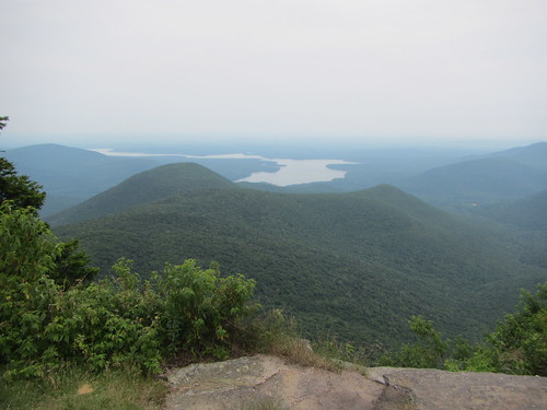
Slide-Cornell-WittenbergAfter warming up on Tremper, we headed out to the Burroughs Range the next day. We followed the same route I had taken previously on this hike, starting from the Slide parking lot at Frost Valley Road and ending at the Woodland Valley parking area. My previous hike had been in the fall, however, so it looked quite different in the green of summer.

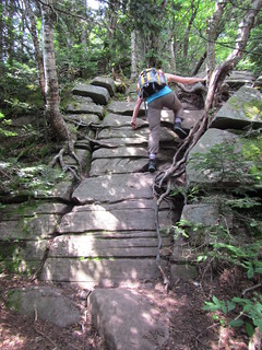
This trail is a showcase for Catskills rock formations, with lots of climbing. One of these climbs is named the Cornell Crack, but the rest are unnamed on the map, which we found amusing - Cornell Crack didn't seem to be any more significant than all the other climbs!

The trail first reaches Slide, then Cornell. There are views near both peaks, and again rather typical of Catskills view - you have to peer over trees to see the mountains over yonder, with little view of the valleys in between. But once you climb up to Wittenberg, it's an entirely different story. I think it's probably the best view in the Catskills. That's true even on a humid day, where the haze obscures the farthest details.

Slide-Cornell-Wittenberg


Thursday, July 27, 2017

Hiking Mt. Tremper another way

Mt. Tremper

Both of my previous hikes of Tremper have been out-and-backs from Phoenicia. This time, we hiked it one-way from the town of Willow.

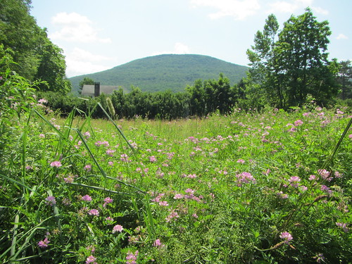
After parking at the post office on Jessup Road, we roadwalked a bit until we reached the Willow trail. (The photo above is from the post office; I think that is Tremper.) The beginning of the actual trail was a bit weedy - it's clear fewer people come this way. Likely that's because this approach is 3.8 mikes instead of 3.05, and there is no parking lot at the trailhead, necessitating said roadwalk, which makes it even longer. The trail itself is not qualitatively different, though.

The Willow trail dead-ends into the Warner Creek trail, and turning left eventually brought us up to the summit of Tremper, where we enjoyed the fire tower. From there, we went down the usual route to Phoenicia.

It's a nice alternative if you have two cars for a shuttle. Otherwise, you could of course do the hike as an out-and-back if you are looking for a change.

Monday, July 17, 2017

Circumnavigating Roosevelt Island

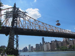
Roosevelt IslandI had never been to Roosevelt Island - in fact, I hadn't been to any of the smaller islands that compromise New York City. Roosevelt Island is the only little island around Manhattan that is actually inhabited*.

You can get there by subway or by tram, and there aren't many cars on the island. Of course I was excited to take the tram, my philosophy on trams being similar to my philosophy on fire towers.** The island is two miles long but probably only a quarter-mile wide. The tram lets you off near the southern end, so I decided to walk around it counterclockwise.
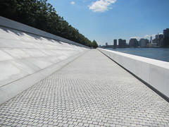
Roosevelt IslandThat meant I started by going through the Roosevelt Four Freedoms Park (at left). It is still being built but is not fully accessible, which is a problem because (a) the Roosevelt in question is FDR, the prez with a wheelchair, (b) Roosevelt Island has a significant disabled population and (c) construction began well after the ADA. The park so far is vaguely visually interesting, but as of yet there was no evidence of the four freedoms, just a giant FDR head.

As I started up the east side of the island, I was blocked by construction and had to retrace my steps, so I figured I might as well go clockwise.
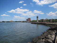
Roosevelt IslandAside from a few historic buildings such a lighthouse and smallpox hospital, almost every building on the island dates from the late 70s or later. The look and feel is very 70s/80s. It's not necessarily aesthetically beautiful, but it took me some time to identify what I was feeling as a weird mix of nostalgia and admiration of the architectural consistency. Smartly, they kept the entire waterfront open, so it's possible to walk around the entire island.*** At the northern end is an old lighthouse; alas, it is closed.

Going down the eastern side of the island isn't quite as attractive. That's partially because the hospital and some public services have their backs to that side, so there are a lot of parking lots, that kind of thing. Also, the view of Brooklyn doesn't necessarily show Brooklyn's best side - the Costco looks as ugly as every other Costco. On the other hand, the power generating plant looks pretty good.
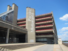
Roosevelt IslandEventually, I ran up against a gate at the edge of construction and returned to the tram.

All told it was a little over four miles, completely flat. Only parts of it were shaded, so bring plenty of water in summer, along with a warm jacket for windy days.

* There is a small population on Wards/Randall's Islands, but you can't just move there. There are various shelters and services on Wards Island, so I suspect the population consists of either users or employees of those services.

** "Never pass up an opportunity to climb a fire tower."

*** Excluding, obviously, the temporary blockage of construction.
Tuesday, July 11, 2017

Hiking from Manhattan to Weekhawken

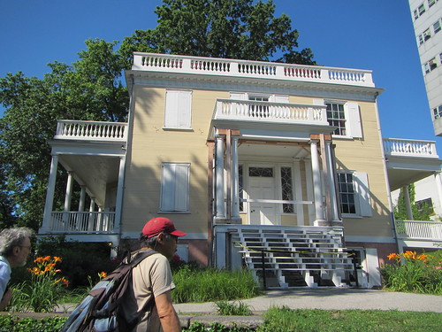
Hamilton Grange

This week's Ramblers hike was an urban hike, starting at 145th St. in Manhattan, and visiting several sites related to Alexander Hamilton. We started off slow, as we stopped frequently. We picked up speed as we headed uptown, going over Highbridge and then Washington Bridge, then over the George Washington Bridge into New Jersey. We then followed the water south, eventually coming a bit inland for a more direct route, before taking the Weehawken ferry back to Manhattan.

Some of the group went on to walk south to Trinity Church for a total of 20 miles, but we had already done about 15, so I went home at that point.

We had great weather, although it was a little warm because we weren't in the shade very much. Most of the New Jersey portion of the hike was new to me, so it was interesting to see.

Thursday, July 6, 2017

Fast and slow at the Wertheim Refuge

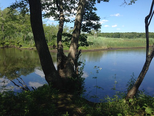
Carmans River

On our way back to the city, we stopped at the Wertheim Refuge. We didn't have a lot of time, so we decided to do the shorter loop of the White Oak Trail. J was able to check out a pair of binoculars from the office for bird spotting, and off we went.

Although the short loop is 1.5 miles, we found out that didn't include the .5 mile connector trail to get there. The connector trail and the beginning portion of the White Oak Trail are along the Carmans River, so there were several scenic spots from which to bird watch, although we didn't see much of note. There were quite a few paddlers out on the river, although that didn't seem to disturb the swans.

We took the shortcut to make the short loop and headed back on the portion of the trail that is deeper in the woods. Then J's phone rang - it was the Refuge office, telling us our binoculars were due in 15 minutes. We started walking very briskly, as we figured we were a ways out.

Finally, I offered to run jog to return them. I made it back on the dot of 4, with J only three minutes behind me. I don't run if I can help it so my pace, although steady, is slow. Nevertheless it's faster than we were walking.

It would be best to do this hike when one has enough time (or one's own binoculars), and if you're interested in birds, likely at a different time of day. It was an attractive woods-and-water hike, completely flat of course. If your goal isn't birding but more of a workout, I'd suggest both the White Oak and Black Tupelo Trails, for a little over 6 miles.