 I'm in beautiful Colorado right now. I spent the first four days of the trip hiking with old Nashville Hiking Meetup friends who live in the Denver area. On Sunday we drove out to Ouray, a really beautiful tiny town with mountains looming over it. After finding a hotel and having dinner, we decided to take a short postprandial stroll. The Perimeter Trail, which circles the city, was close by; Friend C had done part of it before and said it wasn't amazing, but it would get us started.
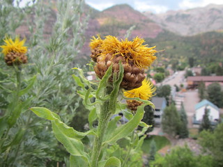
We walked up the street (a literal statement) to where we could connect with the trail on the west side of town. This part of the trail was very nice. First, there were views of town (pictured). Then, we entered Box Cañon, where the rock walls narrowed in close and a waterfall tumbled down. Finally, we thought we'd catch another loop of trail before heading back into town.
Unfortunately, the last bit took longer than anticipated; we think we wandered onto the Ice Park trail by mistake. In any case, we were quickly running out of light, so when we intersected the highway we took it back into town.
While these numbers aren't precise, we figured we hiked 3-4 miles with about 500 feet of elevation change. Now, this was actually the second-easiest hike we did all trip - the first easiest being a 1/4 mile jaunt. However, it was the hardest for me. I was working on two hours of sleep, had been up since 3 a.m. Eastern, and had been at sea level that morning. Spoiler: A good night's sleep would work wonders for the next day.
The hike was quite nice, though, and Friend C agreed it was much better than what she had seen elsewhere on the trail.
No comments:
Post a Comment