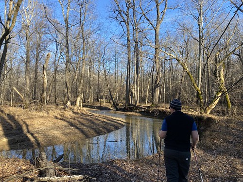
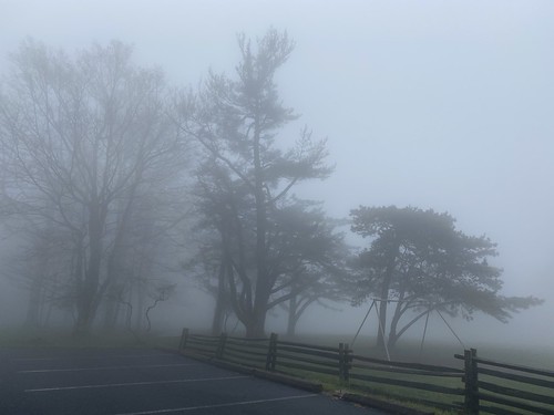
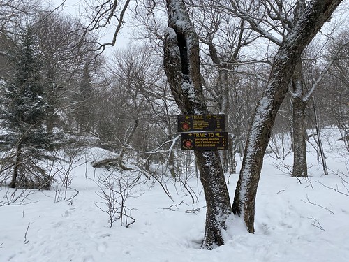
Showing posts with label weather. Show all posts

Friday, July 19, 2024

Cabin John Creek Challenge

July's long hike was the 9.5-mile Cabin John Trail plus a jaunt south to the Potomac, to complete the Cabin John Creek Challenge. I had intended to do it with a group in May, but our local racccoons had other ideas, and I ended up staying close to home to deal with roofers. 

Cabin John Creek Trail

Previously, I had only done a two small parts of the trail, so most of it was new to me. I started at the northern terminus in the morning, trying to beat the heat. It was already incredibly humid - 91%. Fortunately, the Cabin John Trail is almost entirely in the shade; the exceptions, such as passing under powerlines, are mostly short. The exception to the exceptions is the long bit along River Road, which is entirely open. 

Cabin John Creek Trail

The trail itself is rarely completely flat, but it is very gentle inclines. The southern end is the steepest part. Along the way, the trail meanders close to and away from the stream repeatedly. The forest is occasionally varied with a bamboo stand or a rhododendron thicket. The road crossings add variety too, and not too onerous - although I would be more leery during rush hour or poor light. 

Cabin John Creek Trail

The southern terminus of the trail is not the end of the challenge, but the rest of the journey is a little less pleasant in hot weather (and it had gotten well over 90° by then). It involves walking down the sidewalk and across a bridge, then following a steep trail downhill to the C&O Canal. There is a rare path on the north side of the canal it follows for a bit, before crossing it on a bridge. After a brief moment on the C&O, one takes a very overgrown path into the woods to reach the Potomac.

Cabin John Creek Trail

Nearly all of this section is very hot, and the last section in the woods is not particularly pleasant. When I did it, there was a waist-high log I had to clamber over. Upon reaching the Potomac, there is no real sense of finality or grand views, since a couple of small islands block the view of the main channel.

Cabin John Creek Trail

From there, I returned to the southern terminus to catch a ride back to my car. I was definitely ready for a cool-off by then.

I would do this trail again, but I would not be eager to do the add-on at the end.

Sunday, January 8, 2023

First day hike

Our hike of Jan. 1, 2023 won't go down as any kind of record for distance or challenge, but it was a nice start to the new year. We hiked a little over three miles in Black Hill Regional Park. The weather was unseasonably warm (see the short sleeves!), but there was still ice on the lake from the ice storm over Christmas.

First Day Hike

Friday, May 20, 2022

One day, two hikes

On our next day in Shenandoah, it was supposed to be cold; we worried about ice and fog. So we elected to do a hike that we could start from our cabin.

Skyland Stable and Limberlost

After a short jaunt on roads, we took the Skyland Stable trail to the Limberlost trail, then back again on Whiteoak Canyon. It was a pretty easy hike, if a sad one, since the Limberlost is basically a monument to the hemlocks that used to line it. We saw a lot of deer, including one young one bouncing all around while the mom patiently ate lunch.

Skyland Stable and Limberlost

The fog cleared up, so we got in the car and drove to Stony Man. We took the horse trail to the summit and the hiker path on the way back (although we will have to return for a couple of short bits of the latter). This one was short, and even though it was uphill the work/reward ratio was great - we had terrific views at the top. 

Little Stony Man Horse Trail

Thursday, May 19, 2022

Shenandoah in May

Many months ago, I had booked a camping trip in Shenandoah for the first weekend in May. It's May, I thought! It's Virginia, I thought! Surely it will be warm enough. T tried to warn me, but I blithely pressed forward.

Come the day we are supposed to leave, and the forecast for the weekend is supposed to get as low as 21 degrees. Okay, time to pivot. Luckily we found a cabin available in the park at a reasonable rate. It was cute, dubiously clean, and (most importantly) warm.

But that also changed our hiking plans. We arrived late Friday afternoon in fog, and the next morning was drippy. We wanted to go somewhere that wouldn't involve missing out on a great view. T chose Dark Hollow Falls, and it proved to be the perfect choice.

Dark Hollow & Story of the Forest

We approached it on the Story of the Forest trail, a flat path that was a nice warmup. After crossing Skyline Drive, we began the downhill trek to Dark Hollow Falls. Thanks to several days of rain, the falls were at a nice volume. 

Dark Hollow & Story of the Forest

Our route back was essentially the same, although we took another fork on Story of the Forest. 

Overall mileage was 4.4, with 874 feet of elevation gain.

Saturday, July 17, 2021

A cloudy tower hike

The next day's weather wasn't very promising, with the forecast calling for afternoon thunderstorms, so I hoped the morning would be no more than damp. I can handle getting wet, but I'd rather not be struck by lightning!

After a night of bad sleep, thanks to a leaky tent, I got up early in order to beat the storms. I headed over to Wakely, which is a very typical Adirondacks fire tower trail. It starts with an easy two miles on a logging road, followed by a steep, rocky mile. With all the rain, all these steep, rocky trails were essentially streambeds, increasing the challenge level.

Wakely

My feet weren't my only wet part. While it didn't rain while I was hiking, the air was humid and the trees were quite wet, so the effect was the same.

The view from the top were not much, because of the clouds. I'm sure they're much nicer in better weather. 

Wakely

As it turned out, there were afternoon showers but not storms. Still, I had to rest up and try to dry my boots out for the next day's adventure.

Saturday, March 20, 2021

Up to North Point

The second day of my trip, I looked at the cold, cold temperatures (9º, feels like -9º!) and decided on an easier hike that wouldn't go up to the top of a mountain, where it was presumably even colder. 

Rock Shelter/Mary's Glen

From just outside the entrance to North-South Lake, I got on the Rock Shelter Trail, following it up to the Escarpment Trail, headed north a bit to North Point. From there I retraced a bit to Mary's Glen Trail, and followed it out to the road back to the trailhead. Along the way, I passed Ashley Falls. 

Rock Shelter/Mary's Glen

The hike was quite lovely, and the views at the top were spectacular. Plus, it eventually warmed up to a balmy 24º!

Rock Shelter/Mary's Glen

Friday, March 19, 2021

Indian Head, two attempts

I headed up to the Catskills for a few last winter days, hoping to get in at least one winter peak. Alas, I got a slow start out of the city Sunday morning, and snow was blowing in by the time I finally arrived at the trailhead, a bit after noon.

I was planning to hike Indian Head, and maybe Twin, via Jimmy Dolan Notch. I'm a little more cautious when winter solo hiking, for obvious reasons, than I would be with a group or in balmier weather. 

Unfortunately, along with the snow came some nasty wind. It became clear, as I dragged myself up to the top of the notch, that while I could make it to the top of the mountain, I wouldn't enjoy it at all. So I turned back at the notch.

Jimmy Dolan Notch

Skip forward to Tuesday, and to trying again. 

The trail was still postholed and icy, but nothing was falling from the sky. The only wind I encountered was at the Notch itself, which is always breezy. 

Indian Head

From there I pushed on to the top, my legs complaining about being out of shape the whole way. Indian Head is a reasonably safe solo hike for winter, as there is only one modest ledge to climb. I was more likely to injure an ankle in a hidden posthole than to take a fall. Twin is a bit dicier, so I didn't add it on. 

Indian Head

The trip down was uneventful; I ran into two couples (separately) going to each of the peaks, but that was it for people all day.

So that was my first winter solo 3500 peak! And my only one of 2021, at least until December.

Tuesday, March 2, 2021

Hiking all the bridges

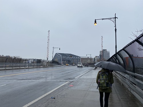
On Sunday I led a hike for my club that was intended to cross every pedestrian-accessible bridge over Spuyten Duyvil and the Harlem River. We ended up skipping two bridges near the end, hiking 16 miles total.

Spuyten Duyvil & Harlem River Bridges

The afternoon was rainy, which I could have done without, but overall we had a good hike.

Sunday, February 7, 2021

Visit to High Bridge

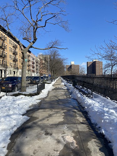
As I'll be leading a hike at the end of the month that crosses High Bridge, I wanted to stop by to see if much of the park was still blocked off by construction. It turns out the answer is it's not - only the area immediately around the water tower is off-limits.

Trip to High Bridge

I opted to take sidewalks alongside Morningside, St. Nicholas, and Jackie Robinson Parks, since they were shoveled and pretty reliably clear from snow earlier in the week. I did the same for Highbridge Park, as I wanted to get a good view of the construction or lack thereof.

Trip to High Bridge

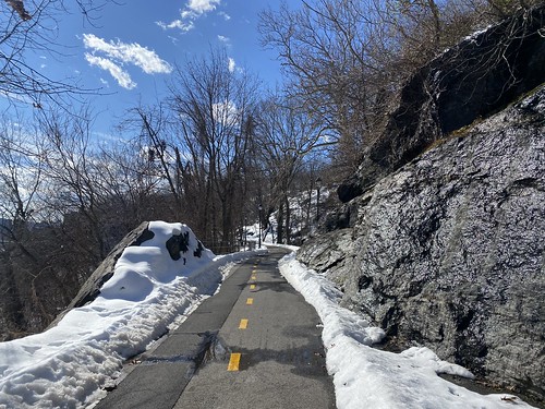
At High Bridge, I crossed over and briefly stood in the Bronx before heading back. There I took a well-cleared bike path, but otherwise I retraced my steps home.

Trip to High Bridge

Monday, December 28, 2020

Up Dutcher Notch

Due to anxiety about driving on black ice, I skipped doing a 3500 peak my second day in the Catskills in favor of a trail that was close to my motel. I needed to hit Dutcher Notch eventually for the all-trails patch, anyway.

Dutcher Notch is a steep climb up to the Escarpment Trail. One could use it as a way to reach Blackhead, but it's not the easiest approach to it, so it gets less use than some other trails. This meant I needed to break out my snowshoes. It wasn't virgin snow, but it wasn't packed, either.

Dutcher Notch

It also doesn't have any particular views, which was fine on a gloomy, gray day.

Although only 1.9 miles, this hike pointed out how out of shape I am, thanks to 1,400 feet of elevation gain, plus the additional challenge of snowshoes. But since I was alone, I could hike as slow as needed!

As I approached the Escarpment Trail, there was a nice view of Blackhead (in the summer it would be obscured by the trees). 

Blackhead Mountain

The other thing this hike had was solitude - I encountered no other hikers on it that day.

Tuesday, July 28, 2020

Back with the Ramblers


Did my first hike with the Ramblers since COVID came to town, on a shortish hike in Harriman State Park. The total mileage was only 8.71, with 1,180 feet of elevation gain. (Let's round to 9, shall we?) But it was a hot day, so that felt sufficient to me.

Pine Meadow

We started from Sloatsburg and followed the Pine Meadow Trail to Pine Meadow Lake. This part of the hike was the busiest I've ever seen Harriman - not just hikers, but families partying by the creek and at the lake. I know it's outdoors and therefore safer, but I was still uncomfortable with how many folks weren't wearing masks.

Pine Meadow

We ate lunch at a shady, breezy spot by the lake - past the party scene - and then three members of the group departed in search of a longer hike. The rest of us hiked out on the Kakiat Trail, which was much emptier.

Pine Meadow

Late in the day was one of our best moments - we came across a snacking deer. This deer saw us but did not care!

Saturday, July 11, 2020

The most popular hike at Fahnestock

My big summer getaway was going to be a trip to the Adirondacks to hike some fire towers. But under COVID, everything changed. The admonition to "stay local" plus the risks of travel led me instead to a camping trip at Fahnestock State Park, an hour away.   

Canopus Lake and Shenandoah Mt. 

I drove up there Monday morning, which turned out to be the hottest day in a very humid week. For my first hike, I chose what I correctly suspected was the most popular one - a hike along the AT to a viewpoint overlooking Canopus Lake. 

On my first visit to the park, I had done this hike; this time, I went further north along the AT to Shenandoah Mountain. I saw six groups/solo hikers, including one group of about a dozen people, only two of whom were wearing masks. In general, the hikers I saw this day were the least likely to mask up when they encountered people. 

At the overlook, pictured above, I could see and hear the beach-goers at Canopus Lake. But I didn't linger, since standing in the sun was hot.   

Canopus Lake and Shenandoah Mt.

Shenandoah Mountain, above, had a nice view - one of the better views I was to see on this trip. It was worth the added distance. Plus, the crowds dropped off dramatically after the overlook.

At just over 4 miles one-way, or 8 round-trip, this was the longest hike I did - no record-setter, to be sure, but the weather was brutal. Plus I'm still not in my finest fighting trim.

Tuesday, January 21, 2020

Rail trails of Manchester

I was supposed to spend last weekend backpacking in the White Mountains. However, the trip got postponed due to weather - a cold, snowy front was coming through. Yes, one expects to be cold in the Whites in winter, but -20 is pushing it, especially for a group tour.

I still had non-refundable plane tickets to Manchester, NH, though, giving me the choice of losing them or throwing good money after bad. What the heck, I said, and decided to go anyway.

Since I didn't rent a car, my entertainment was limited to places I could walk. But, hey, I'm a hiker! So I saw a good portion of the urban trails during my time.

Heritage Trail

Up first was the Heritage Trail, a very short trail along the Merrimack River. The proper trail is only .9, although of course one can walk further on local streets. The old mill buildings foreclose river access in places, however. The photo above shows the view from the access point near parking.

Piscataway Rail Trail

There is another section of this trail to the south, which I did a bit of the next day on my way to the Hands Across the Merrimack pedestrian bridge. It had snowed the previous night, and of course the trails were not plowed, upping the difficulty level. The photo above shows a view from the bridge.

Piscataquog Rail Trail

Once across the bridge, I was on the Piscataquog Trail (above), which I followed in its entirely (2.1 miles) to the Goffstown Rail Trail (below). It's 5.5 miles long, but I only did a portion of it, just over a mile. Volunteers had shoveled out a bit of the Piscataquog Trail, but otherwise it was all snow. (Snowshoes would have been ideal, but no one else I saw out had them either.) Both trails follows the Piscataquog River, although in some sections it's not within view.

Goffstown Rail Trail

Additionally, Manchester boasts the South Manchester Rail Trail and the Rockingham Recreational Trail, both of which would require a car from downtown. As it was, I took a Lyft back from the Goffstown Trail instead of returning on foot.

P.S. I stayed at the Ash Street Inn, which is more upscale than I usually go, but it was a nice choice, and located within walking distance of downtown attractions. Would recommend.

Sunday, December 22, 2019

Hiking "The Six" in winter

A hiking buddy convinced me to do The Six in winter, despite thinking it was more than enough in summer, when there is plenty of daylight. So off we went.

The Six

First, we headed up Friday, which is a long, slow hike. M, our hike leader, set a nice slow pace that would be easy to keep all day. But once you get up Friday, you've gained the biggest portion of your elevation for the day.

The Six

Just past the summit you'll find the above view. From there we proceeded to Balsam Cap. Even though the first four peaks are not on trails, we were helped by following a recent set of snowshoe tracks. I will say that the snow, while it takes effort, does reduce the number of trip hazards as compared to the summer.

Lone

After Balsam Cap, my only photos are of the summits - it was getting colder and my camera was hard to get to. The photo above is of the last off-trail peak, Lone, which you can see we reached in the dark. From there we got onto the trail to Table and Peekamoose.

(This makes the latter two the Catskills peaks I have climbed the most times, at four each. Er, and also Slide, I've also done that four times.)

We didn't get back to the cars until about 11:20, so it was a very long day. And now I really don't have to do The Six again!

Monday, December 2, 2019

Thru-hiking the Batona Trail

Five years ago, I tried to hike the Batona Trail over Thanksgiving but gave up after one night because my gear just wasn't sufficient for cold weather. Now, with better gear and a friend in tow, I tried again.

Batona Trail

There were several things that helped me this time:

  1. Better gear. Most importantly, a better sleeping pad. 
  2. Improved trail signs. We only wandered off course when we weren't paying attention.
  3. The new Southern Ocean County Park and Ride, which allows for a much earlier hiking start on day 1 when coming from NYC.
We took a bus from Port Authority to the SOCPaR Wednesday morning, then a taxi to the southern trailhead. The first day was a longish one - and on top of the Batona trail itself, there was slightly more than a mile on the spur trail to the first campsite, Buttonwood Hill Camp. The third day is also long, with days two and four being short (if you stay at Lower Forge and Brendan T. Byrne.)

It was sunnier on day two, albeit windy. (Our trip had been predicated on the weather being decent; of course it would be cold, but we had agreed to cancel if it was rainy or nasty. We lucked out here.)

Batona Trail

Lower Forge Camp is slightly closer to the main trail than the first camp. One could push on to Batona Camp, but then day three becomes long instead; it's a toss-up. I wouldn't do the entire hike in less than four days in the winter, personally, because of limited daylight. Three could be reasonable in summer.

Batona Trail

On day three, we saw Apple Pie Hill and its fire tower, as well as some nice lakes. Access to the fire tower is limited to when it is staffed, so we expected to be shut out, but to our surprise it was open. This is the view. You can see how flat the landscape is!

Batona Trail

We found the Franklin Parker "reroute" (it's been there since 2012 but still isn't on the official map!) confusing. Not confusing to follow, because of the good signage, but we just couldn't match up what we saw with what was indicated on the map. The map shows you walking by one lake, but we passed three. Very pretty, to be sure, but perplexing.

Batona Trail

The third night at Brendan T. Byrne was the coldest, and also the only night we didn't have the entire campground to ourselves.

Batona Trail

The above photo of Pakim Pond, which we passed on the last day, is a little misleading. The pond is probably very pretty at times! But the water level was low, making the shore rather unattractive. We also climbed our second fire tower, Lebanon, which is unstaffed but open.

From there we pushed a little fast, since we had an appointment with a Lyft at the northern trailhead. But we made it to mile 52.7 with about ten minutes to spare. Our Lyft took us to the Tom's River Park and Ride, and from there we caught a completely full bus back to the city.

It was a nice hike! If you want to do the same route, we used this trail guide, which was very helpful, and the guidance of the Facebook group dedicated to the trail.

Monday, September 2, 2019

Hiking Van Cortlandt and Tibbetts Brook

Well, today was the second attempt at doing this scouting hike and failing. The smart day to do it would have been Saturday, which was beautiful. Sunday I had to work. The forecast for today was rain, but it didn't look that bad initially.

But by this morning, it was an 80% of rain and thunderstorms, and I didn't want to be stuck out in the middle of Harriman if it got ugly. I am something of a weather wimp when it comes to day hiking alone. If I'm backpacking, I'll keep going, barring unsafe conditions (so, for example, I opted to wait it out instead of going up the Long Trail's Burnt Knob with major storms coming in). But if I'm going out alone, I'll probably be lazy.

VCP to South County Trail

So instead, I took the subway up to Van Cortlandt Park. I walked up the Putnam Trail and onto the South County trail, then around the east side of the lake. It started raining as I rounded the north side of the lake, so I bailed out on a bus. It was 5.6 miles, mostly flat, although the elevation gain came out to a surprising 400 feet.

VCP to South County Trail

Thursday, February 21, 2019

Weekend at Camp Nawakwa

One of the Ramblers is a member of Camp Nawakwa, a private camp at Harriman State Park, and she runs an annual winter camping trip there.

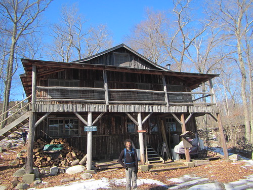
Camp Nawakwa

(Both "backpacking" and "camping" are a little inaccurate, I suppose. We backpack in, but then stay in cabins. The main cabin has electricity, but no heat, while the sleeping cabins just have four walls and a roof. So, "luxury" winter camping?)

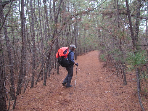
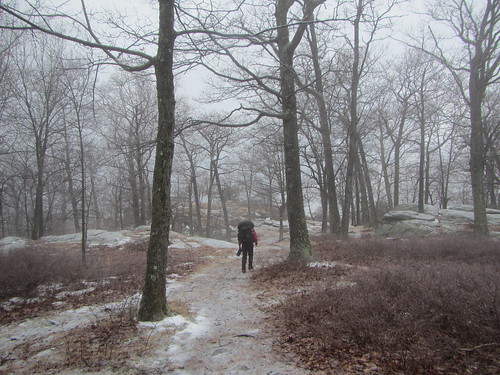
We hiked in on Saturday morning. The trail was very icy, and I wouldn't advise anyone to be on the trails without microspikes under those conditions. Mind you, we saw plenty of people over the three days who didn't have them. It may be hard to believe that, given the photo above - but the amount of snow varied dramatically depending on the direction the slope was facing, etc. And the trails were actually icier than the surrounding woods, thanks to previous hikers packing the snow down.

After settling in, we took a very short walk around camp, and I didn't wear my spikes, which was a mistake.

Camp Nawakwa

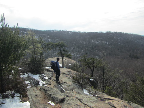
On Sunday, we took a longer hike, covering some trails that I must have been on before but did not remember well. There was some pretty nice scenery.

Camp Nawakwa

Monday the weather was still cold but now also raining/sleeting/snowing. We only had to hike out, though.

It was a nice weekend, although quite cold. My new winter sleeping bag worked great, especially with a couple of blankets from the main cabin added!

Thursday, January 31, 2019

Hiking Windham in winter

Windham

Sunday's Winter Weekend hike was my third climb of Windham, but the first in winter. I had expected the weather to be a tad warmer than on Saturday, but instead it was snowing and blustery. This made getting to the trail head a serious drive, and it meant that the views from Windham weren't optimal.

We took the Elm Ridge Trail (which I needed for my all trails patch!) before joining the Escarpment Trail, returning via the same route. Our pace was quicker than Saturday's hike, and, yes, I was the slow one. My hiking speed is still not what I want it to be, nor what it used to be.

However, we still finished in the early afternoon, with plenty of time for German food.

Sunday, January 6, 2019

Hiking Kaaterskill in winter

Kaaterskill High Peak

I'm working on my Catskills 3500 winter peaks, now that I've completed the regular requirements. I don't anticipate completing very fast, given that there are only three months of the year that count, and trips up there in the winter are both more expensive (can't camp) and harder to schedule (unpredictable weather). Day trips are really only feasible if you already own a car - or if you catch a ride with someone who does.

That's what I did for Saturday's hike up Kaaterskill High Peak, my ninth winter peak. My previous hike of Kaaterskill was in May, on a relatively nice day. Since KHP has some great views, we all hoped for nice weather. My second choice would have been for fluffy, fresh snow. Instead, what we got was a cold rain.

Because of the rain, we didn't follow the herd path up Hurricane Ledge. (Wet and possible icy rocks? Apparently, the wet is worse than the ice - our leader said that one of the rock climbs basically traps you in a shower.) Instead, we bushwhacked up the east face. The trickiest part is shown above, on our descent.

We had a good group of mostly cheerful hikers, which made the weather less of a tragedy. You'll notice a couple of blurry spots in the photo above. I just couldn't keep my camera lens entirely dry. Luckily, I had the right gear (except it turned out my warm mittens aren't waterproof) to stay dry enough and therefore warm.