Somehow in my nearly four years here in NYC I had failed to hike Bear Mountain, easily the most popular local hike. I set out to remedy this on a nice spring day. The leaves were just coming out, and the temperatures were about 70 - which felt hot after the long winter.
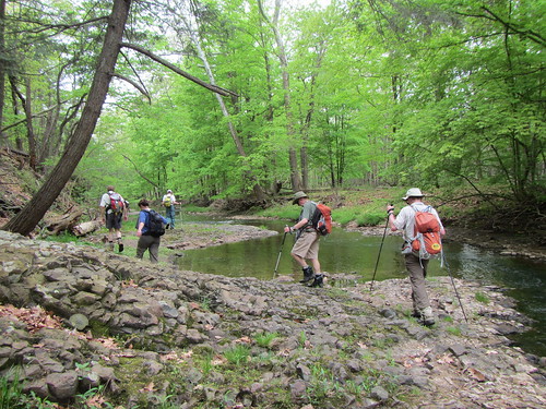
I hiked the mountain in a loop, heading up the Major Welch trail. It's the less popular of the two approaches, as it's more technically difficult. As you can see in the photo, much of it involves rock scrambling, although it never turns into outright climbing.
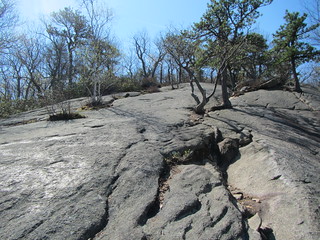
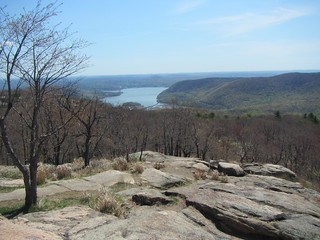
As you near the top, the Major Welch joins with the Appalachian Trail. Because the peak is so popular, this part of the trail is several feet wide and covered in gravel. Of course, it's popular in part because a road leads to the top, and families in cars, cyclists in pelotons, and bikers in groups all drive up. The peak isn't exactly a solitary experience, but the view, shown below, is still terrific.
Now, full disclosure, I had a hard time finding the start of the northbound AT from the top; I planned to come down by that more popular route. After walking literally in circles, I finally found it - mere feet to the left of the viewpoint at the top.
Somehow, I lost it again. I realized after a bit that (a) there weren't nearly enough people, (b) there weren't any blazes, and (c) the trail didn't seem worn enough. There was a power line running overhead, and a couple of the poles had what looked like very faded white blazes, so I kept going. Finally I saw some equipment on my left and heard voices, so I followed the sound to two NY-NJ Trail Conference volunteers pausing for lunch. They told me the trail was a maintenance way for the power line, but not far ahead I'd hit a gravel road and the AT itself. Thanks, friendly volunteers!
Sure enough, I hit the AT and the crowds - some of whom were making the same mistake I had. Well, it wasn't like they would get truly lost; they'd end up at their destination. The AT here, by the way, is a massive amount of rock work. It's almost all stairs and very little natural slope, and it is much more crowded than the Major Welch.
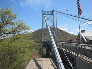
I had considered trying to do the Popolopen Torne, but my ambition was lacking, so instead I decided to circumnavigate Brooks Lake. This meant heading to the Bear Mountain Bridge and then north past Forts Clinton and Montgomery. The photo at left is gazing across the Hudson at Anthony's Nose; the trail to the forts is literally about two feet to my left, but I didn't notice it. (See a theme here?) I'd hiked this area with the Ramblers in the past, but we had come through the zoo. After some bumbling, though, I finally found it.
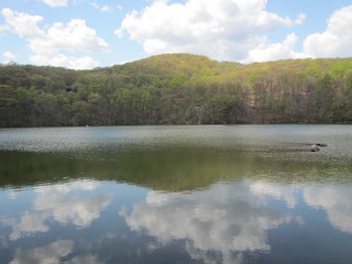
This part of the park didn't have Bear's crowds. Down by the water I saw a lizard, who wouldn't sit still for a photo, and two frogs. The trail through Fort Montgomery and up to the Popolopen Gorge is relatively undistinguished, although pleasant enough. I cut north up to circle around Brooks Lake and was nicely surprised by how pretty it was. This part of the hike was mostly flat. At the northern end of the lake, several locals were out fishing - there is a parking lot on the east side, and the park essentially ends at the lake.
From there, it was simply a matter of returning the way I came, and getting some ice cream at the Bear Mountain Inn.
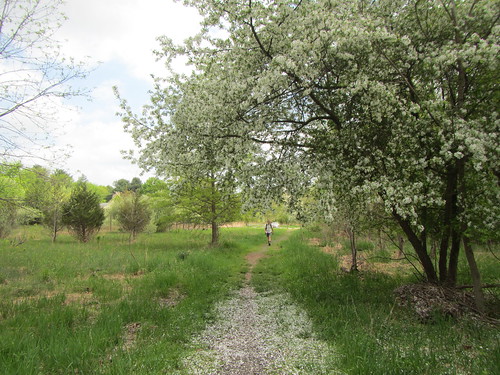
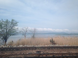 Sunday's hike followed some of the lesser-known trails on the east side of the Hudson River - that is, not Breakneck or Anthony's Nose - on an extremely muggy day. A few weeks earlier, we would have had many spectacular views. Now, leaves obscured most of them. The photo at left is from the train ride up to the hike.