Saturday, December 31, 2016

McDowell Creek Park waterfalls

Royal Terrace Falls
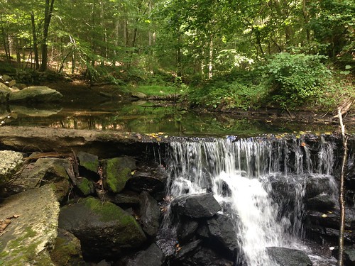
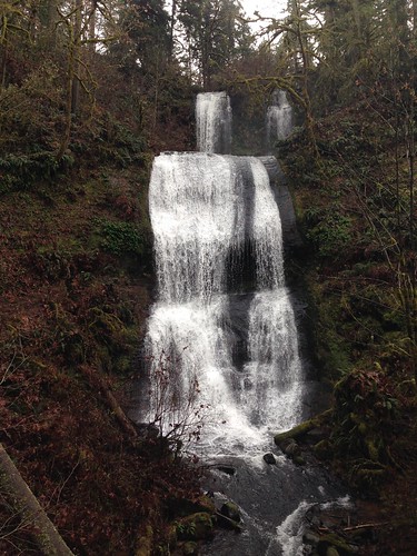
My sister and I went to Oregon's McDowell Creek Park to check out the waterfalls. There are hiking trails that total a few miles, but instead we drove to each of the three parking lots to see the falls the easy way.

Lower McDowell Creek Falls wasn't easily viewable from the first parking area. There is a picnic area there among the mossy trees, and trails start here.

Royal Terrace Falls, as seen at left, is a short distance, perhaps 1/4 mile, from the second lot. It's 119 feet high and obviously impressive. The photo is taken from a bridge over the creek, which affords the best view.

The third fall is Majestic Falls. We walked 400 feet from the lot to the top of the falls, but we didn't take the stairs to the bottom. It's less than half the height of Royal Terrace Falls, but it has a loud, satisfactory roar.

It would definitely be worth taking the time to hike the trails. Aside from the obvious spectacularness of the falls, the woods were lovely and green.

Thursday, December 22, 2016

An apology to Pelham Bay Park

Pelham Bay ParkIf you've been reading this blog for a while, you might remember that I visited Pelham Bay Park once before and didn't enjoy it at all. So why did I go back? It occurred to me that it might be better in winter, since the worst problem was the overgrown and undermaintained trails. Plus, it is close by*, and I was feeling lazy.

Last time, I'd reported that the Westchester 45 bus didn't stop at the park. Well, this time it did, no problem. Did I not request the stop before? Was I not paying attention? Was the driver cranky? I don't know. All I know is that the bus still only runs once an hour most of the day, which is something to take into account when planning, but not a serious inconvenience.

Pelham Bay ParkThe Bartow-Pell Mansion was closed. There were some workers outside in white coveralls working on a project, and they were literally the only people I saw in the park. Weekdays in winter tend to be good days for hiking solitude, even in more popular parks, and Pelham Bay is at the far edge of the Bronx. Again, there is a downside, which is that the restrooms are therefore also closed, but ... well, I was in a park full of trees and nearly devoid of people.

I walked over to the lagoon and up the Siwanoy Trail, up the Split Rock Trail to the road crossing, and then back, taking the other half of the loop back to the mansion. The trails were in much better shape than on my previous visit. I can't honestly tell you how much of the improvement was due to the time of year or whether any of it was due to trail maintenance. Either way, it was much more pleasant than on the previous visit.

Hutchinson GreenwayThere was an abundance of wildlife, perhaps because I was the only one around to scare animals off. The top photo was taken moments after watching what looked like an egret take off. But I also saw sparrows, chickadees, geese, bluejays, robins, swallows, swans, and woodpeckers, plus two black squirrels chasing each other up a tree. There was even a white-tailed deer, dashing quickly but silently away into the underbrush.

Once back at the mansion I did another short loop. The bus had come about ten minutes earlier, so I decided to walk back to the 6 train via the Hutchinson Greenway. It follows Pelham Bridge Road but then turns west next to Orchard Beach Road, crosses the Hutchinson River, and ends at a major bus stop. One could walk to the train on sidewalks from there, although I didn't.

Hutchinson GreenwayAll this was only a small part of the park. West of Pelham Bridge/Shore Road is mostly golf course; east of the lagoon is Orchard Beach and a good chunk of land. To the south is another section of park, separated by the Hutchinson River, but it is mostly athletic fields. Judging from the park map, Hunter Island/Orchard Beach are also worth exploring.

To make a long story short, I owe Pelham Bay Park an apology. I still don't know that I'd go back in summer, but it made a lovely walk on a sunny winter's day.

* "Close" is an odd term in New York City at times. If I were a crow, it wouldn't be far at all. But getting there from my house takes an hour and a half. Besides, if I were a crow, I wouldn't have a house.

Sunday, November 27, 2016

Hiking below the Palisades

Palisades shore trail

J and I joined the Ramblers for part of their hike today, heading across the GW Bridge and then up the Shore Trail below the cliffs of the Palisades. It was a gorgeous day for a hike, with sunny blue skies. We opted out early (we had been up kind of late the night before), heading up the cliff at Huyler's Landing and catching a ride back to the city.

Monday, November 21, 2016

Inwood Park in late fall

I hadn't been up to Inwood Park for a while, so I stopped by this weekend.

Inwood
You'll never forget you're in the city; even when you can't see buildings, you can hear the roar of traffic.

Inwood
Despite that, it is more spectacular than most of the city's parks, because it offers some great vantage points. Here you see the Henry Hudson bridge over Spuyten Duyvil. From other places, you can see the Bronx, Washington Heights, or New Jersey.

Inwood
Spring flowers are great, and fall foliage is lovely, but the smaller details really show up this time of year.

Saturday, November 19, 2016

Insects in the park

Mantis
Saw this sweetie in Van Cortlandt Park's vegetable garden today. The garden was being taken apart for the season, but the peppers and swiss chard were still standing, with this mantis hiding in the chard.

Sunday, November 13, 2016

Revisiting Overlook

Overlook

I had hiked Overlook Mountain just over a year ago, when the fall colors were splendid. This time, they were slightly past peak, but it was a nice clear day, if chilly.

The parking lot was full when we got there (and even more full when we left, although that didn't seem possible). Because the hike is a well-maintained gravel road, it's relatively easy climbing - it's still steep, but not at all technical. And view from both the overlook and the tower aared spectacular, plus there are the ruins of the Overlook Hotel to see. The photo above shows a view from the fire tower.

J now has four of her five Catskills fire towers done - only Hunter remains - while I am excited to have only two 3500 peaks left.

Saturday, November 12, 2016

Hiking Balsam in the fall

Between the electoral excitement and the academic conference I'm at, hiking hasn't been at the forefront of my mind. Last weekend seems like eons ago. Balsam Mountain 
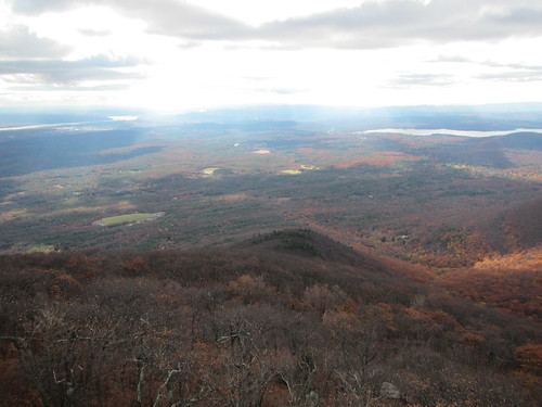
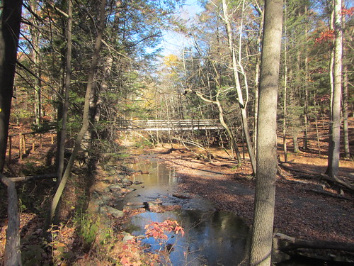
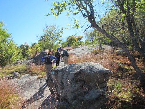
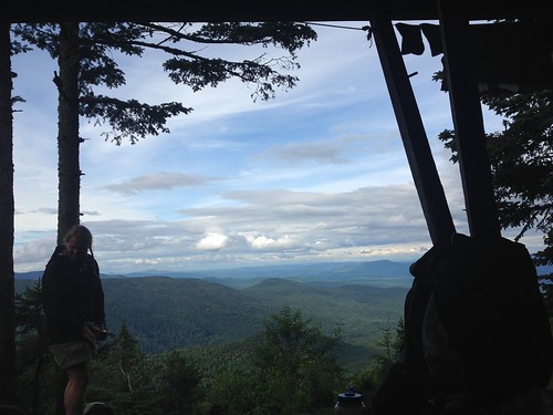
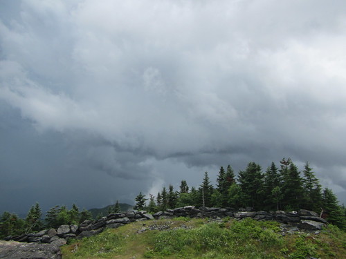
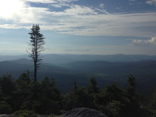
But this time a week ago, I was hiking Balsam Mountain with the 3500 Club. J went to go hike Balsam Lake in pursuit of her fire tower patch, which I have hiked twice previously. Actually, I've hiked Balsam before, but in winter - it's one of the 3500 peaks that needs to be done twice. We took a different approach than on my winter hike, coming up from the east. The leaves were mostly but not completely fallen, making it pretty but very loud to hike through. This route is mostly straightforward hiking, with little to no scrambling, although it is steep in places. 
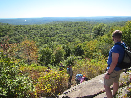
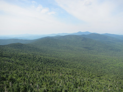
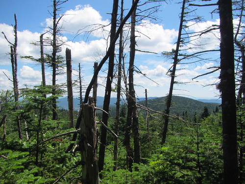
There is no view at the actual summit, just a rock cairn, but a short distance past that is a nice overlook, shown in the photo above - a very Hudson River school kind of scene.

Tuesday, November 8, 2016

Hiking Black Creek Preserve

Black Creek Preserve

J sent me an Instagram photo of a pretty bridge and suggested we go there on our way up to the Catskills. I had never even heard of the Black Creek Preserve in Esopus, but it had an easy 2.5 miles of trail. We decided to stop in on our way up to Tannersville this past weekend.

The forest is pretty, especially at this time of year - autumn makes everything look better. The bridge, seen above, runs over the creek near the parking lot and is one of the highlights. (I'll leave it as an exercise to the reader to figure out the name of the creek.) The other highlight is the far end of the trail, which runs along the Hudson River. This far north, you are well past the cliffs of the Palisades, so the view is substantially different than it is near the city.

The hike is worth a stop. It would be great for kids; there are hills but they are mostly gentle.

Note: You can find a trail map here; they also have them on site.

Tuesday, November 1, 2016

Torrey Memorial without the Torrey Memorial

Torrey Memorial 
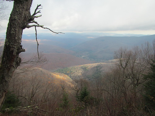
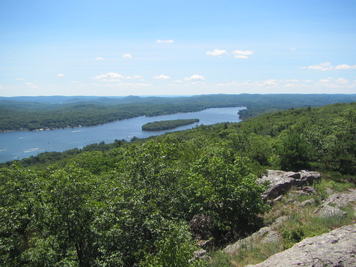
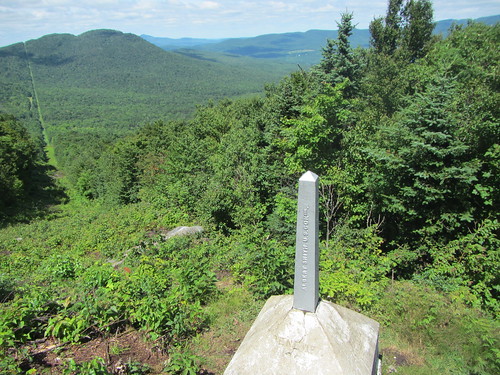
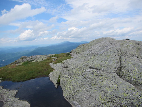
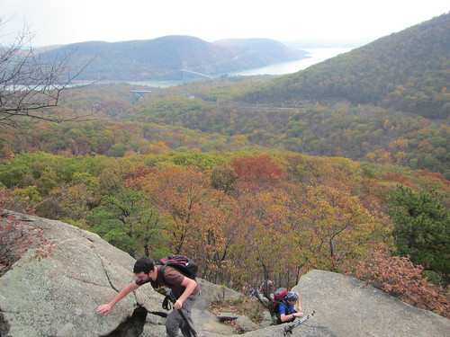
The Ramblers, like many New York-area hiking clubs, does an annual hike to the Torrey Memorial in Harriman State Park. Raymond Torrey was a local journalist and trails advocate, and a memorial is carved to him on top of one of the park's mountains. I was to lead this year's hike. We started from the Bear Mountain Inn and went up to the top of Popolopen Torne, as seen in the photo above. The fall colors were lovely but the air was unseasonably warm. From there, we proceeded to Queensboro Pond, and then realized we were running out of time. There is only one bus back to town - and rain was rolling in. (Just as we were discussing it, thunder started rumbling.) At Turkey Hill Lake we decided to turn around and follow our return route, the 1777 trail to the Suffern-Bear Mountain trail. Then the rain started. At the junction with the SBM, the group voted to take a different, flatter, trail back - one I don't know well. This worked fine until at a confusing trail junction we made a wrong turn and headed south instead of north. We had to turn around and retrace our steps. The good news is we made our bus. It sure would have been nice to have time for a cup of hot cocoa at the Inn, not to mention a chance to try off, but at least we had an adventure.

Wednesday, October 26, 2016

Seeing dead people at Greenwood Cemetery

Skyline
From Brooklyn's Greenwood Cemetery, you can see the Manhattan skyline. Chapel
You can also see lots of fancy tombs and graves.

Sunday, October 23, 2016

Strolling the Gowanus Canal

Concrete

OK, you can't really stroll along most of the Gowanus Canal - there isn't a path beside it. But we did toodle around the neighborhood a bit.

This picture of a concrete works is old-school Gowanus. Gentrification is sinking its teeth into this part of Brooklyn, too, and urban sites are being snapped up as lofts, and some unbearably enormous lots are replacing old buildings. But the process is far from complete yet.

Friday, October 21, 2016

Not enough leaf peeping!

I need to start planning my Octobers better; I really haven't gotten out to see the fall colors nearly as much as I should have.

On the other hand, it's been 80 degrees all week. So is it really even fall?

Friday, October 14, 2016

Greens of Riverside Park

Berries

Fall colors may be at their peak in the Adirondacks, and close to their peak in the Catskills, but here in the city the leaves haven't started turning yet. It's true that the leaves are starting to look a bit tired, but summer is still hanging on.

Sunday, October 9, 2016

Visiting Kaaterskill Falls

Kaaterskill Falls
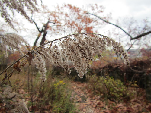
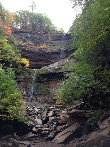
Kaaterskill Falls, one of New York's most impressive waterfalls*, has been undergoing trail renovation over the past couple of years. There was no official trail past the base of the falls, yet people climbed up there regularly, and every year a couple of people fell to their death.

Since I was last there, a new trail has been built to the top - a very solid set of stone stairs. Eventually, there will be a viewing platform at the top, but when we were there, construction on a bridge over the falls prevented access in that direction. You can reach the top, but you can't see much from there.

Despite a dry summer, the falls were still running, but with less water than on my previous visit. It's still worth the steep hike up from the road (not to mention the crowds at the lower levels). What's still a huge pain is parking; the lot simply isn't big enough. People, this is not the place to leave generous space between your cars!

* Obviously, Niagara Falls is the most impressive.

Friday, October 7, 2016

Return to Tremper Mountain

The tower

After successfully tackling Red Hill, J and I had to decide which fire tower was next. My plan for the weekend had been to do Overlook, which follows an old road and has not only a view but a bevy of interesting sites along the way. However, it seemed like a waste to do such a scenic hike on a cloudy day, so we went to Mt. Tremper, which I remembered as having somewhat disappointing views.

I had forgotten, though, that it was the steepest of the Catskills fire towers. Hunter is more challenging, since it's longer and scrambly, but Tremper isn't a laid-back amble. We took our time going up and were pleasantly surprised to find the top of the tower was open - volunteers staff it through Columbus Day (weekends only).

Upon reflection, the cab being open makes a real difference at Tremper, more so than at the other towers, since the peak isn't as cleared as the others. You actually can see a lot more with just that few extra feet of elevation. My view was obscured thanks to the clouds: We weren't socked in, but clouds drifted past the hills, showing only a little at a time.

I enjoyed Tremper more this second time. It would probably be best in winter, when leaves are off the trees, but I am unlikely to be back to it anytime soon.

Wednesday, October 5, 2016

A surprise hike at the Mountain Top Arboretum

As many times as I've been to Tannersville, I never knew it had an arboretum until J saw a small sign for it while cruising through downtown. The Mountain Top Arboretum (free admission) has a variety of gardens, including a woodland walk, labyrinth, spruce woods, flowers beds, and more.

We strolled through most of the park except the East Meadow, and we only took the Black Spruce Glen trail to the boardwalk - since the boardwalk was closed for repairs. I'm not sure what the distance was, but the trail sign's estimate of 90 minutes to walk Black Spruce Glen was wildly inflated; we went slowly and took half that time. I would guess it was about 2 miles total, not entirely flat.

Despite it being a rainy autumnal day, the arboretum was quite a pleasant surprise. There were still flowers in bloom, and of course the large number of evergreens are interesting year-round.

This isn't the perfect hike if you're looking for a fast workout, but it makes a great perambulating, stop-and-look kind of stroll. We saw quite a few parents with kids doing just that, although none of them on the Black Spruce Glen trail.

Supposedly, the arboretum is good for birding, but ironically the most interesting birding sighting of the weekend occurred near the park, not in it - northern flickers hanging out by the side of the road.

Tuesday, October 4, 2016

Revisiting Red Hill fire tower

After starting on the Saranac Six, my sweetie and I decided to start working on the Adirondack Mountain Club's Fire Tower patch. I had already hiked the five Catskills fire towers, but J hadn't, so we started them over a long Catskills weekend.

Having travelled to the Catskills Friday morning, we decided to do Red Hill, the shortest, that day. My previous hike was two years ago. Like that visit, this one was also in October, the weather was less than ideal, and there was no volunteer at the top. However, being earlier in October, the weather was rain instead of snow, and the lack of volunteer was because it wasn't the weekend.

The hike is short and, as the Catskills go, reasonably straightforward - there is no scrambling and the trail is not confusing. At the top, we enjoyed the well-appointed privy (it has framed art on the wall!) as well as the tower itself. While the day was misty, the views weren't completely obscured.

Eventually, I suppose I should get up there when the tower cab is open.

Thursday, September 29, 2016

Hiking in northern New Jersey

Yoo-hoo

Last week's Ramblers hike was led, in part, by me, even though I had never been there before - none of the leaders had. (Don't worry, we advertised it appropriately.) We hiked nearly 14 miles in Norvin Green State Forest, which proved to be more scenic than I expected. The terrain was very similar to Harriman State Park, to the north.

There were several scenic overlooks and one very modest waterfall. Most of my photos are of folks scrambling over rocks, not unlike this:

Yoo-hoo

Monday, September 19, 2016

Long Island Dahlia Society

Dahlia

This past weekend we went out to the Bayard Cutting Arboretum while the dahlias were in bloom for some strolling and some high tea at the Hidden Oak Cafe. We weren't sure what the dahlias would be like (they're supposed to bloom in "August and September"), but they were quite magnificent.

Sunday, September 18, 2016

Brooks and hills circular

Rocks

Last week's Ramblers hike was a nice one through Harriman State Park, mostly in the woods. It avoided the most killer hills in the park ... but as you can see, there were some. But unlike some parts of Harriman, we didn't spend a lot of time on open, bare rock.

Of course, that meant fewer vistas, but we did look out at The Pulpit (where we lunched) and Claudius Smith's Den. We also passed Lake Sebago and followed a nice creek along the Stony Brook trail. All told, it was about 15 miles.

Friday, September 9, 2016

Strolling Trout Pond

Trout Pond

On our way out of the Hamptons, we stopped at Trout Pond to do a short hike, which ended up turning into a mushroom and birding walk, thanks to an abundance of both. We only did a short bit of the trail, which is part of the larger Hamlet to Hamlet trail system.

Of the mushrooms I can't say much, since really all I know is don't eat them unless you really know what you're doing. We saw a turkey up close. We had already seen quite a few turkeys at the Refuge, but those were very comfortable with people. This one, however, saw us and became quite skittish.

Even better was the eagle. We met a family that was having lunch, and they had trained their binoculars on something in a tree. It turned out it was an eagle holding a fish it had caught, just casually having lunch. They let us peer through their binoculars, but the bird was close enough you could see it with the naked eye.

And, of course, there is a pond, as seen above. From this angle it looks rather dramatic, but the other end is peaceful and lily-padded.

Monday, September 5, 2016

Morton Wildlife Refuge

Beach

This weekend I made my first trip out to the Hamptons to celebrate a birthday in Sag Harbor. While there, we went to the Elizabeth A. Morton National Wildlife Refuge. J grew up visiting the refuge, and when she was a child they were often the only visitors there, but thanks to the boom in Hamptons tourism, it is now considerably busier. (And far too many folks are leaving birdseed, attracting rats and raccoons.)

We started at the visitor's center and hiked the 1.2-mile nature trail, where we saw quite a few birds - including a lot of not-at-all-shy turkeys. From there, we walked along Jessup's Neck, a spit of land stretching out into the bay, seeing more birds and an amazing number of shells. The spit is nearly two miles long, and while it is mostly flat, it is slightly challenging to walk on, as sand always is. It's a great hike for taking a little slowly and enjoying the details.

Bird photography generally requires a far better camera than I have, but the turkeys came in close enough for good pics. I leave you with this gobbler.

Turkey

Tuesday, August 30, 2016

An analysis of faculty jobs in higher education administration

An offhand remark on my part that 80 percent of faculty jobs in higher ed were in student affairs led me to wonder whether that was actually true, so I did a little data gathering and crunching. 

For my data, I used ASHE Listserv. Not all openings are posted here, but the majority are, and I felt that any missing jobs would be likely missing at random (or that they were aimed at an inside candidate, but that there was no reason this would occur in any subspecialty more than another).* I only included faculty jobs at colleges and universities, excluding graduate assistants, post-docs, adjuncts, deans or above, and jobs at think tanks, states, or other policy bodies; I excluded jobs outside of the United States and Canada. I excluded jobs that were specifically K-12 but included jobs that were open to either K-12 or higher education scholars. 

I then categorized the searches by specialty, which was easier in some cases than others. “Any,” in some cases, means “a very wide range of specialties, although not literally any,” and in others it means quite literally any. (Examples of the former: “Our preference is for applicants who have experience in higher education administration especially in the areas of academic advising, assessment, leadership, organizational development, or student development,” and “Expertise appropriate for doctoral level teaching in one or more of the following areas:  (1) Quantitative methods applied to institutional research, evaluation, and/or assessment; (2) Leadership in universities and community colleges; (3) Higher education policy; (4) Student learning and academic persistence in higher education.”) In some cases, ads may be incorrectly specified as “any,” if the college chose to only list a speciality in a full ad on their own website. Thus, the number of “any” searches is likely slightly overstated. Additionally, some of the “Methodology” searches in particular were not limited to higher education but also included P-12.

I noted the rank of each position and whether it was tenure-track. In some cases, this was not specified; I assumed ranked professor positions were tenure-track unless the ad stated otherwise. Additionally, ads were grouped by start date, using the semester rather than the month. At this point, it looks like we’ve seen the last posting for “fall 2016,” so I excluded any posts for 2017 start dates.**

Here’s what I found:

Posting date

Unsurprisingly, most ads run in the first few months of the fall semester. There is a lull at the winter holidays, with ads picking back up in February and March. A few run into the summer. 


Rank

One in five postings was non-tenure-track. It’s hard to tell from only three years of data whether the jump from 9 non-TT for 2014 to 22 non-TT for 2015 is statistically significant.

38% of jobs were at the assistant rank with 23% at assistant/associate, and 11% open. Scholars at the beginning of their careers, in other words, can apply for about 3 out of 4 positions, without even considering lecturer/visiting positions. Only about 1 in 4 ads were relevant to scholars at the full professor rank. 


Specialty

This is the question we’re here for, and I’m rejecting my hypothesis that 80% of openings are for student affairs, even without running any statistical tests. (Sorry, guys.) Only 19% of jobs were focused on student affairs. While this was the largest speciality, and while many of the “any” specialty ads are likely available to student affairs specialists, it is still nowhere close to 80%. The second largest specialities were methodology (these postings were particularly likely not to be limited to higher education scholars) and leadership.

A degree of subjectivity on my part was required to categorize some of these postings, but it’s safe to say the frequently requested specializations are student affairs, methodology, leadership, policy, and community colleges. Of course, if you're a scholar focusing on urban education, you don't necessarily need to despair - 41% of jobs were open to nearly any specialty. That said, that theoretical openness may not translate to an actual willingness to hire a historian, etc.

Discussion

Everyone feels that their topic is given short shrift (go ahead, find me a scholar who feels their area gets enough sessions at ASHE), and as someone who isn't in student affairs, I have fallen prey to this same error. 

It's clear that student affairs is the most commonly requested specialty, but it's impossible to tell from this data how this compares to the number of scholars in each area, or to tell how open search committees are to various avenues of research - no doubt there are unstate preferences in the minds of committee members.

Notes

*This assumption may be untrue if jobs in student affairs are likely to be posted with NASPA or ACPA instead of ASHE. Also, it’s not clear to me why ads for a K-12 scholar would run here at all, but there were a few.


**Further methodological notes: Ads that ran twice were only counted once, using their first run date. There is no guarantee that all these positions were filled, or that they were filled with faculty in the desired speciality. If the ads did not specify a start date, fall of the next year was assumed. Data was pulled only from the ads; some ads may have directed readers to an announcement on the institution’s site with more details, such as specialization. I began with the first ad that contained a fall 2014 posting and stopped with the last one that had a fall 2016 posting. A few weeks are missing: Some of those were holidays, with no listserv messages, but it’s possible I am missing as many as five weeks of data (11/14/13, 7/10/14, 7/17/14, 7/2/15, and 11/5/15).

Thursday, August 25, 2016

Greenwich to Port Chester

Waterfall
My first Ramblers hike post-LT was less strenuous than usual - probably about nine miles, with no significant elevation changes.

We began by hiking near at the Audubon Center. Then, after a short road walk, we hiked along more trails that I believe are part of the same property but not contiguous. The final hike back to the trail station was on roads; I opted for the slightly shorter version, not being a lover of road walking.

The trails were pleasant if unspectacular; the highlight was definitely the waterfall, an old dam, where we had lunch.

Tuesday, August 23, 2016

The LT and the body

Wings
Hiking 273+ miles in 24 days is bound to affect your body, and even more so when you're carrying most of your own food. If you've read much about thru-hiking, you know that it's a struggle for most hikers to eat enough calories. Then there is the adjustment of the tendons and muscles to carrying your body and a pack around. Plus, there might be blisters, chafing, and less attention to personal hygiene ...

Well, I was lucky when it came to blisters - I only had one, and was easily dealt with. A little Desitin cleared up a bit of monkey butt. Otherwise, I had no major skin ailments to deal with.

My body worked hard, of course, and I built up my endurance but lost some strength. Upon my return, I either had to go down a bell size or work harder at kettlebells. (The exception to this was overhead presses with my right hand - putting my pack on and taking it off apparently works those same muscles!) Of course, muscles adjust faster than tendons. My Achilles tendon and the back of my heels were hurting, especially in the middle of my hike. It's been a month now, and the soles of my feet still hurt easily; Sunday's hike wasn't that tough, but my feet quickly felt sore. I've definitely been avoiding classes with jumping rope at the gym.

And the calorie thing ... whoa. I knew I lost a few pounds, but I didn't realize how many until I got home and stepped on a scale - after I'd already gained a few back eating in Burlington. Whether it was going stoveless, snacking instead of eating full meals, or whatever, my calorie intake wasn't enough. It was sustainable over the few weeks I was out; but my body would have been in real trouble if I had been on a long thru-hike. Next time, I'll have to reconsider my food choices.

(To be honest, like most people, I didn't mind losing a few pounds. But now most of my bottoms don't fit, and I don't know if I should buy new clothes or if my weight will get back to normal quickly.)

Anyway, now I truly understand the phrase "going to town on" something. Whenever hikers get into town, they eat a lot! Here was where I think snacking instead of eating meals hurt me; my stomach just didn't have room for enormous meals.

But none of these issues turned out to be significant. I didn't have any serious injuries or medical problems on the trail, thank goodness. Part of that is luck, I realize, but it's also good to know my body is generally capable of doing that kind of work.

Saturday, August 20, 2016

Hiking Bearfort Mountain

Greenwood Lake
My first hike upon my return to everyday life was a relatively short hike at Bearfort Mountain. Embarrassingly, I had been here before and totally forgotten about it. On this hike, we just did the highlights - the ridge overlooking Greenwood Lake, Surprise Lake, and the AT at the NJ/NY state line.

Monday, August 15, 2016

The Long Trail, Part III: The End

Lavender fields

On day 17, I was looking forward to the one and only time the trail becomes flat - crossing the Winooski River. After heading down from Camel's Hump, there it was - the road. The trail leaves the road and crosses through agricultural fields. It's perfectly flat except for stiles over electrified fences. As I made my way past a creek, I ran into Pink Heels and Easy Cheese, who were going the wrong direction; they found a fence they couldn't get around. But all good things must come to an end, and the flatness turned into a straight-up grind to the top of Bolton Mountain. Bolton wasn't particularly interesting, but we stayed in a great shelter that night - Puffer isn't a fancy structure, but it has a terrific view.

View from Puffer shelter

Day 18 had its own milestone - Mt. Mansfield, the high point of Vermont. Like Burnt Knob and Camel's Hump, it has a great deal of rocky scrambling. Now, Mt. Mansfield is said to look like a face (which I can't see at all), and the LT goes from the "forehead" to the "chin." The forehead had the most tricky scrambling of the entire trip, and I was glad to be hiking with other people. Of course, the views at the top were terrific, but the sheer number of people was a bit overwhelming - there are several other trails to the top, most of which are shorter by virtue of gondola or car. After a short but steep descent partway down the mountain, we spent the night in Taft Lodge, a very well-appointed shelter, along with the caretaker, two overnighters, and Silent Force.

Climbing Mansfield

On day 19, the trail descended to Smuggler's Notch before going uphill again. At the Elephant's Head Cliff vista, I caught an impressive view of a cliffy side of Mt. Mansfield. Then it was on to Sterling Pond, which had a lot of dayhikers, thanks to the nearby ski area. However, it was to be a short day - a storm was rolling in. Pink Heels, Easy Cheese, and I hoped to make it to the warming hut on top of Madonna Peak - I was glad for their intel, as it isn't mentioned in the guidebook. We came out of the trees onto a ski trail in sight of the hut just as the first drops broke. The hut wasn't the fanciest, but it was dry, and we had some fabulous clouds to watch. Later in the evening, the Skittles and their adults joined us for the night.

Clouds on Madonna

Day 20 was town day again, the last one. The trail itself was up and down until it joined a country dirt road. We stayed the night at Nye's Green Valley Inn; the owner was a truly gracious host and shuttled us around to both Johnson and Jeffersonville. Also, they had goats and miniature ponies, and if you don't love that, your heart is cold.

Nye's Green Valley Inn

After leaving the Lamoille Valley on day 21, we went up and down a few times, enjoying a few vistas along the way, and ending up at Corliss Camp. It was another nice shelter, and we had a good campfire with marshmallows.

Laraway Mt. and maple candy

The next day was a series of ascents and descents. It included the Devil's Gulch, which reminded me of hiking in Tennessee's Cumberland Plateau. Then there was a rough climb up Mt. Belvidere - I had an allergy attack, it was pretty hot, and the deer flies had come out in massive numbers. I felt like Pigpen with a cloud around my head. But there was another great fire tower view at its summit.

Belvidere view

On day 23, the hiking itself was nothing spectacular. I did enjoy Domey's Dome, mostly for its name. Somehow, I didn't have enough water, and spent a good part of my afternoon thirsty. Finally, there was a stream before the road, so I didn't have to hitchhike to town for a drink. I spent the night at Jay Camp, where a major thunderstorm boomed right over us in the night.

That close to Canada?

Day 24 was supposed to be a longer day. Pink Heels, Easy Cheese, and I went up Jay Peak. Thanks to the fog, we didn't get much in the way of views. We took the gondola down to the ski area - unlike many of the trams, it runs on a schedule instead of continuously - at 10:30 and had lunch. They planned to spend the night, so I said goodbye and hopped back up on the 12:30 gondola as thunder began to rumble. It turned out to be a good choice, as they shut down the gondola after that because of the weather. I made it to Laura Woodward shelter with only a few minutes to spare before the skies opened up again, and I was trapped for the day. My final day would have to be longer than planned.

Killington

I got an early start on day 25. The trail was wet but not particularly treacherous. The end was so close! And then it was there - the line post marking the border with Canada. After an obligatory photo and a quick step into Canada, I turned east onto the Journey's End trail to return to civilization. 273 miles plus a few spurs and road walks - done.

Boundary marker


Wednesday, August 10, 2016

The Long Trail, Part II: The Endless Middle

The middle of the hike was the most challenging part for me. Suddenly, the trail grew rougher. The weather grew worse. And my body was growing weary ...

Snail

On day 9, I set off from McGrath's Killington Inn in fine spirits. The weather was unpleasantly hot and muggy, but I was freshly showered and coffeed. Soon, the AT split off the the east, and I continued north, spending the night at the David Logan shelter. Here I met two hikers I'd see much more of later on, Pink Heels and Easy Cheese, and they named me "Weasel Masseuse."

Wet bridge23

I planned to spend day 10 as a zero day; my heels had been hurting me, and I didn't want to push things. But spending a rainy day in a shelter is boring, not to mention cold, so I went on. I decided to go as far as the Sunrise shelter, but I got there and was still tired and cold, and it was nothing special. So I went the extra mile to the road and hitched a ride to whatever town I could get to, which happened to be Rochester, and stayed at a B&B. It was nice enough - the owners were very friendly - but they weren't as accustomed to hikers as the other places I stayed.

Sucker Brook shelter

Still, a night in a warm building did wonders, and day 11 was better. It helped that it was going to be a short trail day - thanks to shelter placement, it was either a very short day or a very long day. Mt. Horrid had a great name (and a Great Cliff, which is very Lemony Snicket), but no view, thanks to rain.

Middlebury Snow Bowl

On day 12 I got back to some decent mileage, a little over 11 miles, and the weather cleared - although the trail was a wet, muddy mess. At one point, nearing the shelter, I had a rather nasty slip that nearly twisted my ankle. It was clearly time to call it a night.

Dead trees

Day 13 came, and I was getting thoroughly sick of the Breadloaf Wilderness. The trail in the this area was quite overgrown, and I got tired of getting thwacked by wet evergreens while avoiding puddles. There were a few good views, though, as a reward.

Foggy morning

Day 14 began with a hike up Mt. Abraham. I understand the view from it is quite fine. I, however, did not see it, as it was still shrouded with fog when I reached the top. This isn't necessarily a complaint - while it would be nice to see it someday, I had chosen to get started early from a very crowded camp in order to avoid the hordes. From Abraham one proceeds over several summits, and then it's down to the road. At the road, I hitched a ride into Waitsfield for my box and lunch (Three Mountain Cafe, which roasts their own coffee, was excellent), and then another ride to the Hyde-Away Inn. 

Cowles Cove shelter

After a ride to the trailhead, I had high hopes for day 15, aiming for Birch Glen Lodge, but nature had other ideas. I stopped at Cowles Cove shelter just after lunchtime, knowing that nasty thunderstorms were supposed to be coming in. Under some circumstances I might have plodded on, but right after Cowles Cove is Burnt Rock, and a sign in the shelter warned direly of how slow it was under the best of circumstances, and how dangerous it was when wet. I sat down to be bored as I waited out the afternoon, closing the tarp door as the rain hit. (This was a feature on no other shelter.) Just as I wished for company, a group of eight campers and their two counselors arrived. While they were planning to tent, there was no point in making them muck around in the driving rain.*

Burnt Knob

I was ready to move on day 16, despite worries about wet rocks - at least the rain had stopped. But Burnt Rock proved to be dry enough, and it was really fun. It's nearly all exposed rock, so not for the faint of heart, but it has great vistas. From there, though ... Next up was the Allen Brothers, Ira and Ethan, and those were some of my lowest moments on the trail. First, I thought I had lost my map. Then the trail went endlessly up and down on scrambly bits, and it looked like it might rain again. I was thoroughly sick of the trail and annoyed when I reached the top of Ethan Allen and paused for a snack. The food and rest helped, and then the sun came out, and everything looked a lot better. So I decided to go on, to Camel's Hump, which is a more magnificent version of Burnt Rock. It offered incredible 360 views.

Luckily for me, that was the low point on the trail. I was now 2/3 of the way done, and beginning to realize the end was in sight. 

Camel's Hump

* Camp groups aren't allowed to stay in the shelters; some of the local camps use the LT on a weekly basis, and would drive out thru-hikers. We wouldn't even have all fit for the night. But for a couple of hours, a roof improved everyone's spirits. Although I'm not sure theirs were ever dampened.