Monday, December 31, 2018

My favorite books of 2018

Well, I read too many books this year.

Although on second thought, I'm not sure I read more books than in previous years. I just didn't reread much, so I read more books for the first time. 138 of them.

In any case, here are the novels I read for the first time in 2018 that stuck with me.
  • Blackfish City by Sam J. Miller. Arctic scifi, kind of like if Autonomous and Philip Pullman got together. 
  • An Unkindness of Ghosts by Rivers Solomon. I'm a sucker for a generation ship, but this isn't like anything else you've read.
  • Girl Mans Up by M-E Girard. YA and not SFF, unlike most of this list. Teenager trying to figure out how to be who she is and not who those around her expect her to be.
  • The Wonder Engine and The Clockwork Boys by Ursula Vernon, writing as T. Kingfisher. Adventure! Romance! Funny things! 
  • Werecockroach by Polenth Blake. OK, obvs, werecockroaches, but specifically, werecockroaches during an alien invasion.
  • American Hippo by Sarah Gailey is a reissue of two novellas bundled together. Alternative history where hippos were brought to the U.S. and ranched.
  • The Steerwoman and its sequels by Rosemary Kirstein. Four books so far, with an unknown number to come. Reads like fantasy but is in fact sci-fi, and very much about science.
  • Criminal Intentions, Season One, 1-6 by Cole McCade. It's a TV police procedural, except in book form. Also romance. "Season One" is about half over. 

Sunday, December 30, 2018

2018 in photos

December:

MOMA

November:

Teotihuacan

October:

Torrey Memorial 2018

September:

Breakneck Ridge

August:

Van Cortlandt

July:

Makoshika Day 4

June:

Mt. Pierce

May:

South Taconic Trail

April:

Blossom hike

March:

#Marchforourlives

February:

Hiking into camp

January:

Table and Peekamoose

Thursday, December 20, 2018

Hiking the Staten Island Greenbelt

Not my first hike here, but always a nice change (and not what people think of when they think of "Staten Island").

Staten Island Greenbelt

Staten Island Greenbelt

Sunday, December 16, 2018

The pyramids of Teotihuacan

Technically, these pyramids not far from Mexico City aren't a hike, but there is plenty of elevation gain!

Teotihuacan

Starting the Moriah Challenge

The Moriah Challenge requires doing four hikes, of easy to medium difficulty. After finishing up the Tupper Lake Triad, we decided to tackle a couple of them, since it was in the direction of home.


Belfry fire tower

First up was Belfry, which does double duty as a fire tower peak. It's a very, very easy hike, even with snow, since it's less than half a mile to the top. However, from the top were great views (made possible by very clear weather).

After this we upped the game, a little, by tackling Cheney Mountain, a whopping .9 one-way to the top.

Cheney Mountain

There are several viewpoints on this peak, one of which is nice views of Lake Champlain.

Saturday, December 15, 2018

Finishing the Tupper Lake Triad

As you can probably deduce, the Tupper Lake Triad patch requires three hikes. J and I had done Coney Mountain about a year ago and hoped to finish it on this trip. Well, our initial plan had been to do McKenzie and finish the Saranac Six, and then do one or both Tupper Lake peaks the next day, but the weather was unseasonably snowy. McKenzie is just shy of being a 4,000-footer, so we decided to save it for another day.

Mount Goodman has a wheelchair-accessible beginning, followed by a turn up to the top of the mountain. As we set out, it was sunny.

Goodman Mountain

But as we reached the top, the clouds and the snow blew in.

Goodman Mountain

By the time we got back to the car, it was snowing hard. But we headed on to our next peak. Mount Arab is also a fire tower peak, which normally means great views - but not in heavy snowfall.

Mount Arab

(Of course, despite the weather, for patch purposes "winter" is defined by dates, not actual weather. This is both good (since dates count towards either winter OR regular patches, not both) and bad (you feel like you should get credit for hiking in the snow!).)

Saturday, November 3, 2018

The complete Torrey Memorial hike

For the third year in a row, I attempted to lead my club's annual hike to the Torrey Memorial. The first year we turned back very close to the memorial due to a thunderstorm. Last year we made the memorial but didn't complete the hike as planned due to pouring rain. So what would this year hold?

Good weather, and a complete hike!

Torrey Memorial 2018

I was also worried, I should mention, because I felt out of shape. I remember finding it a tough hike when I scouted it (to completion) last year. Somehow, though, it wasn't as bad this time. We may have hiked a little slower.

Much of the group didn't finish, although for the most part it wasn't about fitness. Some people had cars and needed to return to them; one hiker was doing the marathon in a week.

The hike went from Fort Montgomery to Central Valley, heading west across Harriman State Park, for nearly 14 miles, with a lot of elevation change.

Wednesday, October 17, 2018

Foliage on the Tanbark Trail

Tanbark Trail
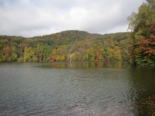
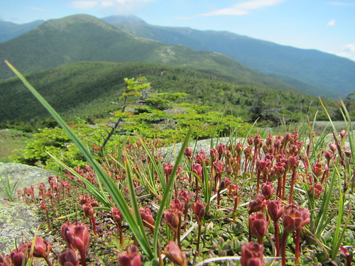
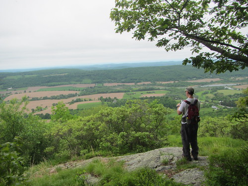
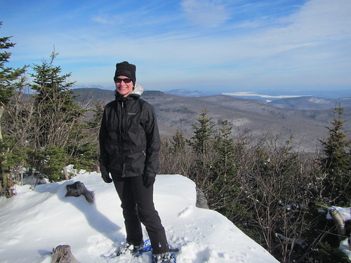
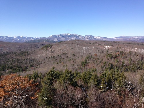
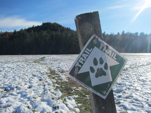
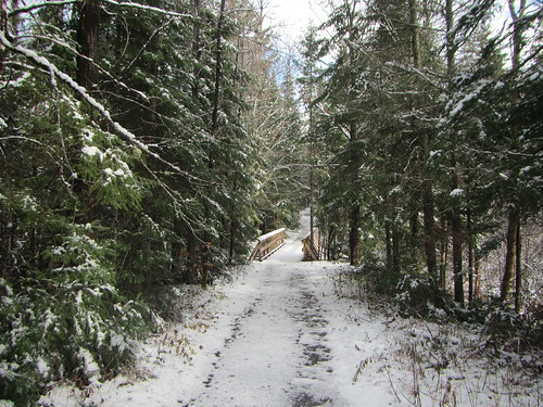
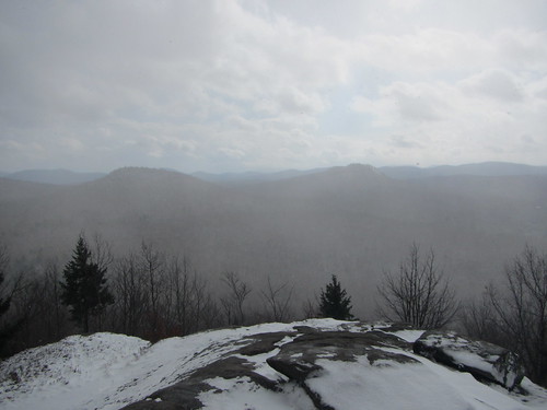
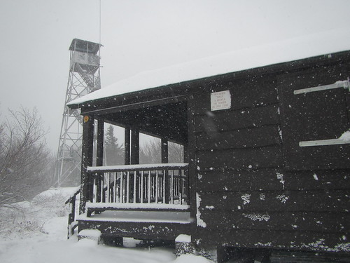
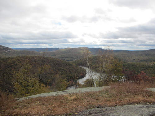
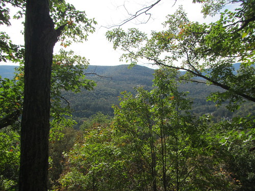
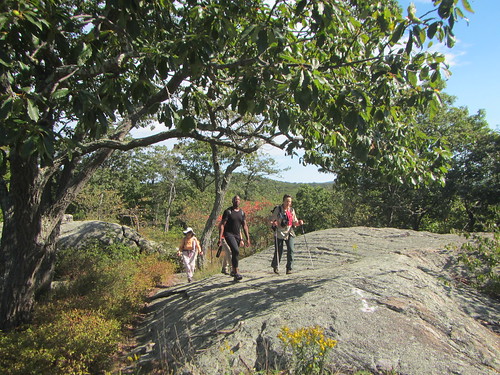
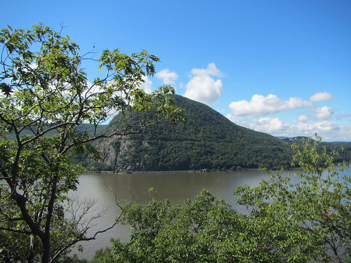
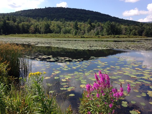
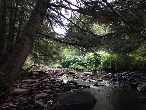
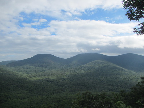
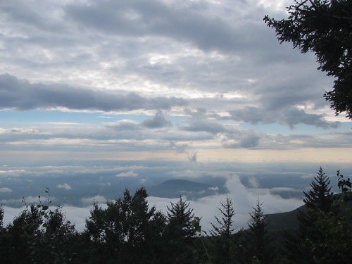
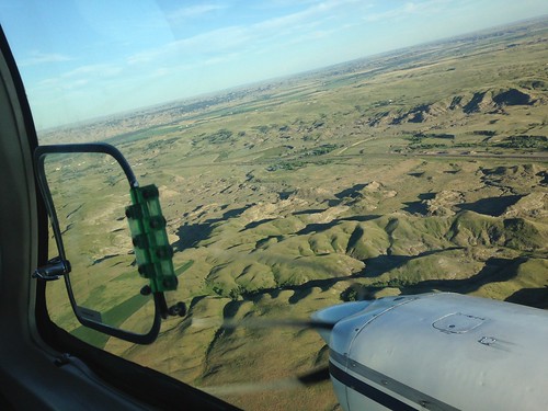
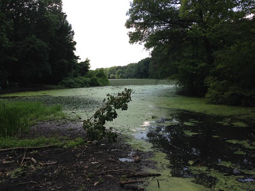
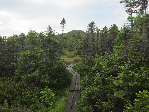
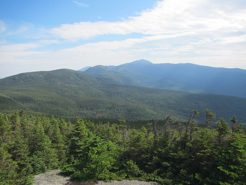
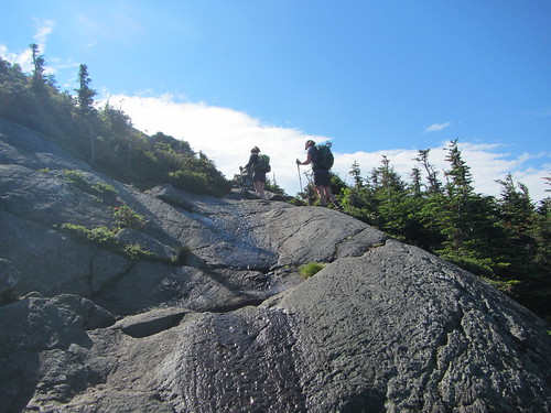
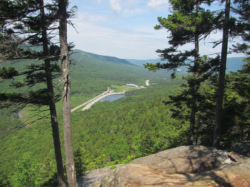
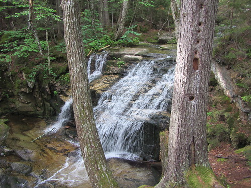
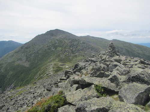
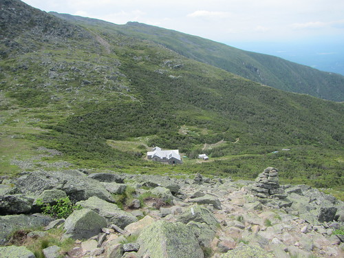
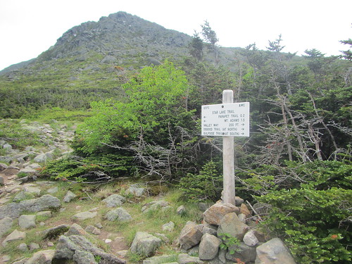
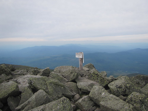
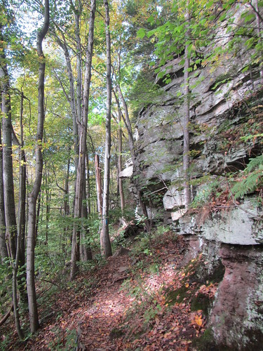
One of my hiking principles is "never spend longer getting to the hike than hiking." Sadly, this year I had managed to book up my weekends in such a way that I couldn't get anyway for a long weekend to enjoy the fall color. And the fall foliage report declared that this weekend would be peak color in the Catskills! Thus I decided to throw principle aside and daytrip up to the Catskills on a Sunday for a short hike.
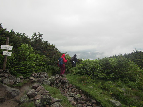
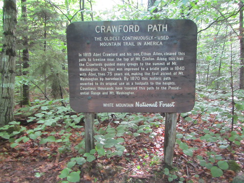
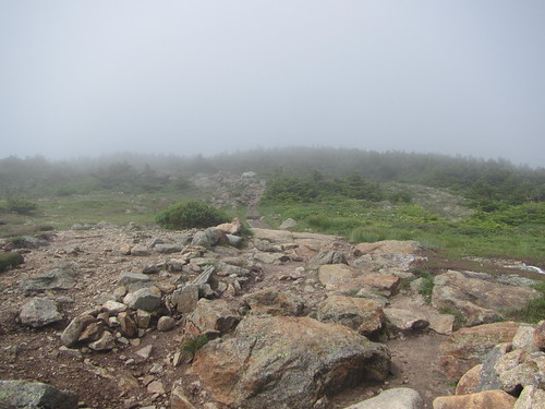
There are only a few hiking trails easily accessible by bus. One of those is the Tanbark Trail, in Phoenicia, which has been on my to-do list for a while.

It turns out that it is a nice little hike. The map shows it as being something of a squashed figure eight (or if you prefer Greek, a theta), but I never did find any connecting trail across the middle of the loop. The irony is that the area in general is criss-crossed with old roads, so some kind of connector in the right place ought to have been easy to find.

Tanbark Trail

Tuesday, October 2, 2018

Dater Mountain group hike

Dater Mountain

I was tapped to lead a Ramblers hike at the last minute, as the original leader had a minor injury. This meant I hadn't scouted it in advance, and some (well, most, as it turned out) of the trails were new to me. So the hike was something of an adventure.

We ended up hiking 12 miles, much of it rather flat for Harriman (about 1,700 feet of gain overall). It was a pretty hike, and the recent rain meant we saw a lot of interesting mushrooms.

Wednesday, September 26, 2018

Ferries, bridges, and Governor's Island

Two bridges + Two ferries

Sunday's Ramblers hike was an urban adventure in Manhattan, Brooklyn, and Governor's Island. We walked about 13 miles all told, I think, nearly all of it flat and on pavement.

The photo above is of old military housing on Governor's Island.

Monday, September 17, 2018

Joining the crowd at Breakneck Ridge

On Saturday I hiked Breakneck Ridge with a friend. The weather was perfect, so as usual the hike was very popular. It's not exactly a place to go for solitude. But it still is beautiful.

Breakneck Ridge

Sunday, September 16, 2018

A stroll on the rail-trail

Rail-Trail

After my backpack, I found myself in Tannersville for the day with no car. With limited options, I decided to walk along the rail-trail. Previously, I'd done some of the western part of it, and I didn't expect much. The western part, after all, passes along the lovely lake seen above, but the view from the trail itself isn't much.

The eastern half turned out to be much more interesting. It follows the old railbed alongside a creek, and much of it is attractively shaded with evergreens.

Rail-Trail

Of course it's flat and not very long (the entire thing is under 3 miles). It ends when it hits a road crossing; while the railbed continues, it is apparently on private land.

Sunday, September 9, 2018

Backpacking the Escarpment Trail

Over the Labor Day weekend, I tackled something that had been on my to-do list for a while: Backpacking the Escarpment Trail in the Catskills.

Escarpment backpack

The Escarpment Trail is 24 miles in the northern Catskills. It's considered to be easier than the Devil's Path, but that doesn't make it easy; it includes two 3500 peaks and another climb to 3420 feet, plus smaller ups and down. My plan had always been to do it over three days, but the difficulty with this is that there isn't a shelter for the second night, and camping is tough along that part of the trail (it puts the "escarpment" into "Escarpment Trail"). So I revised my plan to two days, hoping to spend the second night at North-South Lake, which is the southern terminus. Of course, seeing as I waited until the last minute of Labor Day, all sites were booked.

From the city, I took Adirondack Trailways to Hensonville, then a short (pre-arranged) taxi ride to the Cross Road trailhead. One could road walk the 2.-something miles, but why add road walking miles? Because of the bus schedule, I didn't get hiking until abut 12:30.

The first part of the trail I had done when peak-bagging Windham High Peak. From there, the trail has some ups and downs and views. The above photo is a look at Blackhead, Black Dome, and Thomas Cole mountains.

I spent the first night in the Batavia Kill shelter. I was happy to see a lot of women out backpacking. I was pretty wiped. My right knee has been a bit grumpy lately, and I had to be careful with it, but more importantly, I haven't been hiking enough.

On Day 2, I set out straight up Blackhead Mountain. Here is the foggy mountain view.

Escarpment backpack

I realized quickly it would be very difficult for me to get to the end of the trail by dark. I could push on, possibly bailing out with a shorter route at North Point. Or I could camp along the trail. I hadn't really come prepared with food for that option. Or I could take one of the two trails down from Dutcher Notch and call it good.

I decided to do option 3 - figuring if I wasn't going to have fun, there was no shame in changing my plans. So I took the Colgate Lake trail, so named because it doesn't actually reach Colgate Lake. While it was still 4.3 miles, it was mild and flat to downhill. It was also surprisingly pretty in spots.

Escarpment backpack

(Also, it's a trail I need to complete for the all-trails patch.)

Luckily, I had service at the trailhead and was able to get a taxi to Tannersville, where I had a room waiting for me.

Perhaps another time I will hike from Dutcher Notch south to North-South Lake and complete the trail!

Wednesday, August 15, 2018

Trail work at Makoshika

Some of the kinds of trail work we did at Makoshika:

Makoshika - Day 1

Put in some steps as a temporary solution to a washed-out bridge.

Makoshika - Day 3

Put new steps in on slopes.

Makoshika - Day 3

Rerouted eroded trail that was built too steeply uphill.

Saturday, August 11, 2018

Volunteering at Makoshika State Park

I finally did something I've been interested in for a while - went on a American Hiking Society Volunteer Vacation. This one was in eastern Montana, an area I had never been to before, despite having spent a fair bit of time in the western part of the state.

(To be accurate, I did once drive from Billings to South Dakota, so I had passed through part of eastern Montana. But I didn't see much.)

BIL-GDV

The above photo shows the flight from Billings to Glendive, where the park is located.

Makoshika - Day 1

Here you see a typical scenic view within the park. Notice that there are very few trees. It's not a good place to find shade.

Makoshika - Day 1

These caprock formations are common throughout the park. All these hills and formations are a strange contrast, because they are quite fragile, yet they've held up for a long time. Trail building is hard, because the ground probably won't hold up - yet the park is a rich source of dinosaur fossils.

I'll talk more about the trail work in another post.

Sunday, July 15, 2018

Invasive species removal

Water chestnut removal

I spent Friday helping Friends of Van Cortlandt Park and volunteers from Tibbetts Brook Park remove water chestnut from the lake in the park. Water chestnut grows fast and smothers everything else in the lake, including fish.

The project is expected to take several years, and this year's work is a pilot. It's a rather slow process, but you can see in these two photos that it's possible to make a dent in the problem.

Water chestnut removal

Monday, July 9, 2018

End of the traverse

Mt. Jackson

After breakfast the next morning, I set out for Mt. Jackson. It was nice to take advantage of being on the traverse to reach a peak, rather than hauling up from the valley floor.

The trail was quiet, since day hikers from the valley hadn't reached the ridge yet. The trail passed through boggy areas, with modest ups and downs, then some modest rocky climbing. This was the first peak I found myself surprised to be approaching - the elevation gain from the hut is really quite low. The weather was quite lovely, and the views from the top were nice.

Mt. Jackson

I went down via the Webster-Jackson Trail, which is no joke.

Mt. Jackson

On the way down, the crowds picked up. What with it being a nice weekend day, they were considerable. Near the end, I stopped at Bugle Ledge for a snack, though, and had it to myself.

Mt. Jackson

From there I went around Saco Lake, back to the Highland Center, for one last night before the bus ride home.

It was disappointing to only make half the peaks, but that was always a possibility given the weather up there, and it was still a nice trip.

The middle of the Presi traverse

Valley Way

The Madison Springs hut woke up to bad news the next morning: Thunderstorms and rain all day. The hut croo advised that no one walk along the ridge to Lake of the Clouds but instead to descent to valley level.

While a few people did opt to go on, I decided it wasn't worth it. I'd have to skip past the summits anyway. Instead, I descended via Valley Way, which is supposed to be the most sheltered trail.

My initial plan was to take the shuttle over to the Highland Center and then climb up the Ammonoosuc Ravine Trail, which is the most sheltered way up to the Lake of the Clouds hut. However, I didn't relish doing another mega climb for the second day in a row. So when I got to the Highland Center, I inquired about changing my reservation to stay there instead - and they could do that.

Mt. Pierce

The next day the weather cleared up - at least, it wasn't raining. However, it was very cloudy, which turned to fog at higher elevations. I followed the Crawford Path up to the top of Mt. Pierce, which was still wreathed in fog.

Mt. Pierce

However, within a few moments of sitting down to eat a snack, I watched the clouds blow away.

Mt. Pierce

From there I hiked down to the Mizpah Springs hut for another evening's rest.

Wednesday, July 4, 2018

Starting the Presidential Traverse

The idea was that for my birthday I'd hike the Presidential Traverse - not in the hard-core way, all in one day, but hut-to-hut, north to south.

Mt. Madison

I went up from the valley floor via Fallsway and the Brookside Trail. It's only slightly harder than Valley Way, which is considered the easiest - not that any of it is really easy. But as the trail names indicate, there were a lot of cute waterfalls along the way.

Then I turned onto the Watson Path, which leads to the summit of Mt. Madison. It shortly rises above tree line. Well ... shortly is relative; it's not easy going. It is mostly a boulder scramble at that point.

But the nice thing is that being above the trees means magnificent views.

Mt. Madison

After trying to eat my sandwich for a bit, I gave up due to all the extra protein flying into it, and headed down to the Madison Springs hut.

Mt. Madison

After checking in and resting up, I decided to head up Mt. Adams. It was supposed to be part of the next day's journey, but the forecast for the next day wasn't great.

Mt. Adams

Mt. Adams is entirely a scramble, requiring hands rather than poles. I was going a little fast because I was worried about weather - and I wanted to make it back in time for dinner. Here is a photo from my brief stop at the top.

Mt. Adams

I left Adams behind and settled in for a nice dinner and a good night's sleep, with the next day's weather looking ominous.

Mt. Adams