Monday, May 23, 2022

A little bit of the C&O

It was a hot day, so we wanted to do something flat. We headed over to the C&O Canal to do what ended up being 8 miles, between there and back and farting around.

C&O Canal

On our way back to the car, the storm clouds that had been rolling in let loose, and we got pretty wet. 

C&O Canal

Friday, May 20, 2022

The start of the Tuscarora Trail

On Monday, the weather cleared up, and we finally headed to the hike I had hoped to do on Saturday; the southern terminus of the Tuscarora Trail. The trail is traditionally thought of north to south, but of course it can be done in either direction. T and I wanted to start the TT60 Challenge, which involves hiking 60 miles on the trail in 2022.

To reach the start of the trail, you have to hike a bit on the Appalachian Trail from the nearest parking lot, so that's what we did. After a third of a mile we reached the Tuscarora and started heading downhill. Yes, this was one of those down-then-up hikes, so I was trying to keep a check on myself and not bite off more than I could chew.

Tuscarora Trail/Overall Run

At the top, very few trees were in leaf, but as we descended, the trees got greener. We also had a close encounter with an owl, and we stopped to admire it for a while.

After 2.8 miles on the Tuscarora, we reached the first of two overlooks above Overall Falls and had lunch. We continued to the second overlook (maybe 100 feet away) before deciding this was enough elevation gain - we had about 1,480 feet to go up. 

Tuscarora Trail/Overall Run

Our return was via the same route, albeit slower. 

It was a nice introduction to the Tuscarora, and I'm looking forward to seeing more parts of it.

One day, two hikes

On our next day in Shenandoah, it was supposed to be cold; we worried about ice and fog. So we elected to do a hike that we could start from our cabin.

Skyland Stable and Limberlost

After a short jaunt on roads, we took the Skyland Stable trail to the Limberlost trail, then back again on Whiteoak Canyon. It was a pretty easy hike, if a sad one, since the Limberlost is basically a monument to the hemlocks that used to line it. We saw a lot of deer, including one young one bouncing all around while the mom patiently ate lunch.

Skyland Stable and Limberlost

The fog cleared up, so we got in the car and drove to Stony Man. We took the horse trail to the summit and the hiker path on the way back (although we will have to return for a couple of short bits of the latter). This one was short, and even though it was uphill the work/reward ratio was great - we had terrific views at the top. 

Little Stony Man Horse Trail

Thursday, May 19, 2022

Shenandoah in May

Many months ago, I had booked a camping trip in Shenandoah for the first weekend in May. It's May, I thought! It's Virginia, I thought! Surely it will be warm enough. T tried to warn me, but I blithely pressed forward.

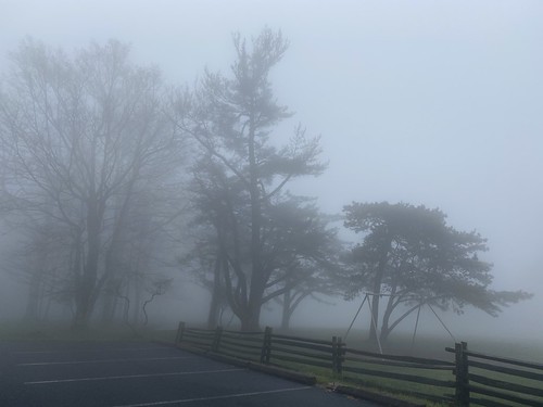
Come the day we are supposed to leave, and the forecast for the weekend is supposed to get as low as 21 degrees. Okay, time to pivot. Luckily we found a cabin available in the park at a reasonable rate. It was cute, dubiously clean, and (most importantly) warm.

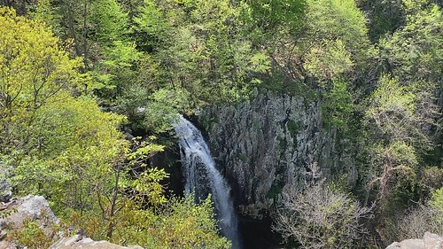
But that also changed our hiking plans. We arrived late Friday afternoon in fog, and the next morning was drippy. We wanted to go somewhere that wouldn't involve missing out on a great view. T chose Dark Hollow Falls, and it proved to be the perfect choice.

Dark Hollow & Story of the Forest

We approached it on the Story of the Forest trail, a flat path that was a nice warmup. After crossing Skyline Drive, we began the downhill trek to Dark Hollow Falls. Thanks to several days of rain, the falls were at a nice volume. 

Dark Hollow & Story of the Forest

Our route back was essentially the same, although we took another fork on Story of the Forest. 

Overall mileage was 4.4, with 874 feet of elevation gain.