Sunday, January 28, 2018

Hiking the 26 Westchester miles of the OCA

OCA
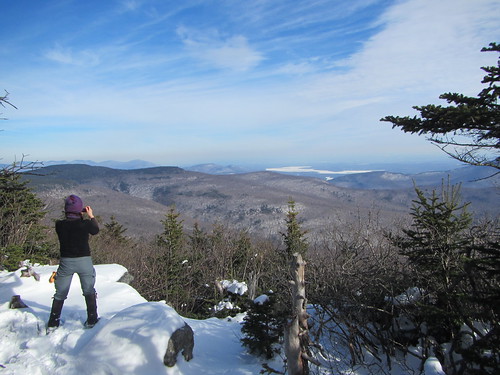
When putting together the Ramblers winter schedule, we are always challenged by the variability of the weather. You don't want to put a rock scramble on a day that ends up icy, or a long trudge on a day with six inches of fresh snow. But then if you put in a lot of easy city walks, the weather ends up being temperate and everyone would rather be in the woods instead.

So when I proposed to do the 26-mile Westchester section of the Old Croton Aqueduct, I thought I'd hit upon a flexible hike for all weather. The hike is almost entirely flat. If the weather were cold or snowy, we would cut it shorter and add any remaining miles to a proposed summer hike of the NYC portion of the aqueduct. I didn't anticipate perfect sunny weather, with no excuse not to do the entire thing.

OCA
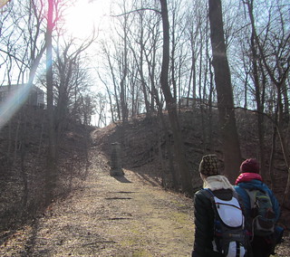
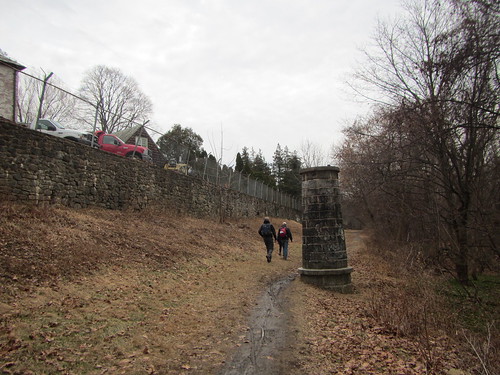
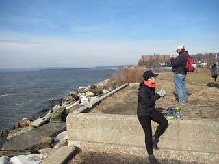
We set off from the Croton-Harmon train station, and (unlike in my scouting hike) walked via Quaker Bridge, which meant a bit of doubling back on the OCA trail. We lunched at Scarborough Park. This is one of the places where the trail detours from the route of the actual aqueduct, towards the water, and the park is just off the trail along the banks of the Hudson.

At Tarrytown, three of our 12 hikers dropped out. I would have been one of them, if I wasn't the leader ... but peer pressure kept me going.

About 5:30 we had to turn on our headlamps. So I really don't have any good photos after that point. It's a shame, because as darkness was falling we had some nice views of the Palisades. By the time we hit Yonkers and the trail swung east, nearly all of us were feeling the struggle. We passed through the northern end of Tibbetts Brook Park and looked for where the trail head south, near the weir, and another hiker left us there. So close to the end!

Finally, we left Tibbetts Brook Park, crossed the last few streets, and reached the border of Van Cortlandt Park. In this spot, unlike most of the park, there is no road at the border. Suddenly you go from a narrow greenway between two streets to being surrounded by park - but at night, you don't so much see the park as no longer see the houses. There is a NYC Parks sign on the rock, and that's it, although you still have to get back to transit. I had planned for us to walk to a bus stop. Most of the group did that, but one of the hikers planned to take an Uber to his girlfriend's, and as she lives just a few blocks from me, I took him up on his offer of a ride.

The hardest part of the hike? Getting out of the Uber at the end. I walked the three blocks more slowly than I ever have in my life.

All told, we hiked about 30 miles - the trail is officially 26, plus it's about 3.5 to the start from the train station. It's the farthest I've ever hiked in a day, coming in a little shot of the Great Saunter.

OCA

Tuesday, January 23, 2018

Hiking to Rainbow Falls

Rainbow Falls
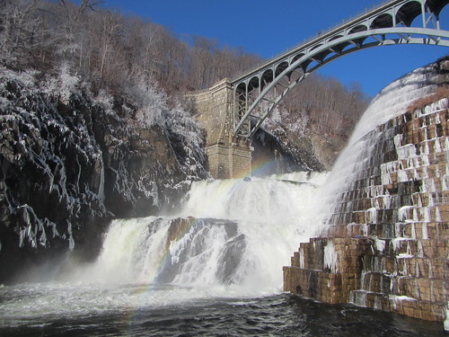
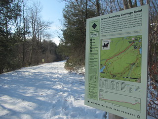
After a tough hike on Saturday, I backed out of the Catskills hike I was going to do on Sunday. Instead, I went to Minnewaska, figuring I could find something easier and beautiful. This winter, parking for hikers/snowshoers is limited to two lots, so I parked at the Lower Awosting lot and somewhat randomly decided to aim for Rainbow Falls. I didn't have my nice maps with me, so I downloaded the official park map to Avenza and set out.

I'm pausing the narrative here to state that the official park map is very bad. It uses bubbly dotted lines for some trails, which caused me confusion a couple of times; one time it looked like the trail crossed a creek (it didn't) and another time I had to look about five times to see if two trails intersected (they didn't). Also, the contour lines aren't at sensible levels. Moreover, it doesn't use visual clues to give some information more weight than others. Every item on it is competing for the user's attention. I just want to get this off my chest - not that it is crucial to the story.

Skipping the snowshoes in favor of microspikes, I headed down the Mossy Glen trail before joining the Lower Awosting Carriage Road. According the the NY/NJ Trail Conference maps, "some" carriage roads are groomed and closed to hikers in the winter; it's worth noting that there was no more specific information available at the entrance or at the maps posted at many junctions. In any case, this particular carriage road was open.

From there I turned onto Jenny Lane (after first going the wrong direction), then onto the Rainbow Falls trail. Foot traffic fell off here; I was following a couple sets of footprints rather than a packed track. The trail also started to get hillier. Traffic really fell off once I came to a creek crossing. Water must have been higher than usual; there was a way across, but clearly not the usual one. It was evident some hikers had turned back here, and from here on I was following the prints of only one person and a dog.

Rainbow Falls
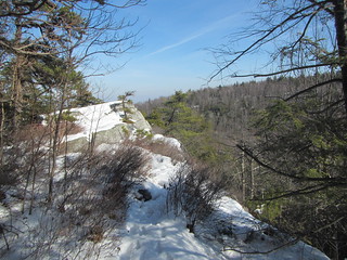
The trail climbed a ridge to follow along a cliff. In summer, there are no doubt some beautiful views from the edge, but I wouldn't try it in winter. The snow was melting in the 40° and sunny weather, making for some slippery trails.

The trail then climbed down a cliff and through a bit of forest to reach Rainbow Falls itself, which was quite spectacular. After pausing to enjoy it, I continued on the trail, which climbed to reach another carriage road, which was when I had a problem: This carriage road was groomed for skiers only. Sure, the Rainbow Trail kept going, but it would soon dead-end at another (presumably) groomed carriage road.

My choices were (a) go back, including a very slippery climb up a cliff, on a path no one else was using, (b) bushwhack through the snowy woods to reach the Blueberry Run hiking trail, or (c) walk on the ski trail.

In retrospect, bushwhacking likely would have likely worked, since it would have been a short shot, but this is one place where I was struggling with the map. Retracing seemed unsafe. So, I am sorry, dear skiers, but I walked on your trail. On the far edge, where one other person had already walked, where only the tippytoes of skis has reached, but nevertheless on your trail. I really am sorry for any inconvenience I caused. (And NY State Parks, you know where to fine me.) But really, I do think it was unnecessary for me to be in that situation; there's no reason park maps or flyers couldn't inform hikers in advance of which carriage roads are closed to them.

As soon as I reached the Blueberry Run trail, I took it until it intersected with the Mossy Glen trail, which I followed back to the car, feeling slightly guilty the whole way. I didn't track the hike, but it was about six miles. And now, here is the moment you have been waiting for: Rainbow Falls.

Rainbow Falls

Monday, January 22, 2018

Hiking Table and Peekamoose in winter

Table and Peekamoose

I returned to the Catskills this past weekend for the 3500 Club’s annual Winter Weekend, hoping to knock a few more peaks off of my winter requirements. We were lucky to have beautiful weather, sunny with highs around 40. Still snowy, of course! Snowshoes were required; the snow wasn’t virgin, but not many people had been through yet. 

We started at the end of Denning Road, walking 1.2 miles before turning south onto the Peekamoose-Table trail. We headed first to Table, then Peekamoose, and then back to the parking lot. This was a different route than I had taken on my previous two excursions to these peaks, requiring us to summit Table twice.

I was a little worried because I’ve been doing a lot of flat hiking recently. Sure enough, I struggled a bit - including getting some leg cramps, which is new for me. However, our group varied in speed, so I didn’t necessarily hold us up.

The peak of Table is viewless, so we ate lunch at the top of Peekamoose, looking out at the peaks of the Devil’s Path and the reservoir. The photo above is taken at this point.


On the way down, one of my compatriots took off his snowshoes after struggling with a broken binding. At this point, the snow was truly well packed. With 1.2 miles left to go, I followed his example, and my microspiked feet felt light and carefree. (It’s possible I may have done a jig.)

I've completed 8 of the 35 peaks for the winter patch. I'm averaging two a year, so I'm not racing towards completion.

Wednesday, January 17, 2018

Scouting around the New Croton Dam

Old Croton Aqueduct

In preparation for an upcoming Ramblers hike, I scouted the area around the northern end of the Old Croton Aqueduct. I walked from the train station to the New Croton Dam, then south on the OCA to Ossining - a little over 8 miles. It's mostly but not entirely flat.

(Technically, if one is heading south, one is walking downhill. The aqueduct runs downhill at the rate of 13 inches a mile. You're not going to notice.)

Much of the OCA is easy to follow, but I wanted to test routes to the dam. The roadwalk I took started off okay, but it meant taking Grand Street at the end, and it's a 45 mph road with no shoulder. It sounded appealing because it takes you past the dam, but it won't work well for a group. You could also go up Batten Road, which takes you over the dam, or cut over to the east side of the river at Quaker Bridge, although the latter would involve some retracing of steps. Given the length of the hike, I'd rather not add any extra length, and Batten Road adds .7. So there is no best route.

Just below the dam is Croton Gorge Park, which has trails beyond the OCA, but alas I can find no map available of it. I'd be curious to see the river trail, which branches off from the OCA early on.

Monday, January 1, 2018

My favorite books of 2017

As I do every year, here I round up the books I enjoyed most in 2017. (No guarantees they were published in 2017, though.) In order to make the cut, I had to like them in the moment, and they had to stick with me.

First up, a non-SFF novel - The Windfall by Diksha Basu. It's a humorous novel that takes place (mostly) in India, about a family moving up in the world. I've seen comparisons to Jane Austen, which is maybe a stretch, but if you enjoy Austen, chances are you'll like this.

Next, a pair of novellas - The Red Threads of Fortune and The Black Tides of Heaven by JY Yang. These were published at the same time and can be read in either order (I read them in the order listed). The protags are siblings in a secondary fantasy world where a rebellion is testing the order of things. Read for the compelling characters and world-building.

The Dream-Quest of Vellitt Boe by Kij Johnson was something I almost didn't read, because I'm a little tired of Lovecraft, even reinvented. (I haven't read Victor LaValle's The Ballad of Black Tom yet, even.) Nevertheless, I enjoyed this feminist take on the Cthulu mythos - told from a very different perspective than most.

All Systems Red by Martha Wells is the first of three novellas starring the lovable Murderbot, a security android that reluctantly has to get involved in the mission of the humans it is there to protect. (By the way, Tor is killing it with their novella imprint: the Yang, Johnson, and Wells novellas are all from it.)

Back in full novel territory is Jeff VanderMeer's Borne. In a post-apocalyptic world, a scavenger finds Borne. Is it a sidekick, a sentient life form, or a weapon? This one is on here for sticking with me and popping up in my thoughts long after I finished it.

Ninefox Gambit by Yoon Ha Lee is the first book in a trilogy (and Raven Stratagem, the next, is just as good). If you like Ann Leckie, you'll like this. Both authors depict far-future worlds (or perhaps just the universe next door) where intergalactic empires have a few issues they need to work out. (Like, maybe less genocide.) The tech in this book is extremely inventive and informs the plot in an meaningful way.

Finally, Hunger Makes the Wolf by Alex Wells should be filed under "fun read with space bikes and solid female friendship." I've been enjoying Wells' short fiction and was excited to see their debut did not disappoint.

As usual, I probably read too many books this year, and you can see the list here. There were many runners-up that almost made this list, too, and I feel a bit arbitrary in some cases with my choices.