Sunday, December 13, 2015

Breakneck Ridge to South Beacon Fire Tower

Breakneck Ridge
Breakneck Ridge is probably the most famous NYC-area hike, and I've done it once before. It's always crowded (in some cases with people who have no business being there), but it's still worth it for the spectacular views of the Hudson River and Storm King.
Sunset Point
Most people turn around and go back by an alternate trail once they reach the top, but we left the crowds behind and continued on to Sunset Point. It wasn't sunset, and it wasn't quite as amazing as the name would suggest. Actually, we had a lot more amazing views on the way, what with all the leaves being off the trees, like this one:
Sunset Point
From there we kept on to the South Beacon Fire Tower. This photo looks north from the tower toward the Beacon Reservoir. The tower itself is 62 feet high and was only restored a couple of years ago. The crowds picked up here, since you can also get to the tower from several other directions.
South Beacon Fire Tower
We took the Wilkinson Memorial Trail back to Sugarloaf Mountain. Along the way, we encountered three jacked-up jeeps driving on the trails. This is your reminder that (a) this is illegal and (b) there are a lot of hikers on these trails, so this is an accident waiting to happen. Accept the fact that you can't take your preferred mode of transit everywhere (whether it be horse, bike, car, or even your own two feet) and don't be a jerk.
Sunset on the Hudson
We reached Sugarloaf at Sunset, hoping to see the Constellation installation on Bannerman's Island. While we could see it, it didn't look like much from that angle; word on the trail is that the best way to see it is by kayak. From there, it was headlamps on, down to the train.

Our leader estimated the hike was 14 miles, and my watch gave our cumulative altitude as 4,200. I don't know if that's accurate: Up Breakneck is 1,250, and we had at least two more significant ascents, but that still may be high.

Thursday, December 3, 2015

Half-bucket list: Clock's a-ticking

Four years ago, I made a list of things I wanted to do before I turned 40. There are about six months left on that clock. So let's revisit:
  1. Be able to walk across a slackline: I haven't done anything towards this goal. Well, not true: I bought a slackline. But I've never used it. Maybe next time I go camping, but that will be perilously close to the big four-oh.
  2. Do macaco: I quit capoeira a few months ago. During the previous almost-four years, I lost a good two years due to shoulder issues and eventual surgery. Even so, I feel like I gave it a fair amount of effort, but I never got any closer.
  3. Be fluent in Portuguese: Fluent? No. I learned a good bit, but I found out my limits when I was in Floripa. I'm okay with calling this one good enough, though.
  4. Travel to Brazil: This I unambiguously succeeded in, for a good seven weeks.
  5. Have a novel published: After making this goal, I reconsidered it, keeping in mind what I tell my students about goals - not to mention my department chair's admonishments for setting annual goals. To wit, a goal should depend mostly on your efforts. Since I wasn't considering self-publishing, as formulated it was not necessarily achievable. But if I revised it to write a novel, that was within my control. And I did, having just finished NaNoWriMo.
  6. Do the Annapurna Circuit: Given the timing when one needs to do this, I'd have to be heading over there right now, and I'm not. So nope.
  7. Hold a handstand for a minute unaided: Much like macaco, this goal suffered for a bit thanks to my shoulder. However, I still occasionally do handstands. I still am not anywhere close to holding it for a minute.
  8. Successfully traverse the swing-a-ring: Much like the slackline ... I haven't even tried.
On the other hand, I picked up some new goals along the way. I decided to hike all the fire towers in the Catskills (done!) and complete the 3500 peaks. The latter will be completed by my birthday - there are ten left (out of 39), and I'll get two done in January. Then there is the SBM End-to-End, which I was supposed to do last year, but stayed home sick instead. This year, folks. My sister and I decided to do a walking tour of Wales, which we had initially talked about for summer 2016; we've pushed it back until 2017 for a couple of reasons, a not-insignificant one of which is that she is having foot surgery in a week or so. We'll see where I am come June. It's likely that Annapurna will slide onto the "life bucket" list, and some of the others will get quietly folded in a drawer to die. And then I'll have to set up new goals ...

Tuesday, December 1, 2015

NaNoWriMo 2015

It’s been radio silence for a couple of weeks here because I was only doing one thing: NaNoWriMo. I am now the proud creator of one shitty first draft! I definitely learned a lot from doing it:
  1. Lots of writers hate prescriptivist advice, but I can confidently say: Your production curve should not look like this:
    Writing 1,667 words a day is a lot for someone with a full-time job. I started off strong but was knocked off course by attending a conference in early November, and I should have worked harder to make it up. The last couple of days were not fun.
  2. Word 2008 for Mac sucks. What do you mean, you can't spellcheck anymore once I get up to about 35 pages?
  3. I'm much more comfortable with writing novels than short stories. I always assumed that one had to master the short story before moving on, and so I really took notice when a couple of writers (I think, Kate Elliott) said that wasn't the case.
  4. I'm a plotter, not a pantser (not news), and plotting is hard for me (also not news). I love world-building and characterization, but I struggle to figure out what happens next. (This is probably why writing fan fiction has never appealed to me - it seems to be skipping over the fun part.) That said, once I reached a certain point, the plot started to figure itself out. My plot outline only went so far, and then characters started surprising me (there wasn't going to be a sex scene, and certainly not with a character I didn't plan on even existing). I was actually writing to find out what happened next, which I had never experienced before.
  5. Is it good? Of course not: It's a shitty first draft. What I don't know is whether revision will turn it into a decent novel ... or a shitty tenth draft. But it's DONE. DID I MENTION IT WAS DONE?

Monday, November 16, 2015

Silent hike in the Ramapo mountains

Ramapo silent hike
Sunday was a beautifully sunny day, and I joined the Ramblers for their first-ever "silent hike." For maybe a third of the hike we took a vow of silence, although we were promised to be released from our vows if any true emergencies arose. (None did.)  "Silent hike" was actually a misnomer, though: With the leaves fresh off the trees, we kicked up quite a ruckus as we walked.

The Ramapo mountains are part of the Appalachians, although "mountain" seems excessive, as the tallest are about 1,200 feet. Still, they are scenic, and the leafless trees meant we had better views than we would have in summer.

Ramapo silent hike

Monday, November 9, 2015

Hiking Mt. Falcon

Summer home
I was in Denver for a conference, so I stayed an extra day to spend time with friends. On Sunday, we hiked Mt. Falcon in nearby Jefferson County.

The hike was 8 miles round-trip, with 2,000 feet of elevation gain. It was an unseasonably warm and beautiful day, even though we saw some small patches of snow, and we took it at a relaxed pace.

The hike has two non-natural highlights. One is the ruins of a mansion belonging to an early media magnate. The other, pictured above, is the site of a planned summer home for the president. Mind you, nobody checked with the White House, yet thousands of Colorado schoolkids donated their cents to the cause. Nothing was ever built.

The views were nice as well, very open in all directions. I've never seen Colorado at this time of year before. Everything was browner than summer, although the peaks weren't as snowy as they'd get in winter.

But I didn't see any falcons.

Sunday, November 1, 2015

Thursday, October 29, 2015

Hiking Graham and Balsam Lake

IMG_2275
Most of the 3500 peaks are either fully marked trails or true bushwhacks, but there are a couple of exceptions - hikes with unmarked trails. One of those exceptions is Graham. The trail to Graham branches off from one of the official trails to Balsam Lake, following an old road on private property. On my last trip, I had hike Balsam Lake but not Graham because I hadn't called ahead for landowner permission.

This time, I hike it with the 3500 Club. The route-finding was very easy, and the hike wasn't too hard either. It's nearly all old road, mostly steep but with a flattish area in the middle, and no more serious "bushwhacking" than one downed tree.

There is a modest view at the top, as well as on the way up if the leaves are off the trees. The top itself less than attractive, thanks to the remains of a microwave tower.

I'd had a wild idea that I wouldn't repeat any of the peaks, except the winter ones, but the group decided to go on to Balsam Lake. I certainly didn't want to be the one to deny a fellow aspirant the chance to get another peak in, so off we went.

It was interesting to see that nearly all the leaves were off the trees, unlike my previous two hikes. It wasn't the difference of a day but micro-climate differences.
IMG_2281

Sunday, October 25, 2015

Twofer: Plateau and Sugarloaf Mountains

Plateau
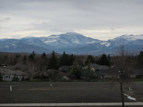
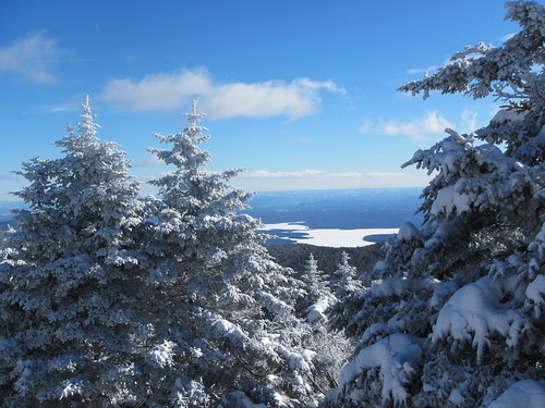
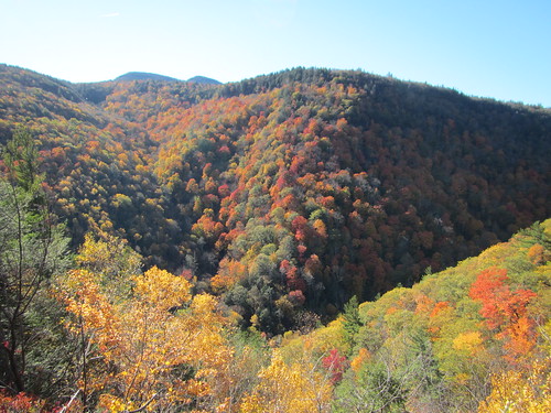
Sugarloaf and Plateau are two Catskills 3500 peaks that are near each other on the Devil's Path. Several approaches are possible, but the easiest one if you want to do both is the one I chose, starting from Mink Hollow Road and heading south to the Path.
Technically, the first bit is trail-less, which is bizarre. It's an old road (the continuation of Mink Hollow Road) that in about .3 miles becomes an official trail. So why not that first bit? In any case, it's easy enough to follow, even without blazes. (I actually missed the start of the blazes on my way up, maybe because they were yellow and didn't really stand out in the changing leaves?)

Less than a mile in, after only moderate climbing, the road hits the Devil's Path. I opted to head west to Plateau first, which proved to be a good choice for a couple of reasons - for one, heading east on Sugarloaf would have had me staring into the sun.

The hike up to Plateau is very rocky, and it was complicated by the inches of leaves that covered the ground. That made going slow even on the relatively few flat bits. The hike gradually got steeper, but I wasn't in any real hurry. Besides, I kept stopping to turn around and admire Sugarloaf behind me (above photo). Finally I reached a nice viewpoint quite near the top, looking roughly northeast. From there it wasn't far to the top, which - go figure - was a long, flat ridge.

The way back down was slow because of the leaf-covered rocks, which, spoiler alert, I wasn't going to encounter on Sugarloaf, making it another good reason to do it first, before I was completely wiped out.

Sugarloaf
Sugarloaf is roughly the same distance and steepness, and as they're neighbors, you might think it was much like Plateau. But it is mostly covered in spruce rather than deciduous trees, and it has just the right amount of rock scrambling (that is: a lot). It was a fun hike up, even though there are no spectacular views at the top - although you can turn around and see Plateau most of the way up.

I only encountered one other hiker, a gent hiking alone on Sugarloaf. Apparently the previous day's fair-weather hikers had all been scared away, although it was really a great day to be out. The sky was cloudless and the visibility was excellent. The leaves were actually past their peak, unlike at Overlook.

Hiking Overlook Mountain

Overlook Mountain
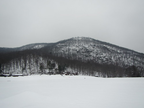
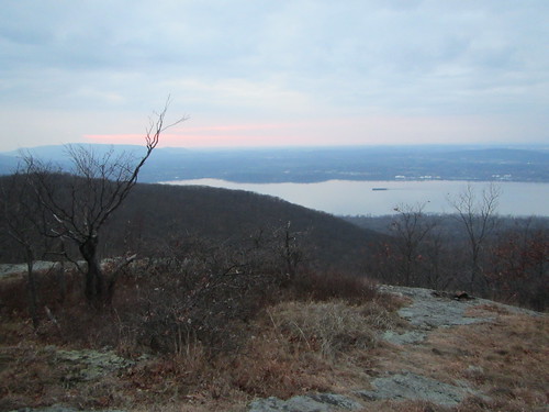
Overlook Mountain was the final of the five Catskills fire tower hikes, one of two that isn't also a Catskills 3500 peak. Because there is also an active tower of some kind on top (radio?), the path up to it is a maintained road, so the trail is wide and smooth - albeit steep.

I was surprised to find the parking lot nearly full on a Thursday afternoon, but the unseasonably warm weather likely had something to do with that. The forecast said there was a small chance of rain later in the evening, and during my hike the sky went from sunny to overcast. Luckily, the clouds were high, so they didn't obscure the views.

The hike itself is pleasant, but the real rewards come at the end. First, there are the remains of an old hotel that burnt down. Then, there is the peak itself with the tower. While the tower was closed, the stairs remain open year-round. From the top landing, I could see 360-degree views of fall colors. There is also a short walk to a viewpoint looking out over the valley. 

(There is also an outhouse, so that's a bonus.) 

Overlook Mountain
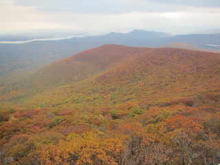
Obviously, this is a hike best done on a clear day; the road hike wouldn't be great for much more than exercise if, say, it was socked in with fog. While by no means easy, it's also a good hike for people who have trouble with uneven footing or depth perception, unlike your typical rocky Catskills hike.

By the way, I read a great deal about the rattlesnakes on Overlook. Well, just like most hikes, it was way overblown. (I always seem to hear alarming things about rattlesnakes on hikes that attract a lot of non-hikers. What are you guys doing out there, practicing your Parseltongue?) These are the rocky ledges all the write-ups describe as snake-infested, but the trail doesn't actually take you up them; this is as close as you get.

Monday, October 12, 2015

Nope

So I was chatting with a friend the other day about Ancillary Mercy, which I enjoyed, although not as much as the first two, while my friend … didn’t. At all. (Edited to add: Apparently I have totally mischaracterized her views. She said at the time it was a bad idea to have the conversation within Twitter's 140-character limit, and she was right. Sorry about that.) Which started me thinking about several books I’ve read, or tried to, recently that I strongly disliked. It’s one thing to dislike a book because it is poorly written, but it’s another to dislike a book that you believe is well-written. Or one that everyone else seems to agree is well-written.

I tried reading Patrick Rothfuss’ The Name of the Wind as part of a quest to be more conversant with the swords and sorcery subgenre, but I gave up nearly halfway through. Unlike the first Shannara book, which I thought had bad plot, bad characterization, mediocre world building, and clunky sentences, I have no real criticisms of The Name of the Wind. The opening plot - evil spider things have come to a remote valley! - interested me. But then the next several hundred pages were backstory. I was like, “All I needed to know was that this dude was a wizard retiring as an innkeeper. Get back to the story.” Even when we got to the part where he goes off to magical college, which I am typically a sucker for, I didn’t care. He’s already established as hyper-talented; I wasn’t interested in more peacocking. But The Name of the Wind is a well-loved book; obviously many other people found the story compelling.

Then I read Andy Weir's The Martian, which I have not heard a single negative word about. Again, I felt it was well-written, but I didn’t like it. And the more I’ve thought about it, the less I like it. At times it felt like an engineering story problem (“Matt Damon has 500 potatoes, each capable of producing x kilojoules of energy… how does he get the three foxes across the lake?”). That wasn’t a significant problem for me as much as the utter lack of self-examination the book displayed. I would liked to have read a serious discussion about whether it was actually worth rescuing the protagonist. I would have liked to see his character grow, instead of merely displaying the Good Old-Fashioned American Resilience he already had. The entire book felt like an uncritical celebration of white male American can-do spirit, down to the “aw gee I’m just a nerd” self-pity too many geeks still hold onto. Look, dude, you’re an astronaut. I can’t believe you couldn’t pick up chicks in bars with that. 

The third book I’m not going to name, in part because I didn’t get very far into it at all, so perhaps I didn’t give it a fair chance. (Although this may be similar to those “pseudononymous” case study journal articles that drive me batty, where the author gives you sufficient detail to easily figure out that “Hallowed University” is actually Harvard.) This book is a sequel to a book I enjoyed but found hard to follow at times - both feature a multitude of viewpoint characters and a lot of action. Having reread book one a few months back, I thought I was up to speed, but instead I struggled to remember who was who and what was going on. The author didn’t leave a lot of breadcrumbs for the reader to pick up. I also found I didn’t care. I wanted to know the ending (do the good guys win?) but I didn’t care about how we got there. And one viewpoint character in particular I felt the author had utter contempt for, making the characterization of said character ring false. But this book is also acclaimed (if not as widely read as The Martian). Maybe I’m just impatient, or too intellectually lazy to follow the multiple narrative threads?

It's odd to find oneself at variance with the general opinion - not in the sense that "well everyone loves Dan Brown," when, despite his popularity, many intellectuals don't. But when writers and critics I trust (not to mention friends) say that The Martian or whatever is good and totally compelling, and I can only find myself agreeing in small part, I wonder what it is that I'm missing. Or if I'm too cynical. Or if my sensawunda has been surgically removed while I slept.

Monday, October 5, 2015

Hiking Storm King

Storm King
Storm King is one of the classic hikes near the city, so why hadn't I hiked it before? Because you can't get there without a car. It's easier to take the train to Breakneck Ridge across the Hudson and admire Storm King from afar.

But it's totally worth it. There are a lot of scenic views along the trails, and we lucked out with beautiful clear weather. Instead of being pounded by a hurricane as we half-expected, we could see clear to the Catskills.

The hike isn't necessarily high on mileage; we hiked nearly all the trails, and it still came in at only 8.4 miles. It is very steep and rocky, though, more like the Catskills than I expected. It would be a great hike to do once the leaves start to change, as there are many panoramic views that would be even more stunning in autumnal colors.

Friday, September 25, 2015

Writing

Since I'm not doing capoeira, I have more free time on my hands, which gives me the kick in the pants I need to work on my writing. So, hooray? It occurred to me that with five year of practice, how much could I improve? Would I get "as good" as I was at capoeira? Better? But that leads down a thorny philosophical and practical path ... First, how do you compare the two realms? It's easy enough to say that Abby is as good at karate as Beth is at capoeira: They're both martial arts with some sort of ranking system. Maybe it's not 100% precise, but at a rough level it will do. You could maybe even say that Cassandra is as good at capoeira as Dionne is at chess. While they are very different sorts of activities, chess players, too, are ranked. But how does Evangeline's skill at tennis compare to Fabiola's at oil painting? Unless they're both utter novices, or at the very top of their field, where would you even begin? Second, I estimate that I spend about 8 hours a week doing capoeira. I don't suddenly have eight free hours; some of that time has been replaced by doing workouts I have no particular commitment to. (I've gone to a few gymnastics classes; they make a great rebound relationship.) Should I spend 8 hours to make it equivalent? What about the writing I already do, or is counting composing an email as "writing" as desperate as counting "walking a block to the drugstore" as exercise? Second.five, I am planning on doing NaNoWriMo this November. If I aim for the minimum 50,000 words, that's 1,667 words per day. At the rate I write, that's more than 2.5 hours per day, or almost 20 hours a week. That's assuming no days off, mind you. (I am hoping that exhaustive outlining will bring this number down.) Third, I started capoeira with zero experience in any martial art, and I am not starting as a writer with zero experience, so after five years you would expect my writing skills to be higher than the equivalent of a green-yellow cord. (I'm still not sure how this writing ranking system would work. Is, like, Morrissey the lowest cord and a Pulitzer Prize-winner a mestre?) Fourth, I need a better schedule. Group exercise works for me not because I'm an extrovert who just loves people! but because it makes me show up. I like the Shut Up and Write meetup for that reason, but I don't think that's a viable solution for seven days a week. Well, no answers, except: (1) I guess I can tell you in five years. (2) Less time watching kittens on the internet would free that time right up. (2.5) Although not that much time. (3) I'd like to think I outrank Morrissey now. (4) This is one way the irregular schedule of a professor is actually a problem.

Monday, September 14, 2015

Hiking in Westchester County

Spitzenberg Mountain
Westchester County, just north of New York City, isn't known as a hiking destination. It's a suburb, without any large parks within its borders. Of course, if one can find hiking within NYC, one can find hiking in Westchester. For the casual exerciser, there are plenty of parks and greenways to get out and jog or walk the dog. Putting together a lengthy hike is a bit more of a logistical challenge.

Luckily, the Ramblers thrive on those sorts of challenges, and this week's hike was 14.5 miles with probably only a mile on roads. We started from the Peekskill train statin and walked to Depew Park, which connects to the Blue Mountain Reservation. The reservation is mostly bicycle trails, but hiking is allowed. At the south end of the reserve we climbed up Spitzenberg Mountain, which would more accurately be called a hill. The photo at left is of one of our hikers approaching the summit. At the top there is an old building and a nice view of the Hudson River.

Reservoir
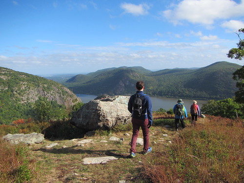
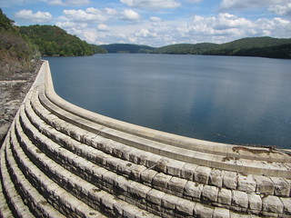
We then followed the Peekskill Briarcliff Trailway to the New Croton Dam, which holds water for New York City and marks the beginning of both the Old and New Croton Aqueducts. The OCA* is no longer in use, but a trail following its path stretches all the way down into Van Cortlandt Park. We followed the trail as far as Ossining, where we caught a train back into the city.

The hike was overall very nice in a "pretty woods" sort of way. Elevation changes were moderate. The dam was the highlight in the middle of the hike, but the woods to the north felt surprisingly isolated at times, although not wild - old stone walls and the occasional backyard served as reminders this was the suburbs.

* Everyone calls it the OCA for short, but I have trouble with that. To me, the OCA will always be the Oregon Citizens Alliance, the hate group that sponsored anti-gay Measure 9 when I was in high school. On the other hand, the "Old Croton Aqueduct trail" is a mouthful.

Saturday, September 5, 2015

What I have learned from capoeira

I have stopped doing capoeira. Maybe forever, maybe for now, but I doubt I’ll ever be as serious about it again as I once was. In some ways the choice was hard.  That’s what 2015 has been about for me: Stripping things out of my life, to find out what’s left and what’s really me. Trying to find out what choices I’ll make with some of my assumptions gone. And capoeira was something that not only took up a lot of my time, it constrained my choices - for example, where to live. A friend on Twitter posted something about taking the lessons from your past and moving on. Most wisdom is trite until it hits you when you need it, right? So here is what I learned in five years of capoeira. Some of it I thought I already knew, but apparently I had to learn it again.
  1. My body can do more than I thought it could.
  2. Those with less natural talent are often better teachers than those abundant in natural talent.
  3. Portuguese.
  4. When people’s actions contradict their words, believe their actions. 
  5. Most of your friends are friends of convenience. Whether its because you train together, work together, or are neighbors, when the mutual activity stops, the friendship does too. If you find someone who remains your friend, hold on to them.
  6. Hardly anyone uses every muscle in their body properly. If you’re active, it’ll catch up with you by your 30s, when it’s still easier to fix it. If you’re inactive, it’ll catch up with you when you’re elderly.
  7. Capoeira has a huge problem with male teachers preying on female students. I’ve seen all of the following:
    • A male teacher engaged to a female teacher, who hits on another capoerista.
    • A male teacher living with a female student, who hits on another student, offering to move to be with her.
    • A male teacher sleeping with several of his female students, not serially.
    • A male teacher in a supposedly monogamous relationship with a female student, but also being in another second, also supposedly monogamous relationship with:
      • Another female student at a different school.
      • Another female student in the same school.
    • A male teacher who regularly cheats on his girlfriends with a female capoerista (not his student).
    • A male teacher sexually propositioning students who have shown no interest.
    • A married male teacher making out with a female capoerista.
    Patriarchy is a real dick, and capoeira ends up losing about 80% of the women who have been involved in these scenarios. Another 10% switch groups but remain in capoeira.
  8. You need to be honest with yourself about why you’re involved with something. If you deny it to yourself, you’ll end up frustrated because you’ll likely pick a group that gives you what you claim to want instead of what you really want.
  9. Never date someone who thinks they deserve to be excepted from what even they agree is ethically correct. Don’t even be friends with that kind of person.
  10. Even someone totally untalented at music, like myself, can improve. 
  11. Never look down on the person whose priorities change today, for tomorrow that could be you.
  12. People may choose to forgive people who have hurt them, but it’s never your business to tell them they must.
  13. People rarely share scuttlebutt with those who most need to know it.
  14. If you’re bothered by the way people are treating you, make sure you’re not treating other people in that same way.
  15. People at the top set the tone. If the leader makes Mistake X, so will the followers. If the leader doesn’t do Mistake Y themselves but doesn’t make stopping it a priority, some of the followers will Y. 
  16. If someone seems unhappy, see if they want to talk, even if you aren’t close. If they don’t, of course, don’t push it, but far too often no one at all is willing to get involved.
  17. Breathing and not looking at the floor really help when doing cartwheels.
  18. I have no problem eliminating people and things from my life when they offer me nothing. I have a lot of difficulty eliminating people and things when they are just okay but standing in the way of truly good.
  19. As Thich Nhat Hahn said, there is no such thing as a perfect sangha; one must simply strive to be the best member of the sangha one is in.
  20. Fresh papaya is really delicious.
So there you have it. I think all of that was worth the five years I invested in it.

Thursday, September 3, 2015

The Sausagefest of Shannara

I'm a bad fantasy reader - my sword-and-sorcery reading is actually fairly limited. Most epic fantasy doesn't interest me much. But then I found a copy of The Sword of Shannara for $1 at Shandaken Days, sold by the steampunk proprietors of Pine Hill's only bookshop, so I figured it was time to finally read some Terry Brooks.

No suspense here: I strongly disliked it. But literary merit aside, what was most striking to me was the lack of female characters. Consider:


There are 55 male characters and nine female characters, a few genderless creatures, and many (minor) characters unidentified by gender. Of those nine women, one is present but an illusion, one is probably fictional, five are only discussed or remembered by the men, and two are both present in the scene and real. One of the two real, present women is an old serving woman who appears and is gone in one paragraph. The other only appears halfway through the book, on page 430.

Shirl's character is pretty limp, and she seems to have no agency whatsoever. She is uninterested in the advances of the man who is obsessed with her, although she is nevertheless probably going to marry him. She is kidnapped and then rescued. She falls in love with her rescuer. Most of her action and dialog consists of waiting, listening to him talk about himself, and telling him to take care of himself.

One telling detail is that Brooks was the kind of writer who used "man" to mean "human." While this is old-fashioned, he really seems to mean it. All the women are either mothers or love interests (or a serving woman). There aren't even serving wenches in the inns or alive mothers to send their sons off.

Of course, Brooks is hardly alone in this. To be fair, compare Sword to J.R.R. Tolkien's The Hobbit, a book I like much better:


The Hobbit actually comes off worse, as there are no women actually present in any scene. (The paltry few women in his trilogy suddenly seem overwhelming in number. Of course, it's rather like comparing the healthy food choices at fast food restaurants: "Hey, this place actually has a withered salad with carrot scrapings and a sad tomato!") To the extent that Brooks is a pale imitation of Tolkien, his lack of women is at least authentic.

I can enjoy books in spite of these kinds of issues (as I said, I liked The Hobbit), but some days they're just too hard to ignore.

Tuesday, September 1, 2015

Hiking North Dome and Sherrill

Downclimbing
On Sunday, I finished two more trailless Catskills peaks with the Catskills 3500 Club. North Dome and Sherrill are neighbors, just west of the Devil's Path. We first climbed up to North Dome, then down and back up to Sherrill. As with all the trailless peaks, the entire hike was quite steep.

This photo is from the descent from North Dome. There was a fair amount of interesting rock, not too much face-slapping balsam, and less stinging nettle than I expected. Neither peak offers a view at the top, alas.

However, near the end of our hike we were rewarded with this waterfall:
Waterfall

Monday, August 31, 2015

Balsam Lake and Phoencia

Fire tower views

I decided to hike Balsam Lake on Saturday, as it was the only fire tower Catskills 3500 peak I hadn't yet done, and on summer weekends the fire towers are staffed with volunteers and open to visit. Spoiler alert: There was no one at the tower. (Other hikers reported that the volunteers arrived shortly after.) You can still climb the tower stairs, though, and get essentially the same view, so that's what I did.

The hike up seemed relatively easy - mostly because I've been doing a lot of the trailless peaks that require bushwhacking as of late. Even compared to many of the peaks with trails Balsam Lake is somewhat easy, simply because most of it is an old road. There is no scrambling up ledges, for example.

After two miles of road, the trail splits. The left fork continues the road, going to a shelter, another trail, and eventually the tower. The right fork goes more directly to the tower. There is actually another fork a little before this one, an unmaintained trail on private property to Graham Mountain, but it's more obvious when coming downhill than when going up. I didn't do Graham, partially because I hadn't called and partially because I promised my PT I wouldn't push it too hard.

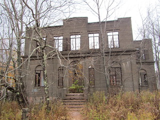
After coming down, I decided to ride the Catskill Mountain Railway. The route is short and not really that interesting, but the stop at the railway museum was interesting. The railway is on the outside of Phoenicia, which is a touristy little town.

Many of the towns in the Catskills are only a collection of houses at an intersection, plus maybe a post office. Others have a business or two, but still aren't draws in themselves. In the areas I've explored thus far, there are two principal towns of size. One is Tannersville (shading into Hunter), which I am quite fond of. It's cute, it has several decent restaurants, and reasonably interesting shopping. You can stay at nearby North-South Lake Campground or sleep indoors at the Snowed Inn for reasonable prices, or stay at one of several pricier B&Bs. I am not qualified to speak as to those, however. Eat breakfast at Maggie's before hiking and dinner after at the Last Chance.

Feta and watermelon salad

Phoenicia is the other town, and I just haven't been as fond of it. It's not as attractive; it is well-sited and has some historical buildings, but one side of the downtown strip is just boxes. There is a souvenir shop and an ice-cream-and-fudge shop; there is also a river tubing service ("Why not tube the Esopus?") and the railway. Its offerings seem to be aimed at families, and you could exhaust them in a day. It also has very little lodging and almost no decent food. Mama's Boy coffeeshop is good, but it's not an all-purpose restaurant. Brio's, which bills itself as a wood-fired pizza joint, is really a diner, and it's not bad but it's nothing special. There is an attached sports bar, and that's it.

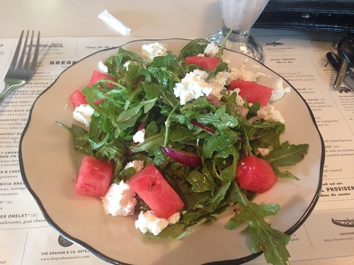
However, there is the Phoenicia Diner, which isn't on the main strip but on the highway. I've seen it totally full up with bikes and pickups, but it's not always convenient eating for hikers - it's not open for dinner. But the railway ticket guy recommended it, so I tried it. You see that watermelon-feta salad above? That's from the diner. Apparently they hired all the chefs away from another former Phoenicia establishment. So, the diner in town is fancier than a diner, and the place that bills itself as a restaurant is actually a diner. Go figure.

There are a couple of other largish towns in the Catskills, such as Margaretville, but I haven't found their locations as convenient to explore, as they tend to be on the edge of or outside the "blue line" marking the park edge. But I readily confess there is a great deal I may be missing out on.

Monday, August 24, 2015

Halcott and Rusk

Bushwhacking
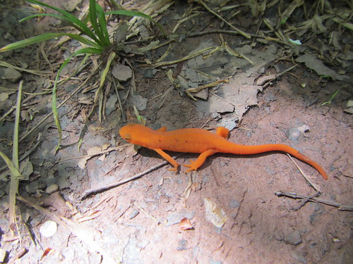
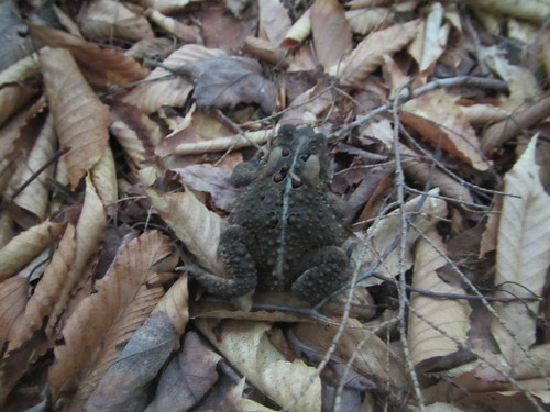
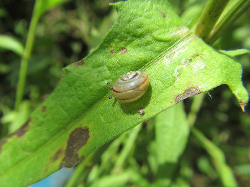
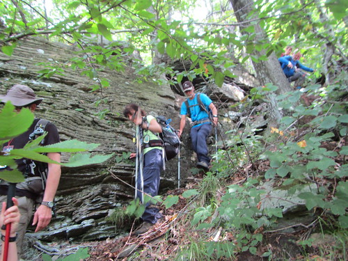
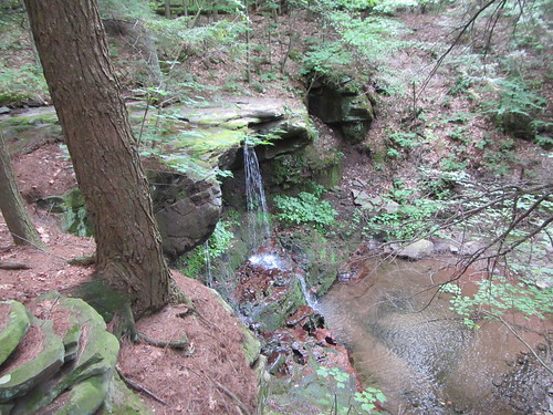
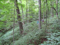
On Sunday I knocked off two more Catskills peaks, the trailless Halcott and Rusk. Neither peak offers anything in the way of views (in winter, there may be glimpses of other mountain through the trees); aside from a brief bit of walking on a gravel road up to Rusk, they're both straight uphill through the brush.

I've noticed before how different the peaks are. Perhaps it has to do with their history, such as how recently they were logged, or whether the face I was on faced north or south. But each one has rather different plant growth. When we hiked The Six back in June, we fought our way through balsam trees. On Halcott, this was a non-issue, but there was a lot of vegetation in the 2-4 foot high range, some of it nettles (see photo above). And on Rusk the ground was much clearer.

Ledge
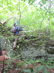
Frankly, neither Rusk nor Halcott is particularly interesting. There is a waterfall on the route to Halcott, but it's perhaps 50 feet from the road. If they had trails, they would be more pleasurable, but they wouldn't have big payoffs - you wouldn't take a newbie to them to entice them to fall in love with hiking. These ledges on Rusk are kind of interesting, and I'd want to route a trail near them, but my understanding is that bushwhackers usually go around them. 

I'm now up to 23 of 39 required climbs. Next weekend, I'll head back up there for more bushwhacking on the nettlesome North Dome and Sherrill.

Sunday, August 9, 2015

Hiking Fire Island

While I was in Iceland, I didn't keep up with my usual workout routine. I did capoeira once and hit the gym not at all. There was plenty of walking - certainly hitting 10,000 steps a day - and quite a few hikes, including very strenuous ones. Our two weeks of trail volunteering were active; a friend said that thanks to "hauling rocks and digging weeds" I was "probably stronger than when [I] left," but that was an overoptimistic assessment. Frankly, none of the work left me sore, except for the first day with a lot of hammering, but that was specific, hammer-related muscles.

I went back to capoeira class Wednesday, which worked me over after less time than I usually put in. The next day at the gym nearly incapacitated me - although, to be fair, I went to two classes whereas one is my usual. So I was still sore when I woke up Saturday morning and had to hike because, you know, I was the leader.

"But that's okay," you're thinking. "The one thing you've said you kept in shape was your hiking muscles." Indeed, my body could have gallivanted up and down a few hills. But this hike was the only kind of hiking my body wasn't prepared for - is never prepared for: a beach hike. 12 miles of this:

Fire Island

Pretty, yes? But that's a lot of sand hiking. By the end, we were all glad to be done with this flat, only 13.2-mile hike, because it had taken its toll on us.

We did have a beautiful day for it, complete with "swimming" at Bellport Beach (in actuality, letting the waves knock us around). It looked very different than my scout of a few months ago, due to higher tides, better weather, and larger crowds.

Anyway, if you need me, I'll be at home, lying here helplessly.

Friday, August 7, 2015

Packing for a month, redux

I have a lot to process from my trip, but let's start with the easy stuff. How did my packing work?

There were a couple of items I didn't wear:
  • winter gloves
  • Uniqlo down jacket
The latter may have been a mistake, as it was packed tight all month, and I'm not sure it'll bounce back. If I had done any of the long treks, maybe I would have used them, but as it was they weren't necessary.

A couple of things I only wore so I didn't feel bad about packing them:
  • street shoes
  • skirt
Next time I'd leave them out, and probably replace the skirt with another pair of pants.

I lost a couple of items:
  • one sock (why is it always one!)
  • one SmartWool shirt (this made we very sad, as I was wearing it a lot)
I left out the following item, and I'm not sure why:
  • warm leggings
(OK, I know why. They were the wrong color.)

I bought a few items:
  • Icelandic sweater (sadly, not a hand-knit one)
  • wool leggings
  • two wool shirts
  • wool socks
Of these, I wore the first three a great deal; the leggings were really essential, and the sweater was great so I wasn't always wearing my hoodie. The two shirts I bought at the end of my trip.

But overall, I did a decent job of packing. Good job, me.
And the photo? The worksite supplied waterproof gear from 66° North, which really worked. Note that they don't sell it online/in their stores, just through professional marine supply type places. (And I checked; it doesn't come in black.)

P.S. The new bag liner and pillow were the bees' knees. The liner was so warm! And the pillow was as good as my memory foam at home. My camping kit has been taken up several notches.

Friday, July 31, 2015

Visiting Viðey

Today I visited the island of Viðey, reachable by a short ferry ride from several points in the city. The 1.6 km island is currently uninhabited; there is a restaurant and some art, but mostly nature - including about 30 species of birds.

The island is long and narrow, east-west. Reykjavik is to the south and Mount Esja to the north. The island itself is relatively flat and covered in grasses and flowers. No birch trees - and also no lupins! 

On the western half are a few pieces of art, including some monoliths by Richard Serra, and an incredibly uninteresting piece by Yoko Ono. The eastern half has ruins of the fish-drying operations and village that were once there.

But the birds - I saw and heard plenty of them, most of which I can't identify. However, I did see and hear and can identify the kría, which I'm pretty certain was one of Hitchcock's inspirations. This bird divebombs your head if it thinks you're in their territory. And the trail designers of Viðey decided to put part of the trail right next to prime egg-laying area. Seriously, people? I had some truly Tippi Hedren moments.

Aviary aggression aside, what is most notable about the island is how peaceful it is. Even when you can see the city, it feels very far away. We were fortunate to have a beautifully sunny day, with views of the mountains and the bay beyond the rustling prairie. The wind and the birds dominated the soundscape; the occasional aircraft broke in, but not startlingly so - unlike the ludicrously loud hedge trimmer being used upon our arrival.

There is enough hiking to occupy you for the afternoon, but you could also find a nice vantage point and watch the waves and the grass for a while. Bring a picnic and a sketchbook if that's your talent.


Tuesday, July 28, 2015

Inside Stakkholtsgjá Canyon


The second hike I did on Tuesday was special enough I thought it deserved its own post. The canyon is accessible by bus once a day from the Volcano Huts (or, I suppose, by foot). The ride is only 15 minutes via Reykjavik Excursions. (If you get to the huts on RE, as most people do, the ride to the canyon is free.)

South of Þórsmörk is the Krossá river valley. On the south side of it, the Stakkholtsgjá canyon opens up between tall cliffs. This canyon itself is the hike, although there is no trail per se. It's quite flat, but a hiker will have to cross a stream several times. I would recommend hiking poles, and if you know me you know I don't use them! But they are helpful for stream crossings.

The canyon itself is beautiful; my photo above doesn't do it justice.* The walls are vertical, and in many places green with mosses and small plants. The canyon winds a bit, so the view constantly changes. 

I was the only one to get off the bus, but I encountered other hikers who had arrived by car or tourbus. Aside from the large group of Americans, chattering away about their lives and seemingly oblivious to their surroundings, the experience seemed to reduce most visitors to silence. With the high walls and the tumbling of the water, the space seemed sacred.

It was probably my favorite hike thus far, although I had a feeling that this was one of those trips where I said that about every hike. If I come back to Þórsmörk, it'll be to do the Fimmvörðuháls or Laugavegur treks, not repeat dayhikes, but I would stay an extra day just to do Stakkholtsgjá again.

* Better photos to come from my camera.

Monday, July 27, 2015

Merkurrani Plateau and Valahnúkur


With another hike planned for the afternoon, I decided to kill the morning by doing the Merkurrani Plateau hike, which didn't sound all that exciting.

At first it goes up through the woods, past Sönghellir cave, which I didn't stop to look at. Maybe next time. The trail is supposed to turn west, while the trail up to Valahnúkur goes straight. I didn't see my turn, but I wanted to go up it anyway.

It was a steep ascent, 869 feet, and much of it heavily used and in need of some TLC. However, the view from the top was incredible in all directions. At the peak there is a sundial (inoperative at the moment) that also labels all the surrounding features. Unlike Rjúpnafell, the view from the top was much better than on the way up.

On the way down the turnoff was more visible; at least, the pegs were. The path itself wasn't worn. It followed the top of the plateau quite pleasantly for a while, before descending to the valley below. 

Supposedly, the trail passes by the cave Sóttarnellir, but I didn't see it. However, I had descended all the way to the valley, and on the map it's not clear the trail goes that low.

The hike was about 3-4 miles total, with 1079 feet of cumulative elevation gain.


Sunday, July 26, 2015

Hiking the Tindfjöll Circle and Rjúpnafell Mountain


On my first full day in Þórsmörk, I decided to hike the Tindfjöll Circle, a hike of 4-6 hours.* It's the longest of the recommended short hikes in the area - the longer ones being the two treks that end in the valley.

From the hut to the riverbed (2km) is pleasant but nothing exciting. From there one picks up the Tindfjöll trail.**

The trail climbs gently up through a canyon to emerge on the north face of Tindfjöll, with spectacular views in every direction. My phone was hard-pressed to capture them, although I hope my proper camera did better. The trail heads east towards Tröllakirkja, a rock outcropping that looks rather like two hands pressed together in prayer. 

Not far past this point, the mountain Rjúpnafell is visible. It sticks out quite  obviously from the land around it and is also obviously quite steep; the trail switches back and forth up the side of it. For some reason I decided it would be a good idea to climb it.***

After heading downhill to a pretty mountain stream, I began the ascent. It was steep to begin with and got more so, until I was using my hands as much as my feet.

Finally, I did something I don't do very often; I decided to turn around before the peak. I was at least two-thirds of the way up, and technically I probably could have done it, but it wasn't fun. The views weren't going to get any better - I was already on the side of a bald mountain. And all I was doing was worrying about getting back down again.

So I climbed down and set out to finish the Circle. The trail here is a little dull (relatively speaking), until the river valley comes into view. From there it is ludicrously spectacular, with viewpoint after viewpoint, descending to the river. The trail then follows the river back to the beginning of the loop.****

All in all, it was a lovely hike. It's in need of some maintenance, which I believe it is undergoing, but Icelandic weather is rough on trails. My best guess is that I hiked 5-6 miles, with 3,238 feet of elevation gain. (The latter being derived from the altimeter on my watch, although as it is based on barometric pressure it is basically useless in Iceland.)


* This is my first of many pet peeves about the Icelandic trail maps; the one sold through Volcano Huts lists distance only in time. You can only estimate imprecisely with the key.

** Theoretically. My second pet peeve is that the Volcano Hut maps color-code the trails, but in different colors than the trail markers. Blindly following the markers led me to cross the river quite unnecessarily, although to be fair it was quite obvious from the map that I shouldn't.

*** My third pet peeve is that the VH maps indicate steepness with "xxxxxxx" on the trail, ignoring the perfectly good convention of contour lines. Here the official Iceland area maps do a much better job, although they are worse in almost every other way. They make great guides to the local birds, though. Which is exactly what one looks for in a map.

**** On one online forum, a user complained that the trail in fact did not follow the river valley, which was impassable. Here I am inclined to give the VH map a pass, as (a) there was a trail and (b) the watercourse changes from year to year and season to season. Mind you, I extend no such charity to the Iceland map, as it doesn't show the river trail at all.