I felt like I read less in 2021, but it looks like I was just returning to a historical average.

I felt like I read less in 2021, but it looks like I was just returning to a historical average.


Did a six-mile hike in Black Hill Regional Park, including most of the Hard Rock Trail.
The original plan was to do the entire 17-ish mile Mount Vernon Trail over two days, but we looked at the gale-force winds on day one and said "nah." So we did the northern half of the trail, from Rosslyn to Alexandria's Old Town. Next time, we'll do the rest.
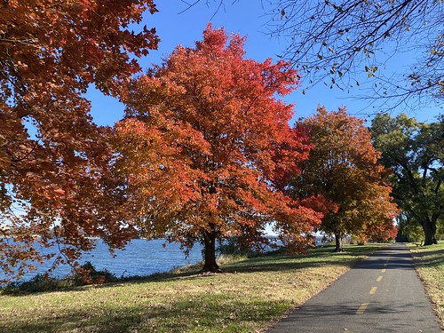
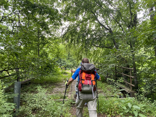
Last weekend I tackled a longer walk, in part as a challenge and in part because it would let me see new parts of the city - the Arlington Loop. At 16.2 miles, the Loop uses the Custis, W&OD, Four Mile Run, and Mount Vernon trails to roughly circumnavigate the city, and is generally done as a biking trip. But there's no reason it can't be walked.

I did it counter-clockwise, starting from a point on the Custis Trail. I've done the Custis Trail previously, so I knew what to expect there there. However, the W&OD was pleasantly surprising. The first portion of it was in a wooded area and paralleled Four Mile Run (the creek). Four Mile Run (the trail) is on the other side of the creek. I'd like to do these two together as a loop sometime. The eastern end of the W&OD was my least favorite part, as it ran alongside a road and was not very scenic.
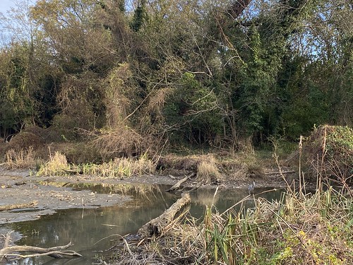
At the W&OD eastern terminus, the Loop follows Four Mile Run - less bucolicly than before, but nevertheless pleasantly. The creek really needs some litter pickup in this area, though.

Where the creek empties into the Potomac, the trail turns north on the Mount Vernon trail. Given that it was sandwiched between a highway and National airport, it was nicer than it had any right to be. But note that from here on to the northern end of the Mount Vernon, the only restrooms are at Gravelly Point.* This park is just north of the airport and is full of plane spotters. From here on, the Mount Vernon trail is along the river, which makes for some nice views.

I was getting hungry, as I had only brought snacks, but it was too late to do anything about it. There are a couple of places on the Custis near grocery stores, and the eastern W&OD/Four Mile Run portion goes past some businesses. But the only business along this portion was one ice cream truck.

Finally, I reached the Custis Trail again, and finished the loop on home territory.
*The maps advertise restrooms at Theodore Roosevelt Island, which is accurate. But that's really a long way off the trail.
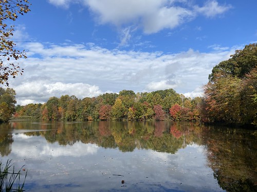
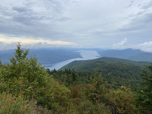
As the fall leaves were turning, I trekked through DC to Maryland to hike with a friend at Black Hill Regional Park. It's a county park, but apparently Montgomery County insists on naming all of its parks as regional, local, or neighborhood, so okay.
We walked about ten miles. This was right after a lot of rain, so the water was high in the creeks.

Some of the best views were the leaves reflecting in the dammed lake.
Overall, it was about ten miles, and then I forgot to turn my tracker off on the bus/Metro until I was practically in DC, so I don't have exact stats.
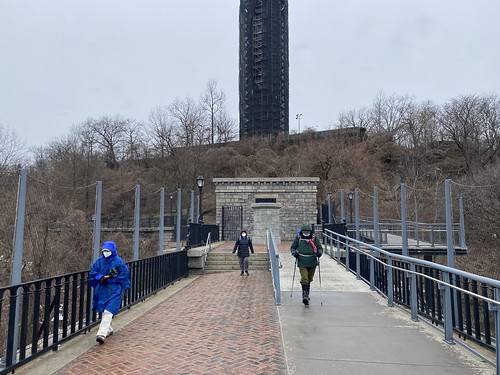
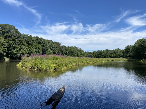
A few weeks back (still catching up on blogging here!) I visited Theodore Roosevelt Island. It's technically part of DC, but accessible only from Arlington. This relatively small island is wooded, with trails. The only other things on the island are restrooms at the south end, and a statue of Teddy Roosevelt near the pedestrian bridge.
A lot of it is pleasant woods, remarkable more for feeling removed from the city than for the views. The soundscape is a different matter; you can't hear the bustle of the city, but you can hear planes and helicopters.
My favorite part was a boardwalk on the eastern side, surrounded by wetlands.

This post is massively overdue, so instead of breaking it down into separate posts like I normally one, it'll be one big post for the entire trip.
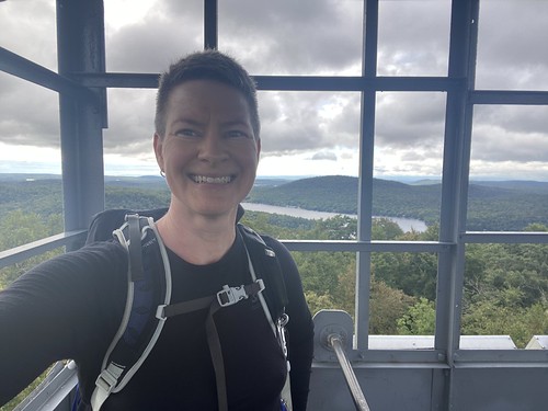
In September, I headed up to the Adirondacks to finish up the fire tower patch. Although there are more than 18 towers there, you only need 18 to complete it.
I started with Swede, as it had just opened after restoration, and it was about to close for hunting season. Swede is a very easy hike. It's short, not steep, and not rocky.

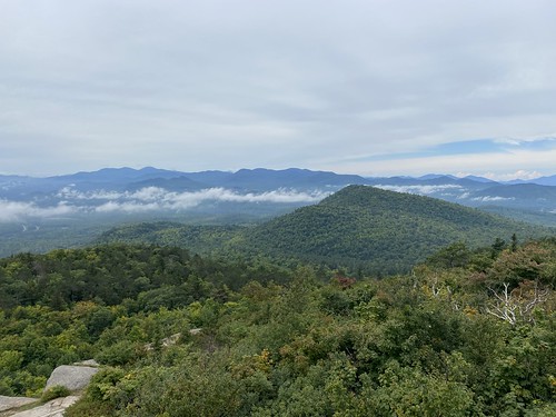
On day two I did Hurricane, which was definitely one of my favorites. It has a bald, open top, so the views would be great even without a tower. I had planned to do a second tower that day, but the weather had other ideas.

On day three I had to squeeze two in. First up was Poke-O-Moonshine, which I had intended as a chaser to Hurricane. I've never seen a fire tower hike with so many steps and even ladders along the way. This made for a hike with a very different feel.
After that I did Black. I wasn't wild about this one. The hike was fine, but the fire tower has had a weird radio tower built over it, and you can't climb it. The view from the near the top are decent, though.
Finally, I finished the challenge on Kane. It wouldn't have been my ideal choice for a finale, as its location in the central southern Adirondacks means the views aren't as fabulous, but the location made it ideal for breaking up the drive home. I managed to time it just right - it started raining just as I got into my car.
So that was the fire tower challenge! I would love the visit the other towers I didn't complete, but - I was about to move out of New York, putting them further out of reach. It's a great challenge, and it's a wonderful way to get terrific views.
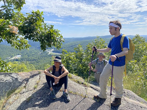

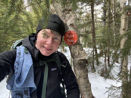
A hiking buddy suggested getting a crew together to do the Shawangunk Ridge Trail, so I sat down and mapped it out into six one-way, car shuttle sections. We did our first section this weekend.
We began at the southern end, in New Jersey's High Point State Park. The trail actually begins somewhere on another park trail, and two different maps show slightly different starting points. We started even slightly farther south so we could see the view from the observation platform. We never did see a triple blaze that indicated an official beginning point.
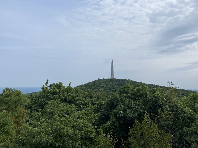
The trail in High Point is quite nice. Between the platform, the monument, and a few very short side trails, there are a lot of nice views. (Sadly, the monument was closed beyond the first level due to repairs.)
From there, the trail began to roll gently up and down - although much more down than up. In many places, the foliage needed some trimming back, but there was nothing that significantly blocked the trail.

Along the way, there were two road walks. The first was along Greenville Turnpike, a rather sleepy country road. The second included Old Mountain Road, highway 6, and Hathorn Boulevard. The highway was busy with high-speed traffic, necessitating caution.
The trail eventually popped us out alongside the Metro North Port Jervis line. At Shinhollow Road, a bridge crosses the railroad, and there was a double blaze on the bridge indicating a right turn. However, the embankment was entirely overgrown. Once we scrambled up it, we could see we were on a path with blue blazes ... that also extended behind us. So which was actually the trail?
But we crossed over the bridge to where our cars awaited us.
This first section was close to 11 miles. We ganed 1,370 feet of elevation, but lost 2,250. If you're trying to replicate this, note that there is an entrance fee at High Point. We sensibly took the New Jersey car to the start point, to pay the lower in-state entrance fee.
Last weekend K and I went camping at Wildwood State Park out on Long Island. It was mostly a relaxing camping weekend, including beach time and an incredibly large tent. But we did do a couple of hikes.

One was the Red Trail at the campground. It's a short loop, 1.8 miles, and it leaves from the campground. It's a pleasant wooded stroll.
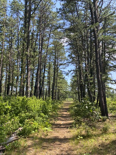
The other was 3 miles on the Paumanok Path (1.5 each out and back). The entire thing is 125 miles long, and this section was in the pine barrens, which I rather like.
On the final day of my trip, I faced overcast conditions and a need to return my rental car. So I tackled Pillsbury, the last peak I needed for the Hamilton County Fire Tower Challenge.

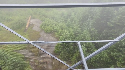
This trail could use a little TLC. Especially near the top, it was overgrown, and I got slapped around by wet branches. The tower itself is missing a few railings, and the cab is closed. I don't have much fear of heights, but even I stopped when it got to wet, rail-less boards thirty feet off the ground ...
In good news, I ran into some DEC and SCA folks near the trailhead, as they were there to plan out some work. And next weekend, volunteers are working on the tower.
I started the day off with Owls Head, a longish but less difficult hike. It has nice views from the base of the tower, for folks who don't like heights. Of course, at the top you get the full 360 panorama.

Then I made a spontaneous decision to go hike Cathedral Rock. It's one of the easiest towers, but it isn't near anything. Owls Head was as close as I was going to get, as I had already done Mount Arab, which is its closest neighbor. I wasn't in the mood for a hard hike, but a long drive sounded fine. So I headed out to SUNY ESF to bag Cathedral Rock.

The views from it reminded me of Spruce, somewhat removed from the high peaks, albeit in a different direction. But it was a nice "bonus" tower I hadn't planned to do.
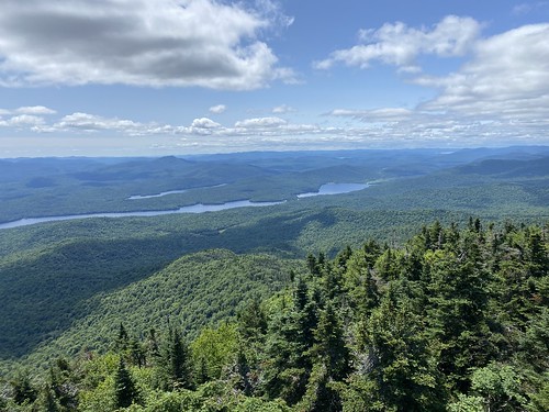
My next hike was the longest of the trip, at nearly eight miles round-trip. Snowy Mountain is one of the more challenging of the Adirondack fire towers. But at least I had a beautiful day for it!
This hike is another one with a long warm-up, then a steep, rocky, wet ascent. However, there was an added wrinkle - there were several unbridged stream crossings in the first half that could not be done drily. (Short of wearing waders, I suppose!) I quickly found out it was irrelevant that my boots hadn't dried out from the previous day.

Not long after beginning the ascent, I met another solo hiker, and we hiked together for the rest of it. It was nice to have company for a change.

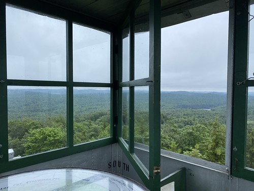
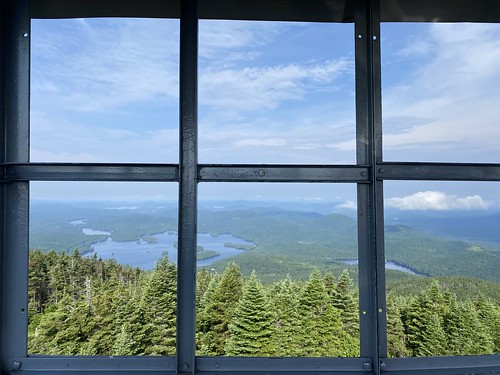
Near the top, there is a nice, open view. Then the trail plunges back into the woods. The fire tower itself is in the woods, with no view unless you climb it. But once you do, it's spectacular.
Then it was back down again, down the wet rocks, across the rushing streams. By the time I was done, I was really excited to take off my wet socks and shoes!
The next day's weather wasn't very promising, with the forecast calling for afternoon thunderstorms, so I hoped the morning would be no more than damp. I can handle getting wet, but I'd rather not be struck by lightning!
After a night of bad sleep, thanks to a leaky tent, I got up early in order to beat the storms. I headed over to Wakely, which is a very typical Adirondacks fire tower trail. It starts with an easy two miles on a logging road, followed by a steep, rocky mile. With all the rain, all these steep, rocky trails were essentially streambeds, increasing the challenge level.

My feet weren't my only wet part. While it didn't rain while I was hiking, the air was humid and the trees were quite wet, so the effect was the same.
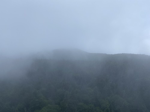
The view from the top were not much, because of the clouds. I'm sure they're much nicer in better weather.
As it turned out, there were afternoon showers but not storms. Still, I had to rest up and try to dry my boots out for the next day's adventure.
The fourth day was overcast, but it looked like the rain might hold off. So I made the long drive to Stillwater Mountain. It was long mostly because the road to the trailhead is eight miles of dirt, and I wasn't driving any kind of high-clearance vehicle.
I had the trail to myself. It's another relatively easy hike, much like Spruce - nothing tricky.
Since it was still dry, I headed over to Bald. It has even less elevation gain, so it's quite popular. I managed to get off-trail early on, along with a group of young folk, but somehow we always managed to find a way back. The trail itself is quite fun, since much of it follows a rock spine. This means a lot of great views on the way up, and at the base of the tower. (And from the tower, too, of course!)

The weather was nice again on the morning of day three, and I woke up even earlier than I intended, so I headed out to Blue Mountain early. This turned out to be a great strategy, as it's a popular hike. I had it all to myself on the way up and at the tower, but on the way down, lots of folks passed me going up. It's a pretty rocky hike, so I was cautious, particularly on the way down.
While I was in the neighborhood, I visited the Adirondack Experience Museum, which was quite nice. It had turned overcast - truly, I hit Blue at just the right time! - but a little drizzle is okay. So since I still had time left in the day, I headed to Watch Hill, another Indian Lake hike. It's close to Snowy Mountain, and it features excellent views of it. (Of course, you can also get excellent view of Snowy from the Watch Hill parking lot.)
