Wednesday, December 13, 2023

A loop in Rock Creek

We actually spend more time doing trail maintenance in Rock Creek than hiking it, so for the "other national park" hike as part of Hike with PATC in 2023, we went down to Rock Creek. Our loop started at the Nature Center and went clockwise, for a little over five miles. 

Rock Creek loop

On the western side of the park, we started off at Fort Russy, which we have visited before, and then return to the outer loop, spending time on paved trails. Since we never do trail work on paved trails, that section was new to us. We then crossed over to the Valley Trail. Personally, I enjoy the valley trail, since it follows the creek. We then crossed back over, returning to the Nature Center. 

Rock Creek loop

We enjoyed nice weather, and a chance to get out without carrying any tools!

Monday, December 4, 2023

Patapsco Valley State Park

Patapsco Valley State Park is a heavily used park on the edge of Baltimore. T had been there before, but not I, so we decided to visit it for Hike with PATC 2023 as our other state park.

The one really unusual thing is that is has a large network of unofficial, unmaintained trails that the park administration is fine with. Usually, parks try to close down most or all unofficial trails. But Patapsco says right on their website that, "We have over 200 miles of trails, with 70 of those miles identified as maintained trails." 

Patapsco Valley State Park

In practice, this meant that signs and blazes were very inconsistent, so we did a lot of route-checking as we went along.

Patapsco Valley State Park

We set out to do a loop from one of the PATC hiking guides, but we got a late start to our day and did a truncated version. After parking at the Orange Grove area, we crossed the swinging bridge and did a loop on the other side of the Patapso River. It was a pretty hike, and it's definitely a park I'd like to go back to.

Friday, November 10, 2023

Cool Springs Run loops

I'm slowly getting to know all the trails in Black Hill Regional Park. The eastern portion is right on the edges of neighborhoods, with lots of entrances; the center has a lot of park infrastructure, like picnic pavilions and boat rentals. The western section has only natural-surface paths and a more remote in feeling than some of the other parts of the park.

The Cool Spring Run section is in the northwest corner. From the parking by the side of the road, the trail heads downhill towards the lake, and from there roughly follows the shore all the way the the southern end of the lake. Along the way, though, there are several loop trails. While Cool Spring Run is used more by cyclists than pedestrians, some of the loops see very little traffic. This was made immediately clear by how crunchy with leaves various segments were!

Cool Spring Run loop

My most recent hike was 7.5 miles, and while there are no big hills, total elevation gain was close to 900 feet. I started pretty early in the morning, while fog was still rising off the lake. It had cleared off by the time I returned to my car.

Cool Spring Run loop

Into the Paw Paw Tunnel

As part of the Hike with PATC 2023 challenge, we visited a rather distinctive part of the C&O Canal - the recently reopened Paw Paw Tunnel.

Paw Paw Tunnel

This tunnel was built in a spot where the Potomac is quite sinuous and the hills are tall, so it was easier to tunnel through than going around. The NPS had closed this tunnel for some repairs, but it re-opened this fall.

Paw Paw Tunnel

We hiked from the nearest parking lot, through the tunnel to a campsite by the river, and back. There are alternative overland trails, if you prefer not to double back. As we did it, the hike was relatively short, and very flat.

Paw Paw Tunnel

Sunday, October 29, 2023

Another loop in Little Bennett Park

I returned to Little Bennett Park to the second loop from the PATC Part A book, one that focuses on the southern portion of the park. It first does a loop east of Clarksburg Road, then a loop to the west. The eastern loop was more interesting, in my opinion, but it's solid exercise in both halves - 8.5 miles with 1,000 feet of elevation.

Little Bennett South Loop

The schoolhouse, which is pretty close to the road, is one of the highlights.

Little Bennett South Loop

A short section near the campground was set up as a Halloween attraction.

Saturday, October 28, 2023

The easiest peak in the Adirondacks

After Cranberry Lake, we wanted an easy hike, and T has been wanting to visit a fire tower. So we took in New York's easiest fire tower - Belfy. While it is uphill, round-trip it is less than a mile.

Views were great, aside from a little smoke from the Canadian wildfires.

Belfry Fire Tower

Friday, October 27, 2023

Attempting the Cranberry Lake 50

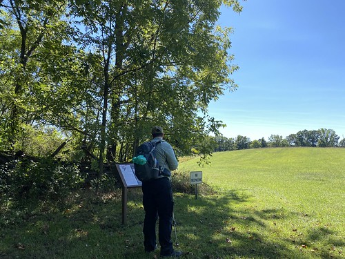
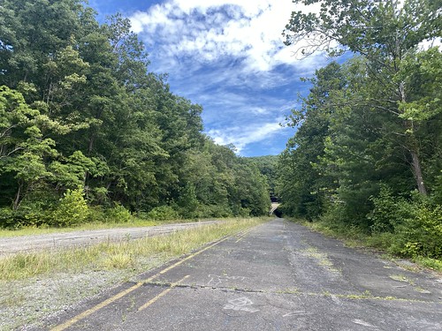
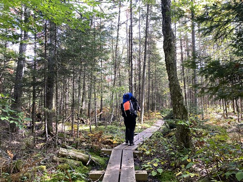
At the end of September, T and I headed up to the Adirondacks to try to do the Cranberry Lake 50. Our plan was to start in Wanakena and head clockwise, taking five days. We ended up bailing out after four days, at Chair Rock Flow, due to a combination of issues with untested gear, as well as (if I'm being honest) fatigue on my part from not being in shape.

Cranberry Lake day 1

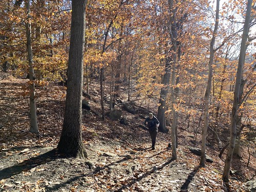
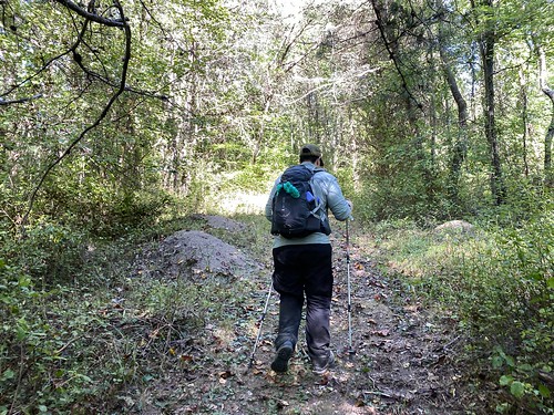
However, the trail was beautiful! The temperatures were perfect, and the leaves were beginning to turn. We really want to come back next year and finish it.

The first night, we stayed at Birch's Lakeside. The general store also has a campground, which is primarily used for RVs that stay for the season, but they have a few (paid) tent spots, which you need to reserve in advance. 

Cranberry Lake day 2

The second night, we stayed at the Cranberry Lake Campground. It's a ways off the trail (definitely farther than the maps say), and again requires payment.

Cranberry Lake day 2

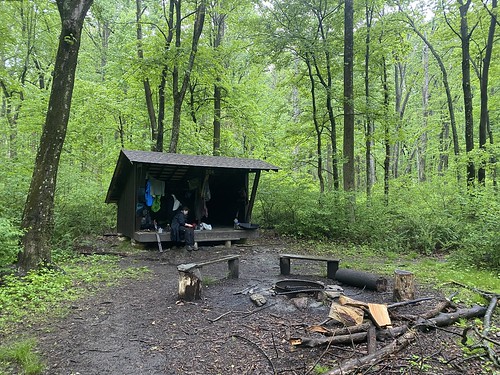
Our third night, we stayed at Curtis Pond. This gorgeous site barely fit our tent. If you're a hammock camper, I don't think there are trees here that work. We were really very relieved to get there and find no one already camped, since we didn't have the energy or daylight to make the next site - or to go back to the previous. 

Cranberry Lake day 4

Our fourth and final night was spent at Chair Rock Flow. There is room here for quite a few tents, and it's also the last place the water taxi can pick you up. Luckily, it was the rare spot with internet, and we decided to call for a ride out. 

Cranberry Lake day 5

At that point, we were ¾ of the way around the lake, but about 30 out of 50 miles complete - the last section takes the long way around the lake.

Cranberry Lake day 3

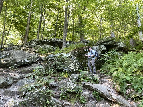
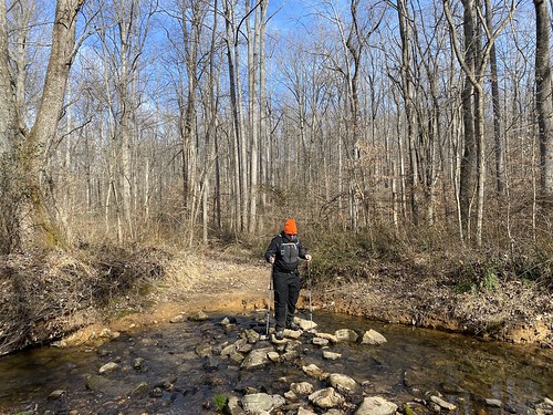
People talk about this hike being "flat," but it's only flat relative to the eastern Adirondacks and real mountains. It's not flat like the Batona Trail! While we did that in four days, I would want five or six for Cranberry Lake, at least at my current fitness level.

Cranberry Lake day 1

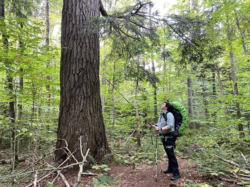
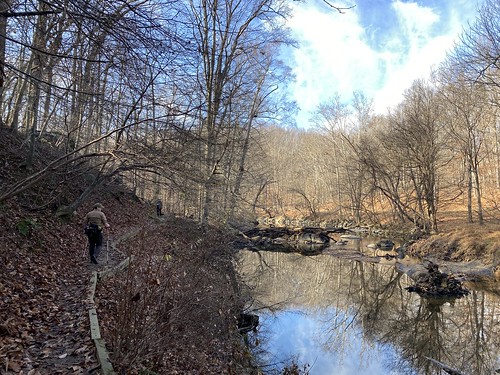
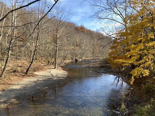
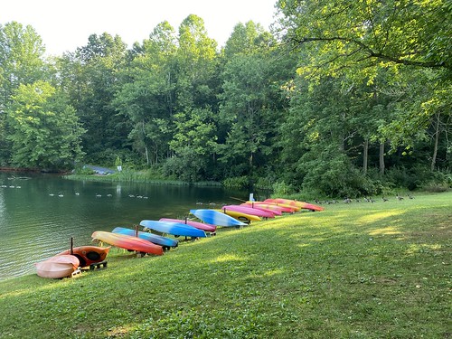
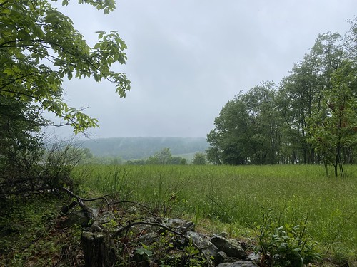
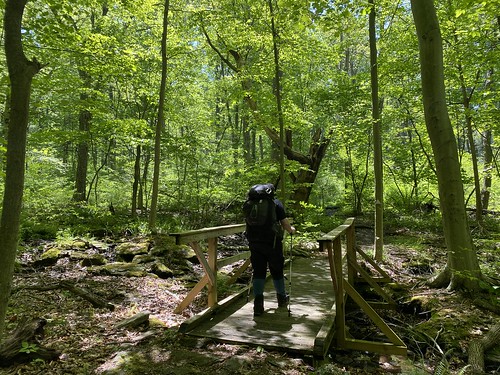
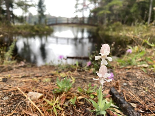
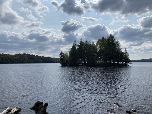
It is beautiful, however. There are not as many lake views as you might assume from the name - you're often far from the shore - but there are beautiful ponds and nice woods.

Next year, part two!

Wednesday, October 11, 2023

Loop in Little Bennett Regional Park

My pardon to any entomologists, but usually when a hike advertises "ants" as the big thrill, I don't expect much. So we went into this one not sure what we would get.

This hike was taken from the PATC book for DC area hikes, part A. Overall, it is almost 10 miles (we made it 10 with a slight add-on to the campground). As advertised, there are Alleghany ant mounds, but there is also varied terrain and a few other sights along the way.

Little Bennett Park

However, the ants did turn out to be pretty cool. I like this photo for its sense of scale.

Little Bennett Park

Return to Riverbend State Park

TVOP at Great Falls

T and I returned to Riverbend State Park to join a group hike with the Venture Out Project. It's still a nice hike, with excellent views of the falls. (Which were flowing much better than the ones at Cunningham State Park.)

TVOP at Great Falls

Tuesday, October 10, 2023

Cunningham Falls State Park

In early September, we visited Cunningham Falls State Park, in part for the PATC 2023 challenge. Well, I forgot that late summer is not a great time for water flow. The falls were nearly bone-dry.

However, we got there early enough to beat the hiking crowds. (We did have to wait in the entrance line.) And the hike was pretty, especially coming back via the cliffs. Overall, it was a short hike, but we got done before the heat got bad.

Cunningham Falls

Friday, September 1, 2023

Buchanan State Forest and the abandoned turnpike

For another Hike PATC in 2023 hike, we visited Pennsylvania's Buchanan State Forest. It is divided into several discrete parcels, all land donated to the state after forestry companies were done with it. We visited the Sideling Hill area to see the abandoned railway aqueduct.

Sideling Hill

The hike is a short and flat one, but we ended up making it longer by deciding to hike through one of the three abandoned turnpike tunnels nearby. The abandoned turnpike is not part of the forest but adjacent.

Sideling Hill

Overall, a fun hike.

Sideling Hill

Monday, August 28, 2023

Cowans Gap State Park hike

We picked a hot day for this one - a hike around the lake at Cowans Gap, then up the Standing Stone Trail as far as the first overlook.

Catskills2

Ten Mile Run - the video!

This is not turning into a vlog, but I am making a few videos as part of a fundraiser for the Catskills Center.

Catskills1

Sunday, July 9, 2023

Black Hill loop hike

I am working up to longer hikes again, and so on Saturday I aimed for at least five miles in our local Black Hill park. My route traced one of the lake's northern peninsulas, and so was rather flat.

Black Hill loop Black Hill loop

Saturday, July 1, 2023

Byrd's Nest #4

On our last day in Shenandoah, we got another hike in, only a little more challenging - a loop to Byrd's Nest #4. We started on Rocky Branch, which was surprisingly overgrown, then took the Appalachian Trail to the Neighbor Mountain trail. We followed it to Byrd's Nest #4, one of four day-use shelters. What was supposed to be a mown (I think, based on other photos) field was filled with waist-hike grass, which obscured the trail. But after a lunch break, we plowed through and down Neighbor Mountain back to Skyline Drive and our car.

Neighbor Mountain

Traces Trail

We spent a few days in Shenandoah, and in large part due to the weather only did a little hiking. On one day, I did a solo hike of the Traces Trail, an easy loop around Mathews Arm campground.

Traces Trail Traces Trail

Tuesday, June 6, 2023

Dyke Marsh

For the PATC Challenge, any hike on National Trails Day counted, so we took advantage of this to make a Pride-month appropriate visit to a trail that had been on our list for a while - Dyke Marsh Wildlife Preserve. This is a short, one-mile flat trail in Alexandria, starting from the Mount Vernon Trail. 

Dyke Marsh

The difficulty level was very low, of course, but we saw wildlife, including a little green snake. Some volunteers were out planting trees, too. At the end of the trail, which is mostly gravel turnpike, is a boardwalk with views of the Potomac.

Dyke Marsh

Tuesday, May 16, 2023

Catoctin Mountain shelters

This past weekend we went backpacking in Catoctin Mountain National Park, my first backpacking trip since my move to the DMV. It was T's first backpack, and it was a good intro (or re-intro) for both of us.

Catoctin Mountain Park

Catoctin is divided into east and west halves, with Camp David sitting in the middle, off-limits to most of us. The most well-known parts of the park are in the eastern half - it's where the views are. On the western side is the northern terminus of the Catoctin Trail, as well as two reservable Adirondack shelters. We reserved shelter 1, although the other was empty during our stay. Shelter 1 is more in the trees, while 2 has a mini-meadow around it. Both have their own privy.

Catoctin Mountain Park

Shelter visitors have to camp at Round Meadow, unless of course someone is dropping them off, so there is a natural route of about 3.5 miles to the shelters. Some alternatives could make it longer (and hillier). We chose the easiest route. It was raining on Saturday, so we weren't eager to make it longer than necessary. On Sunday, we came back by almost the same route. There are two spots where two trails are parallel and for a bit, such as the yellow loop, so we enjoy those minor differences. We also enjoyed the sunshine!

Catoctin Mountain Park

The trails were mostly well maintained - the trail off of Round Meadow was the most overgrown, unexpectedly. We found the trails pleasant and scenic, crossing streams and passing interpretive areas. 

Next time we head up there, we will spend time in the eastern half, but I think we will do it midweek. On Sunday when we stopped by the visitor's center, it was extremely busy.

Monday, March 27, 2023

Cherry blosson time

The cherry blossoms came early this year, so we took an afternoon off to stroll around the tidal basin and admire them.

Cherry blossoms Cherry blossoms Cherry blossoms

Thursday, March 2, 2023

Washington Monument State Park

It was a total coincidence that we visited this park on president's day weekend, but an apt one. For our fifth #HikePATC2023 hike, we ventured to Washington Monument State Park. No, not that Washington Monument, but one in Maryland. 

Washington Monument State Park

The park itself isn't very large, but the AT passes through it. From the parking lot, we walked north on the AT before reaching the turnoff to the monument. From the lot to the monument is uphill, but only a quarter mile.

Washington Monument State Park

So, from there we proceeded north on the AT to the next road crossing. It was a pretty hike, with views through the winter trees. Round-trip, it added up to 5 miles, with almost 800 feet of elevation gain.

Washington Monument State Park

Wednesday, February 22, 2023

Trying out Monocacy Natural Resources Management Area

After reading about this area in the latest PATC newsletter, and seeing it was quite close to home, we decided to pay it a visit. Our hike was relatively short, just over three miles - the entirely of the blue trail, with a loop on the red, orange, and yellow trails. We were pleasantly surprised by how nice it was!

Monocacy Natural Resources Management Area

Most of the blue trail follows Furnace Branch, and the far end of the trail is a lime kiln. There were several stream crossings along the way; only the first was bridged. I'd like to visit the entirety of the red and yellow trails out to their trailheads next time.

Monocacy Natural Resources Management Area

Thursday, February 9, 2023

Great Falls from the Virginia side

My previous visits to Great Falls had been from the Maryland side, as had T's, so we headed down to Virginia to see them from a new angle. We actually started from Riverbend Park, north of the falls, and headed down the Potomac Heritage Trail. 

Riverbend Park

There were plenty of folks out enjoying the nice weather, especially around the falls themselves. The Virginia side doesn't offer the experience of crossing over some of the channels on bridges, but the falls are spectacular either way.

Great Falls

We went past the three overlooks to where the river narrows, down to Sandy Landing, then returned via the Matildaville trail to the visitor's center area. We took the PHT back up to where we parked, then a bit farther north to see an eagle's nest across the river.

Our hike was about 7.5 miles, without significant elevation gain, but with minor scrambles over rocks. The restrooms at Matildaville were closed, including the port-a-johns stationed there, so beware that the visitor's center may be your only bet. Riverbend does charge $2 to park, on the honor system, so we avoided the fee to enter the national park. 

Great Falls