Wednesday, January 29, 2020

Hiking Rusk, Hunter, and SW Hunter

I have hiked each of these peaks separately, in the summertime, but not together. Most people do Hunter with SW Hunter; adding Rusk turns it into a hike of a little over 12 miles.

Rusk

Going from Spruceton Road to Rusk is a trail-less endeavor, which means going almost directly uphill. We did enjoy much better weather than on Saturday - some snow, but no rain.

Hunter

From Rusk we bushwhacked over to the trail and up to Hunter. The photo above is from the fire tower at the top.

SW Hunter

Technically, the spur trail to SW Hunter is trail-less - but a herd path has developed, so it really isn't. It too has a canister at the top.

We then followed the spur back to the trail and followed it back out to the cars, finishing after dark.

Tuesday, January 28, 2020

Hiking Halcott in winter

This past weekend was the annual Catskills 3500 Club Winter Weekend. I opted to do an easier hike on Saturday in order to do a bigger hike Sunday, and it turned out to be a good decision for other reasons - namely, the weather on Saturday was terrible. It went from gray to brief ice pellets to rain, which is never pleasant when it's a little below freezing. This is what most of the hike looked like.

Halcott

Halcott is a trail-less peak, which meant our hike was a charge straight up the hillside without switchbacks, before we turned and followed a ridge to the actual top. There are no views at the top, with or without bad weather, but there is a canister to sign.

Halcott

Tuesday, January 21, 2020

Rail trails of Manchester

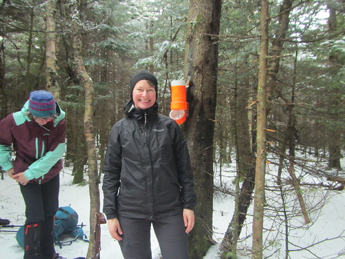
I was supposed to spend last weekend backpacking in the White Mountains. However, the trip got postponed due to weather - a cold, snowy front was coming through. Yes, one expects to be cold in the Whites in winter, but -20 is pushing it, especially for a group tour.

I still had non-refundable plane tickets to Manchester, NH, though, giving me the choice of losing them or throwing good money after bad. What the heck, I said, and decided to go anyway.

Since I didn't rent a car, my entertainment was limited to places I could walk. But, hey, I'm a hiker! So I saw a good portion of the urban trails during my time.

Heritage Trail

Up first was the Heritage Trail, a very short trail along the Merrimack River. The proper trail is only .9, although of course one can walk further on local streets. The old mill buildings foreclose river access in places, however. The photo above shows the view from the access point near parking.

Piscataway Rail Trail

There is another section of this trail to the south, which I did a bit of the next day on my way to the Hands Across the Merrimack pedestrian bridge. It had snowed the previous night, and of course the trails were not plowed, upping the difficulty level. The photo above shows a view from the bridge.

Piscataquog Rail Trail

Once across the bridge, I was on the Piscataquog Trail (above), which I followed in its entirely (2.1 miles) to the Goffstown Rail Trail (below). It's 5.5 miles long, but I only did a portion of it, just over a mile. Volunteers had shoveled out a bit of the Piscataquog Trail, but otherwise it was all snow. (Snowshoes would have been ideal, but no one else I saw out had them either.) Both trails follows the Piscataquog River, although in some sections it's not within view.

Goffstown Rail Trail

Additionally, Manchester boasts the South Manchester Rail Trail and the Rockingham Recreational Trail, both of which would require a car from downtown. As it was, I took a Lyft back from the Goffstown Trail instead of returning on foot.

P.S. I stayed at the Ash Street Inn, which is more upscale than I usually go, but it was a nice choice, and located within walking distance of downtown attractions. Would recommend.

Monday, January 13, 2020

Hiking in the Hudson Highlands

Yesterday's Ramblers hike was a goodbye to one of our long-time members who is moving away. That, combined with unseasonably high temperatures, made for a big turnout.

East Hudson Swansong

Part of the hike was along the Catskill Aqueduct, which brings water to New York City. But the second half was hillier.

East Hudson Swansong

The total distance was just over 13 miles, with about 1700 feet of elevation gain.

Sunday, January 12, 2020

Visiting the Marcus Garvey fire tower

The first time I saw the fire tower at Marcus Garvey Park* was on an urban hike with the Ramblers in 2012. The tower looked very cool, but it was disappointing to see the condition it was in. It was in this sad shape, of course, because New York quite shamefully spends more money on parks, infrastructure, etc. in neighborhoods that are white and/or well off.

The awesome tower

However, since then, locals led a charge to get it restored. You can read about it here.

I recently stopped by the park to see it, but the tower itself, while beautifully renovated, was closed to climbers.

Marcus Garvey fire tower

The parks department does offer regular visiting hours, though, where a ranger is present and the tower is open. So I took K with me on a visit to the top yesterday.

Marcus Garvey tower

The above photo is facing towards Queens and Brooklyn. To the northwest, one can see the GW bridge. It's a nice view! They also let you ring the bell. (This might be one reason hours are restricted - otherwise, people could toll the bell any time.)

*This tower is also called the Mount Morris Fire Tower, because that's the name of the neighborhood. However, there is also a former firetower upstate on a hill called Mount Morris. These are two totally separate fire towers with no connection.

Thursday, January 2, 2020

Hiking in the new year

My hiking club has an urban hike on new year's day every year, which I try to make when possible. This time, I had initially intended to be hiking in the Catskills instead, but that hike required an earlier start than I liked, so instead I joined the Ramblers in Rambling around the Bronx.

Bronx step streets

For the second year in a row, we walked the step streets (and other steps, and ordinary streets) of the Bronx. The official hike was 13.75 miles, but I walked a few extra, just over 17. Since we went up a lot of stairs, but down a lot of others, the elevation gain was 1,473 and the loss was 1,397.