Wednesday, April 27, 2016

Cherry blossoms at the Brooklyn Botanic Garden

On Sunday, I went to the Brooklyn Botanic Gardens, and the cherry trees were magnificent:
Brooklyn Botanic Garden
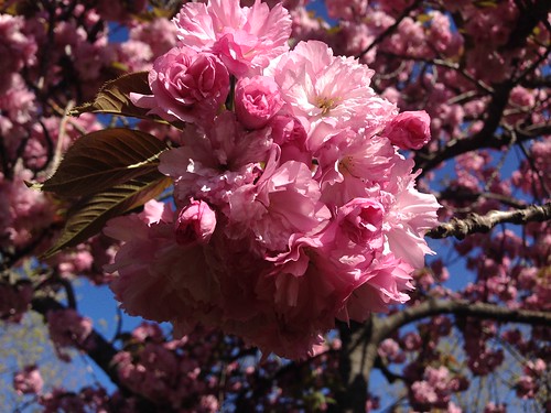
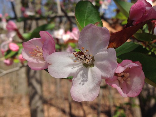
They were also very nice up close.
Brooklyn Botanic Garden
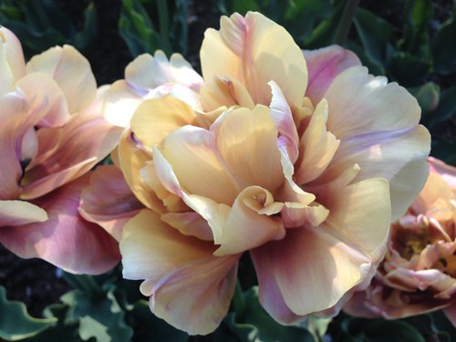
Even the tulips were impressive, and I've been to the Skagit Tulip Festival:
Brooklyn Botanic Garden
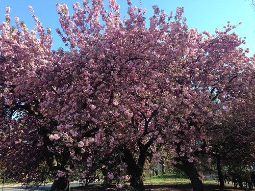
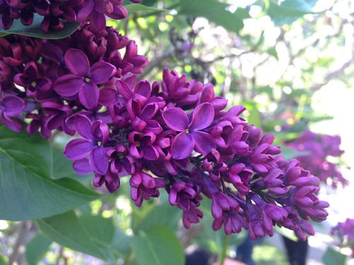
The lilac was pretty alright too:
Brooklyn Botanic Garden

Tuesday, April 26, 2016

Suffern-Bear Mountain End-to-End: Check!

SBM End-to-End
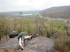
Well, I finally did the Suffern-Bear Mountain End-to-End hike. Put on annually by the Appalachian Mountain Club, this hike travels the entire length of Harriman State Park, from Suffern in the south to the Bear Mountain Inn at the north, accumulating over 6,000 feet of elevation along the way.

The climbing starts right away up a rock face in Suffern. In the photo to the left, you can see the town of Suffern behind us. From there, the hike rolls up and down hills of varying size.

I started off trying to keep pace with a few people - near the back, mind you; I wasn't trying for any record - which turned out to be a mistake, as I was walking faster than was comfortable and burned myself out a bit. I finally slowed down some, but even so was going faster than I could enjoy. At the bail-out point, 13 miles in, I did think about bailing out.

SBM End-to-End
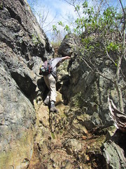
Instead, I went on, and the hills continued, up to the Irish Potato and then up Pyngyp (pictured). Frankly, I found scrambling a nice change from walking uphill.

A few miles from the end, we caught up with a few Ramblers who had started out an hour early. I slowed down with them, and was finally going at a pace I found comfortable. (Endurance I have ... speed not so much.) We weren't quite the last ones done, but almost.

I don't think I'd do it again - once was plenty. Nevertheless, completing it gave me a nice sense of accomplishment.

Tuesday, April 19, 2016

Mountainview Nature Park hike

Long Path
Sunday's hike primarily followed the Long Path, starting close to where I had ended the previous week and ending at Rockland Lake. It was more hilly than I anticipated, with 2,600 feet of elevation gain in 15.5 miles.

The hike was pretty, not spectacular; I suspect it will be less interesting once the trees leaf out and views are restricted. One highlight of sorts was Buttermilk Falls (not the more famous one in Ithaca, or the other more famous one at the Delaware Water Gap); it was a small but pleasant fall that fades into insignificance on camera.

I'm not entirely sure I'm ready for the SBM end-to-end next weekend, but ready or not ... here it comes.

Monday, April 18, 2016

Van Cortlandt ramble

VCP
Saturday's hike was low mileage (in fact, I don't know the mileage), but it was a nice stroll around Van Cortlandt Park. Spring is back, and I haven't ever seen so many trees in blossom in the park before.

Tuesday, April 12, 2016

Hiking the Palisades

Palisades
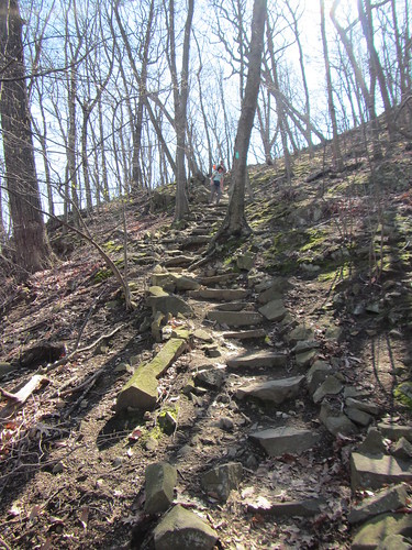
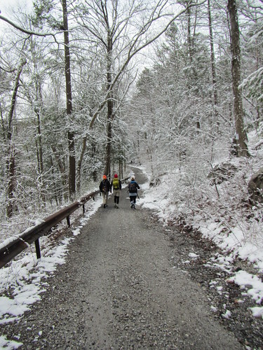
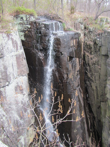
I was supposed to hike the Ramapo-Dunderberg Trail end-to-end this past Saturday, but it ended up being cancelled on account of the weather forecast. Snow was being predicted, and the RD has a lot of rock scrambling. I still needed to get some miles in, though. Instead, I hiked the Long Path along the Palisades.

Starting from Fort Lee, just north of the GW Bridge, I hiked up the Long Trail to the state line, where it turns west and heads inland. I turned south there onto a side trail, looping back to the State Line Lookout, and followed the Long Trail back to the Alpine Cloister exit and caught a bus home. The total distance was 17 miles.

I've hiked this area several times, but last time I was at the northern end, I somehow got lost. This time, the route was much easier to follow. Was it user error? Easier route-following thanks to the leafless trees? In any case, I definitely hadn't seen the northern bit properly before.

Along the way, some light snow did start to fall, before turning to a wintry mix. It wasn't dangerous, as the trail doesn't have the scrambles the RD does, and I was appropriately dressed. Still, I was a little lazy, and didn't hike quite as far as I had intended. ("Only" 17 miles is relative, mind you - I had wanted to do more simply as a better test of my readiness for the SBM in two weeks. However, with easy outs and no one to push me, laziness comes naturally.)

Monday, April 4, 2016

Fahnestock in the snow

Jim's Swan Song
The Ramblers did a hike in Clarence Fahnestock State Park this weekend as a goodbye to a long-time member who is retiring and moving away, and our early spring was interrupted by a late snow. I certainly wasn't anticipating three inches of snow, not with blossoms on the trees! Nevertheless, we had a good hike - if more difficult than I anticipated, mostly because we were going quite fast for part of it. We started at Pelton Pond, hiked south to Candlewood Hill, and then back. 

It was quite beautiful with the snow, although chilly. We didn't really notice until we stopped for lunch - in style, thanks to catered pizza - and then everyone started to notice their wet socks. A planned loop around the lake was called off due to full bellies and literal cold feet. 

Most of the group did about 9.5 miles, but those of us who went up Candlewood Hill probably added 1.5 on top of that. Not quite regulation Rambler length, sure, although plenty for before lunch.