Our next big hike was another C&O Canal one, this time starting from the center of the Tuscarora section, heading east to where the Tuscarora turns north.

Our next big hike was another C&O Canal one, this time starting from the center of the Tuscarora section, heading east to where the Tuscarora turns north.
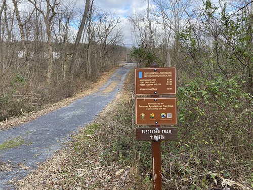
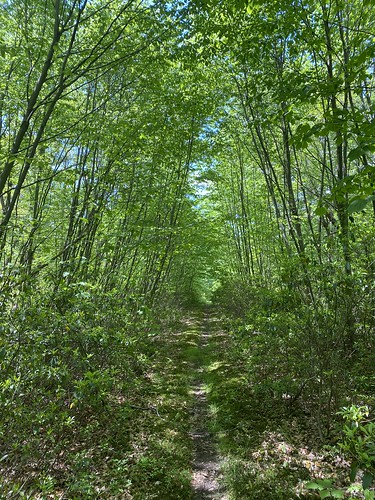
With my ankle finally healed up, we had a lot of Tuscarora miles to go to make 60 by the end of the year, so we headed back out to the easiest section - the C&O Canal. We started at the Hancock end, hiked about halfway along the canal section, then back.
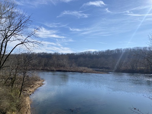
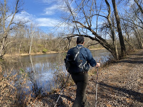
It was not a long hike, but it was the first interesting hike since my sprain. T and I headed out to Hancock, Maryland to do a wee bit of the Tuscarora Trail. We started where we had left off last, where it diverges from the C&O Canal to cross the Potomac.
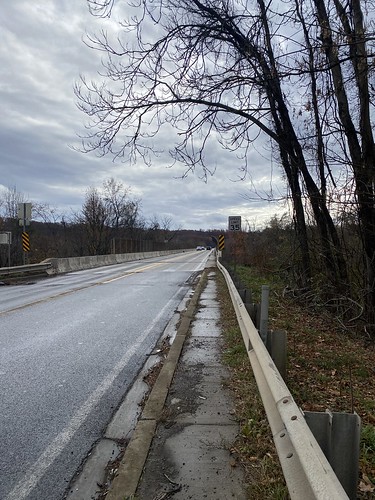
Our hike was short - through Hancock, then across the bridge. (The next section is a particularly dicey section of roadwalk we have no intention of doing.)

The crossing is a two-lane bridge, with a narrow pedestrian sidewalk that is raised but has no barrier between you and the cars. We deliberately chose a light-traffic day, and we wore bright colors for visibility.
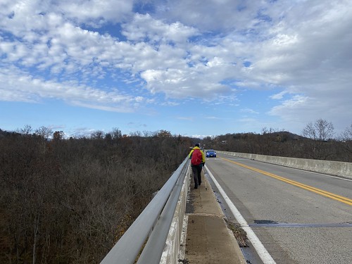
There were nice views from the bridge, but it was not exactly a relaxing walk.
In mid-October, we returned to the Shawangunk Ridge Trail after over a year to do the next section. Well, we didn't get very far. About a mile in, I sprained my ankle, and we had to turn around after splinting my injury.

We did walk a little further at the end of our section, near the shuttle car. Part of the trail was under a deep, deep puddle, so we retraced to the road. It's going to be hard to find a time of year where the Bashakill section isn't wet.
While my sprain wasn't a bad one, I was out of commission for a bit. I'm back on it now, but I am keeping mileage very low.
The last month or so was a lull in hiking due to life interfering, but on Indigenous People's Day, I took a walk in Black Hill Park, following the Hard Rock Trail. It was only 4.5 miles, with gentle hills, but it was more than I had done in a few weeks.

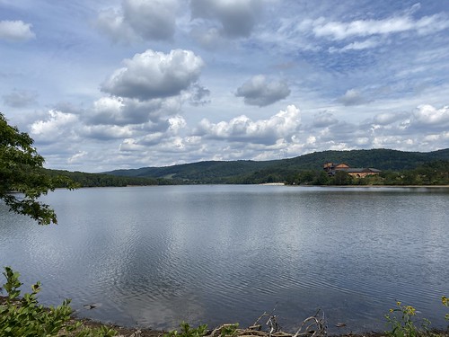
I feel like I've been walking around a lot of lakes lately, not all documented here - Lake Frank, Black Hill Regional Park and Lake Churchill, and other Montgomery County dammed lakes. And once again we found ourselves circumnavigating a lake, this time on a weekend trip to Rocky Gap State Park.

We had hoped to get more hiking in, but rain dashed those plans, so our only real hike of the trip was around Lake Habeeb. Like most such hikes, the elevation gain was negligible. At 5.3 miles, it could be done in a couple of hours, but we took our time. (This included a stop at the visitor's center for snacks.)

Different portions of the lake had different feels, as the northwest side was mostly wooded, and the southeast side had the resort, visitor's center, and most of the day use areas. Overall it was a pleasant hike.
Sugar doesn't come in loafs any more, but we're stuck with dozens of mountains named for that shape - including one in Frederick County, Maryland. This Sugarloaf is a monadnock, meaning it stands alone and is not part of a range. It's a popular hike because it's the only game in town, mountain-wise.

While Sugarloaf rises 800 feet above the surrounding land, many of the parking lots are halfway up the mountain, saving you some elevation gain. However, we chose to loop around on the blue trail, which traverses some ups and downs to visit other sub-peaks. It's about 5 and a half miles, with 1,375 feet of elevation gain total. That makes it a decent workout, and good training for other peaks.
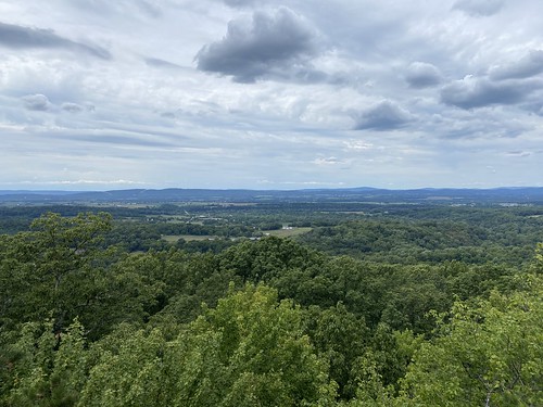
The first photo above is from the main peak; the second one is from White Rocks. The latter has a nicer view, and a bit more privacy (although the entire mountain is popular).

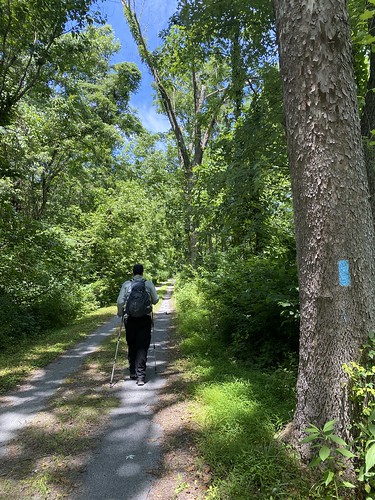
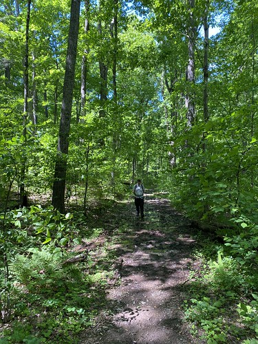
On a hot summer day, T and I set out to hike one of the trails in the AMC's DC dayhikes book. The Matthew Henson Trail is a 4.2-mile greenway connected to the Rock Creek complex of trails. Most of it is very nicely shaded, and of course it is almost entirely flat. It occupies a fairly narrow corridor in between houses, with a few major road crossings. Given all that, it was pretty nice for what it is.
We did it round-trip, with a short detour on the way back for pupusas and Rita's ices.
We decided to change things up and do the easiest part of the Tuscarora Trail, the part that is coterminous with the C&O Canal.

The hardest part ended up being that, while we had planned it as a one-way hike, we couldn't get an Uber back to the start - guess that's the problem with a small town on father's day. We did end getting a ride from a nice stranger at the gas station, so it ended well.

Our last day was another short one, what with packing up the camp site and driving home, so we picked a short but fun-looking trail - the Tunnel Trail. This easy trail through laurel-covered hills leads to a railroad tunnel that was started but never completed.
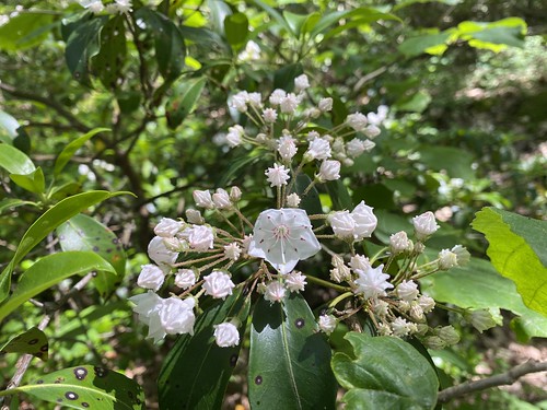
The laurel was only just starting to bloom, but it would have been spectacular in a week or two.
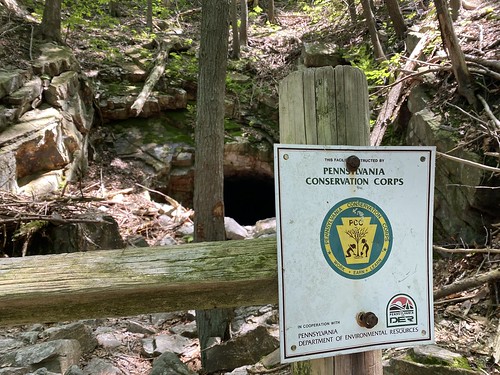
The tunnel itself was cool and refreshing.
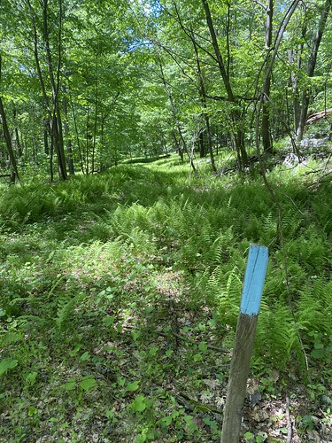
We were eager to get more miles in toward the TT60 Challenge, so on day two, we drove to one of the few trailheads where the hike didn't start with a massive elevation gain. This was where section 6 ends and section 5 starts, and we headed down section 5.

The first part of the hike was on an old road. While it had elevation gain, it was relatively easy going. The trail then left the road and narrowed to a mossy tunnel. This was still pleasant.
It then opened up to an area formerly of hemlocks, now dead. Ferns had taken over, although there were enough trees to provide shade. The trail steeply but briefly headed uphill, and then proceeded to follow a ridge for much farther than we had time to do.
The ridgetop trail badly needed maintenance - it was overgrown and rocky. After an encounter with a harmless rat snake, we were on the lookout for any more of its pals. Despite the overall flatness of the ridgetop, it was slow going. Plus, it was hot and humid.

After lunch, we decided to call it quits and turn around.
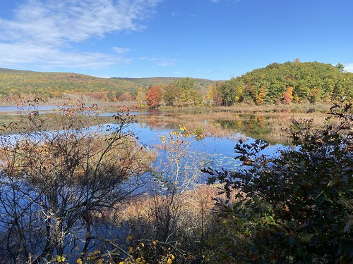
A four-day trip to Pennsylvania was cut down to three thanks to bad weather. But we made it up there and got the tent up at Fowler's Hollow campground with time to do a shorter hike on the first day. We oped to save on any further driving by just taking the Fowler's Hollow trail out of camp to the Tuscarora Trail.
The trail follows a stream (Fowler's Run), and is probably normally relatively easy tread, but on this day it was very wet and muddy from the aforementioned bad weather. But it was pretty. This trail then ends on logging roads, which we followed to the Tuscarora. We then walked on the Tuscarora for a wee .05 to a shelter. Finally, we returned via the same route.
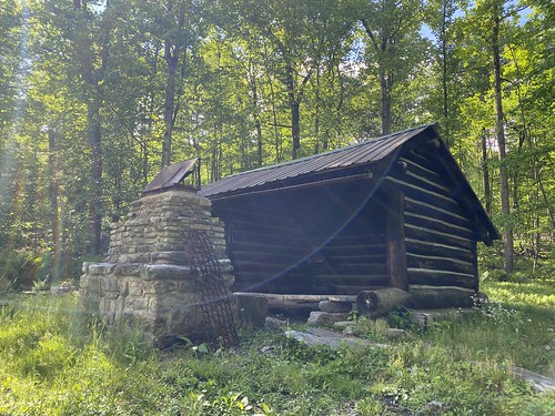
The Tuscarora, even the tiny bit we were on, was in rough shape. A small bridge had slid out of place, and it was overgrown. But the shelter was nicely maintained.
It was a hot day, so we wanted to do something flat. We headed over to the C&O Canal to do what ended up being 8 miles, between there and back and farting around.

On our way back to the car, the storm clouds that had been rolling in let loose, and we got pretty wet.

On Monday, the weather cleared up, and we finally headed to the hike I had hoped to do on Saturday; the southern terminus of the Tuscarora Trail. The trail is traditionally thought of north to south, but of course it can be done in either direction. T and I wanted to start the TT60 Challenge, which involves hiking 60 miles on the trail in 2022.
To reach the start of the trail, you have to hike a bit on the Appalachian Trail from the nearest parking lot, so that's what we did. After a third of a mile we reached the Tuscarora and started heading downhill. Yes, this was one of those down-then-up hikes, so I was trying to keep a check on myself and not bite off more than I could chew.

At the top, very few trees were in leaf, but as we descended, the trees got greener. We also had a close encounter with an owl, and we stopped to admire it for a while.
After 2.8 miles on the Tuscarora, we reached the first of two overlooks above Overall Falls and had lunch. We continued to the second overlook (maybe 100 feet away) before deciding this was enough elevation gain - we had about 1,480 feet to go up.
Our return was via the same route, albeit slower.
It was a nice introduction to the Tuscarora, and I'm looking forward to seeing more parts of it.
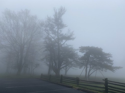
On our next day in Shenandoah, it was supposed to be cold; we worried about ice and fog. So we elected to do a hike that we could start from our cabin.
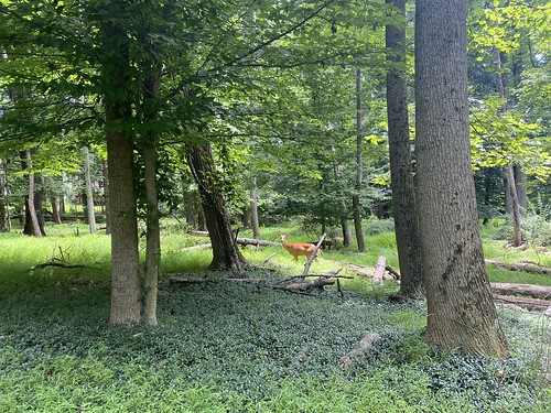
After a short jaunt on roads, we took the Skyland Stable trail to the Limberlost trail, then back again on Whiteoak Canyon. It was a pretty easy hike, if a sad one, since the Limberlost is basically a monument to the hemlocks that used to line it. We saw a lot of deer, including one young one bouncing all around while the mom patiently ate lunch.

The fog cleared up, so we got in the car and drove to Stony Man. We took the horse trail to the summit and the hiker path on the way back (although we will have to return for a couple of short bits of the latter). This one was short, and even though it was uphill the work/reward ratio was great - we had terrific views at the top.

Many months ago, I had booked a camping trip in Shenandoah for the first weekend in May. It's May, I thought! It's Virginia, I thought! Surely it will be warm enough. T tried to warn me, but I blithely pressed forward.
Come the day we are supposed to leave, and the forecast for the weekend is supposed to get as low as 21 degrees. Okay, time to pivot. Luckily we found a cabin available in the park at a reasonable rate. It was cute, dubiously clean, and (most importantly) warm.
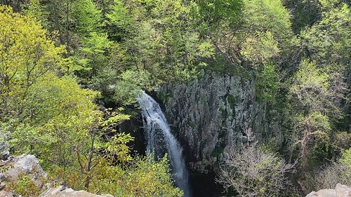
But that also changed our hiking plans. We arrived late Friday afternoon in fog, and the next morning was drippy. We wanted to go somewhere that wouldn't involve missing out on a great view. T chose Dark Hollow Falls, and it proved to be the perfect choice.

We approached it on the Story of the Forest trail, a flat path that was a nice warmup. After crossing Skyline Drive, we began the downhill trek to Dark Hollow Falls. Thanks to several days of rain, the falls were at a nice volume.

Our route back was essentially the same, although we took another fork on Story of the Forest.
Overall mileage was 4.4, with 874 feet of elevation gain.
T and I took a short jaunt around Lake Needwood, three miles and mostly flat. Lake Needwood is located in Rock Creek Regional Park in Maryland. DC's Rock Creek Park is probably more famous, but a corridor around the creek is protected heading northwest, and RCRP enlarges around a dammed area of the creek, which creates said lake. It's a pleasant little excursion, although not a destination if you're not in the area.

Luckily, the day after we toured Gathland, the weather warmed up a bit and we visited Weverton Cliffs. This is a hike that follows the Appalachian Trail in Maryland for a bit before taking a side trail to the cliffs, where there is very nice view of the Potomac River and Virginia, not far from Harper's Ferry.

The hike up was pleasant, but the real payoff was the cliffs. There is a rocky area near the edge, and we found a spot sheltered from the wind to have a snack and admire the view.

After returning to our starting point, we followed the AT the other way down to the C&O Canal. We walked along the canal a bit, looking up at the hill we had just been on.
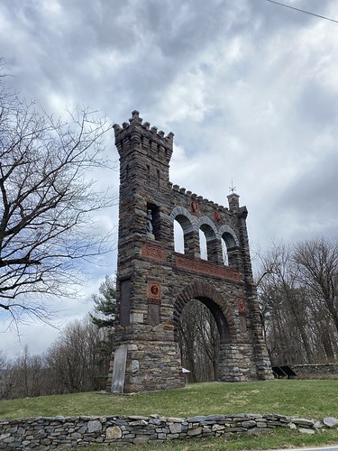
T and I took a weekend trip to cabin camp that ended up being really cold, so we hiked less than we had hoped. One of the places we did visit, simply because it was right nearby, was Gathland State Park. It's a pretty small park; while the AT passes through it, the only other trail is a short interpretive trail, which we did. Neither of us are Civil War buffs, so I can't say we read every sign assiduously, but I did like the Civil War correspondents memorial, shown below.
It was a little pre-peak, but we took a hike from my front door out to the National Mall and the Tidal Basin to see the famed cherry blossoms.


One of my goals for the year is to hike 10 hikes from AMC's Best Day Hikes Near Washington, D.C. On Saturday, I finally knocked off one.
The hike at Seneca Creek State Park starts at the parking lot and does a lollipop around the lake. The book bills it as a moderate 4.5 miles; my mapping app says it's 5.5. However, my tracker came in at 7, (with a slight shortcut out), and it's usually fairly accurate. Safe to say, 4.5 is incorrect.

From the visitor's center parking lot, we followed the creek for a while, which was pleasant, before reaching the lake. There were only modest ups and downs. The hike around the lake, of course, benefitted from views at nearly all times.

This month has not been a big one for hiking, but I did do a sunny winter hike in Black Hill this past weekend.

The Billy Goat Trail, on the Maryland side of Great Falls, is extremely popular and, therefore, extremely crowded. That's one reason we decided to visit it on a very cold day with a snowstorm predicted to move in that night.

We got a later start than was ideal, so we didn't reach the park until the afternoon. From the parking area, the C&O Canal towpath heads east and west; we went east towards the falls. We then headed out to Olmstead Island, which is an easy boardwalk path with nice views of the falls. We then used the towpath to reach the start of the Billy Goat Trail. It is now one-way, so we hopped on at the entrance and began scrambling over boulders.
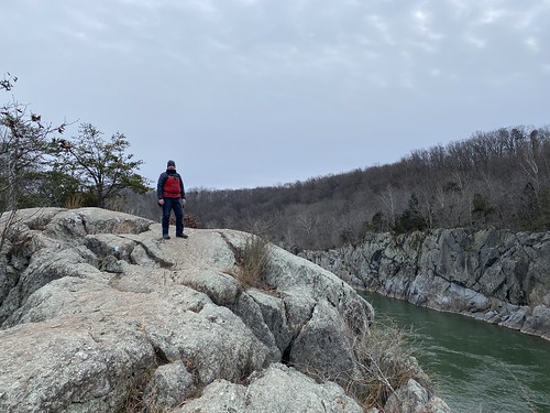
Because of our late start, we opted to use the exit trail before Purplehourse Beach, returning via the towpath. I think that was the right call - I'd rather be able to enjoy this hike than rush through it.
https://www.flickr.com/photos/turducken/51828137410/in/datetaken-public/Our loop was a total of 4.5 miles.
On January 1, I headed out with a couple of family members to McDowell Creek Falls. We hiked a little over two miles, gained 350 feet of elevation, and saw two waterfalls.
Thanks to recent snow, the wooden stairs and overlooks were icy, and caution was required. We had brought two dogs with us, and we ended up carrying them at points. It wasn't so much that they would fall as that they pull.
Lots of folks were out, as it was sunny (but cold) weather.

