Saturday, March 24, 2018
Wednesday, March 21, 2018
Hike to Tibbett's Brook
The first time I ever went to Tibbett's Brook Park in Westchester was when I did the Old Croton Aqueduct; unfortunately, I couldn't see most of it very well, since night was falling. So on a nice day during spring break, I decided to toodle back up there.
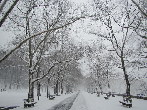
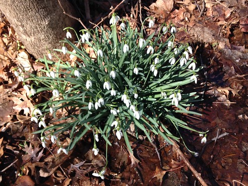
I started in Van Cortlandt Park, walking up the doomed Putnam Trail. From there it turns into the South County Trail, a paved greenway right next to the Saw Mill Parkway. Along both the northern end of the Putnam trail and the South County Trail, snowdrops were in bloom.
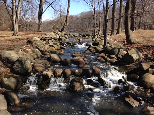
Upon entering the southwest corner of Tibbett's Brook Park, the trail still parallels the parkway, but it seems to recede behind more trees. Tibbett's Brook has a dramatic but small cascade here. Farther along, there is a small waterfall where the dam spills over.
At the north end of the park is a waterpark. It's limited to Westchester residents and their guests, but of course it wasn't open for the season yet anyway. (The restrooms are year-round, though, if you need to make a stop.)
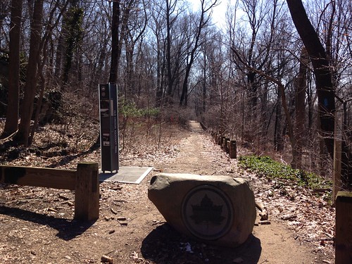
I then returned along the east side of the park. I wanted to find where the OCA entered Van Cortlandt Park, but two factors hampered me: I hadn't brought my OCA maps, and I on this day I wasn't walking through the woods trails, where the OCA trail actually goes. So when I left the park for the streets of Yonkers, it took some trial and error to figure out where the trail was. However, I did find it, and got to see the Westchester OCA finish line in daylight.
Round-trip, this was 11.5 flat miles. The plan had been to finish up with a walk around the Jerome Park reservoir, but it turned out that it was unattractively fenced in, so I passed.
Tuesday, March 13, 2018
Hiking High Peter's Kill
Since I didn't go all the way to Minnewaska just to hike a mile, I drove over to the Peter's Kill parking area to check out some scenic views. (It's also possible to continue on the Awosting Carriage Road from the falls to this point, but I decided to just do the highlights.)
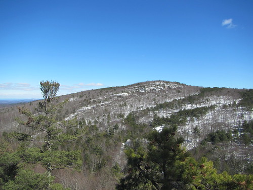
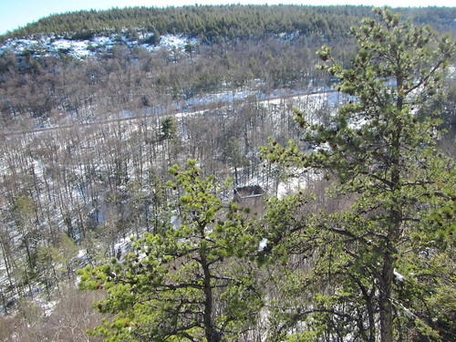
I followed the short side of the Red Loop downhill to Peter's Kill, then turned to follow the stream on the yellow-blazed connector trail. It deadends at the High Peter's Kill trail, part of the Shawangunk Ridge Trail. I turned west and climbed up the other side of the creek to the top of the ridge. From there, it was mostly flat as it followed the ridge, and I went as far as the fourth starred "scenic view." The top photo is of the first of the four views. The photo below is of an old power station at another viewpoint.
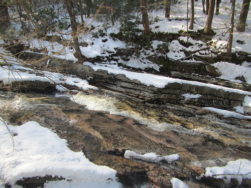
Then, I turned around and returned the way I came, this time taking the long side of the Red Loop trail. In addition to the great views, this hike also boasted a great creek. It was hard to adequately photograph, but below is a photo of it running swiftly downhill.
Unlike Awosting Falls, very few people were out on this hike. Round-trip, it was 3.8 miles - still nothing hardcore.
Monday, March 12, 2018
Down to Awosting Falls
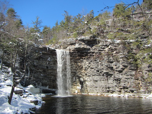
Went to Minnewaska for the day and did two hikes. The first one was quite short, from the Lower Awosting parking lot down to Awosting Falls. It's probably less than a mile round-trip, so lots of people were out there.
After walking down the road from the parking lot, you take the Awosting Carriage Road down to the base of the falls (with a short stop, if you like, at their top first). Enjoy the scenery and then reverse it.
I think in the summer you can park even closer. You could take even your littlest hikers on this one, for an easy hike with a big payoff.
Subscribe to:
Posts (Atom)