Thursday, June 22, 2017

Camping at North-South Lake

North-South Lake

I've camped at North-South Lake many times now, but on this past visit we had the best campsite yet. The above photo was taken where our site met the water. Plus, this same view was visible from the site itself - a few sites have short paths to the water but the view is blocked by trees.

10/10, would do again.

Monday, June 19, 2017

Birdwatching in Bashakill

Bashakill

We decided to explore a new area on our way back to the big city, and J wanted to get some birding in, so we stopped in the Bashakill Wildlife Management Area to try to find the eagles. She wasn't sure where they had seen them before, seeing as her notes were at home, so we took a shot in the dark. We didn't find that area, but we did find visit a nice viewing platform.

After turning on Haven Road, we parked at the side of the road where the Shawangunk Ridge Trail/Long Trail run through on an old rail bed. The trail then parallels Basha Kill Lake for a mile, before a side trail leads to the platform. The view from the platform is shown in the photo above. From the platform, we mostly saw catbirds and red-winged blackbirds, so nothing exotic, but it was pretty. Other birds were around - there were swallows where Haven Road crossed the lake, for example.

Sunday, June 18, 2017

Chill hike along the Kaaterskill Rail-Trail

Kaaterskill Rail TrailThe day after summiting SW Hunter, we thought it best to take it easy and do a nice recovery hike. Since the 1.5-mile Kaaterskill Rail-Trail was very close to our campground, we decided to stroll it.

We parked at the eastern end and walked to the other end, where the historical society is located. The entire trail looked very much like the photo at left. Occasional vernal pools or small embankments on either side mixed things up a bit.

Once we returned to the parking lot (which, unlike far too many Catskills parking lots, actually had port-a-potties!), we decided to also head up the .3-mile trail to the viewing platform above Kaaterskill Falls. You can't actually reach it from the main falls trail. Last time we were there, we actually saw construction on this area. I don't know if some day they will connect.

The view from the falls is nice, although popular, given its proximity to the parking lot. The platform itself is sturdy. (Seriously, people, you all have no more excuses for randomly wandering off trail and falling to your death! Stay on the paths.)

Kaaterskills Falls overlook

Saturday, June 17, 2017

Quick trip to Ashley Falls

Ashley Falls

At .2 miles round-trip, the walk to Ashley Falls is about as short as a hike can get. Still, you get to see a waterfall, so it counts, right?

The falls (above) are a little hard to photograph, because there is a large rock slab at the base that dominates any photo. Still, they're pretty.

On this trip, we had the added bonus of a duck couple hanging out in the stream along the trail.

Duck fam

Friday, June 16, 2017

SW Hunter, my final Catskills 3500 hike

SW Hunter

SW Hunter was my only remaining Catskills 3500 peak, and it was becoming my nemesis. Not because it is so challenging, but because we simply tried it at the wrong time twice.

Backtrack: I began hiking the Catskills peaks three years ago with Hunter Mountain. As a solo hiker, new to the Catskills, it didn't occur to me to hike it with SW Hunter, although that is how it is frequently done. Fast-forward to January of this year, when J and I spent a weekend in the Catskills. After doing Balsam on Saturday, we had planned to do SW Hunter on Sunday. But with the weather being exceedingly brisk, we scaled back to just going as far as 
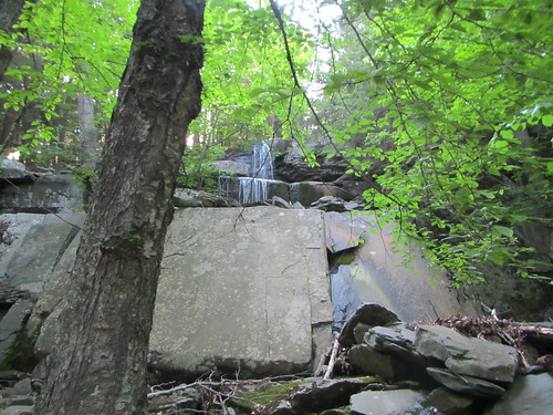
Diamond Notch Falls. Then in March we again spent the weekend, trying to get some peaks in before the official Club end of winter (March 21). Naturally, we came up right after a major blizzard, and once again we only made it as far as the Falls. Meanwhile, I had finished Eagle, my penultimate peak.
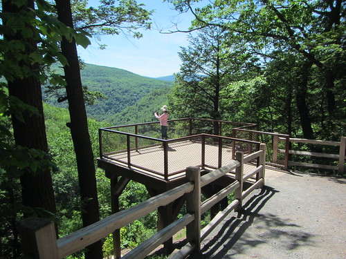
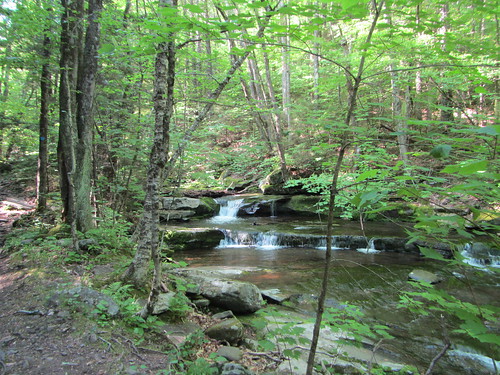
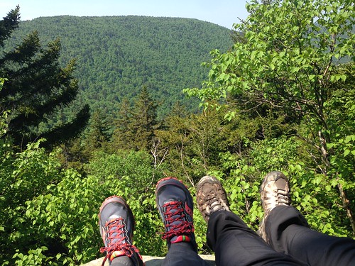
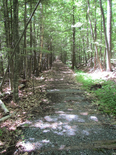
So back to this trip, where neither snow nor below-freezing temps were likely to be a problem. We started out once again from Rider Hollow, where we encountered a group of four 3500 club members setting out to do a one-way hike of SW Hunter and Hunter. They zipped by us as we hiked the easy stretch (seen in the photo at the top) to the Falls.

We then got on the Devil's Path and started going up. Most of the hike is fairly unremarkable. Oh, sure, it is uphill, and it is pretty woods, but there are no major landmarks, intersections, or scrambles. Finally, we reached Geiger Point, the only real viewpoint on the trip, seen below.

SW Hunter

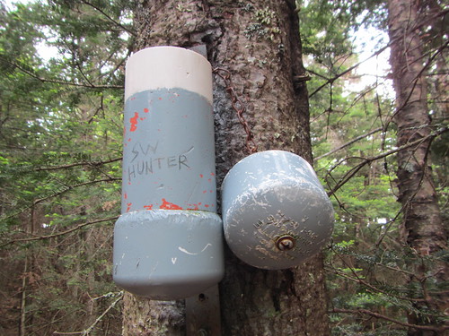
Now, SW Hunter is considered trail-less because it can't be reached by trails formally maintained by the DEC. But it's like Bearpen, Vly, and Kaaterskill in that there are use trails or old roads - it's not bushwhacking. We found the old logging road to turn off on pretty easily, after only one false turn to a campsite. The next turn, off of the old logging road to the summit, was well-marked by cairns.

Because of this, the canister is easy to find; you don't have to hunt for it. We found it and signed in, finding a note from Tom (thanks!). In addition to my final peak, SW Hunter was also J's first trail-less peak, so it was an exciting moment for us both. We didn't linger long, however, thanks to the flies.

SW Hunter

The trip back down was only notable for a brief rainshower near the end.

So ... there it is, the end of my 3500 quest. What now? Do I work on the winter patch? The grid? Red-lining? New England's 100 highest? So many decisions?
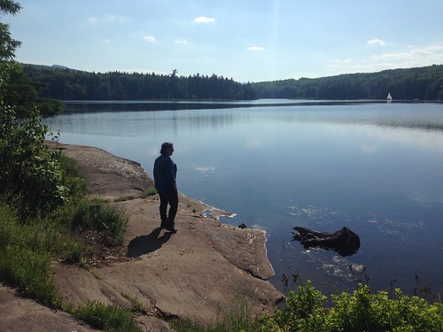
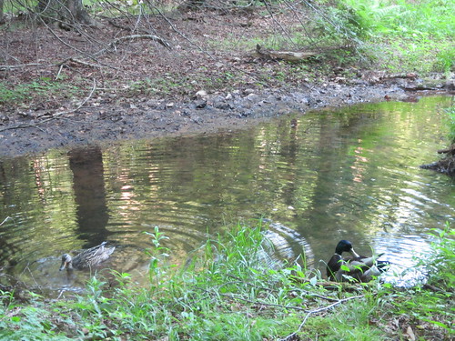