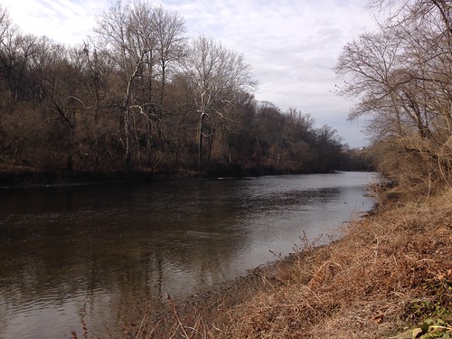
When I asked what there was to do in Wilmington, several people mentioned Brandywine Creek State Park. My plan was to do a short loop hike or two as indicated on the park map, such as the Tulip Tree Wood trail. However, at the visitor center, the helpful staffer suggested crossing the creek to Thompsons Bridge and hiking the bike trails on that side. The trails on the north side also go onto a national park and a farm; the farm has been donated to the park, but at present the farmer still resides there and happily permits hikers to use the trails that cross it.
I didn't ask for advice not to take it, so I parked on the north side of the creek and followed a trail along the creek for a while. In fact, I went so far as to take his other advice that I download and use the Avenza map of the bike trails. Bike trails tend to pack a lot of unmarked trails into a small area, and so this turned out to be excellent advice.
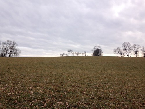
I then turned uphill, towards the high point of the park. There I left the woods and skirted fields before starting back downhill.
The trail I followed downhill did not go all the way back to the creek in any convenient way on the map. However, given the number of trails not shown on any map, I gambled that there would be one anyway, and my gamble paid off. (Here the app was also quite handy to keep me on track.) I reached the creek and followed it back to the parking lot. All told, it was 3.45 miles and about 500 feet of elevation.
The landscape reminded a great deal of Wissahickon Valley Park, which shouldn't have been a surprise as they are only about 30 miles apart. Further south, Delaware gets flatter - it is the sixth flattest state (but it has the lowest mean elevation). So this is probably the biggest hill you can hike in the entire state.
No comments:
Post a Comment