A few logistics:
- This was the biggest enemy I faced on the trail:
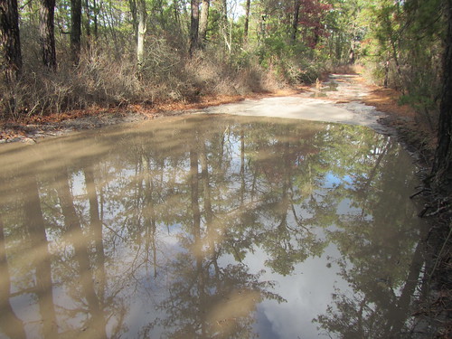
That’s right, puddles. Big and too deep to wade through, the danger came from having to walk around them when there were thickets right at their edge - including lots of greenbriar. I can see why in the summer people complain about ticks.
- The map is terrible. Now, I didn’t get lost. However, whoever drew the map knows nothing about usability. Sand roads, streams, contour lines, and borders all look identical. Most of the ponds aren’t shown. Segment distances aren’t given for side trails, such as to the campsites. There are two reroutes (the Bass River one was called a “relocation,” which brings to mind internment camps) not yet shown on the map. I hope when the redone map becomes available, it is better, because there aren’t any commercially available alternatives.
- Taking the bus to Atlantic City and then the NJ Transit 557 bus to Greenleaf Road and walking two miles to the trailhead worked fine. Next time, I’d go down to Atlantic City the night before and try to make it to Buttonwood Camp the first night.
- If you want to start at Batsto, take the train to Egg Harbor City or the 554 bus to the same and then call a taxi. It’s not worth walking the 7 miles.
- Bodine Field Camp is not worth the 1.2 mile hike to it. There is a water pump … somewhere. I couldn’t find it. There’s also no way to pay there.
- I thought water might be an issue at this time of year, but there was plenty. Just bring something to treat it with.
No comments:
Post a Comment