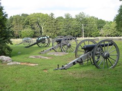
I decided to go for a hike today at Stones River National Battlefield. I picked it rather randomly - perhaps in my subconscious it is associated with three-day weekends. It wasn't a great hike.
You can see a map here. The hike starts at the upper left corner of the trail and heads down and right, around the outside of the auto loop. It then crosses the road and wanders around inside the loop before crossing back over again. Somehow I got lost on the inside portion and ended up going around in a big circle, adding a couple of miles to the hike.
The book wasn't much help, in part because it was outdated - I don't have the latest edition. Apparently the trail used to be called the Five Mile Trail, but the park service materials currently don't use that name. (Well, that was a dumb name for a 3.6 mile-long trail.) The map also wasn't very good, not showing side trails and major landmarks. In any case, at one point I was supposed to come to "an open trail bordered by a split rail fence" with the visitor center across the fence. Instead, I came across a different open field with an intersection, which means that either an important detail was left out of the description or that things had changed much. My left turn I made then was the mistake that led to my wrong loop. But coming around the second time, I still couldn't see where I was supposed to go. I found the field, but not how to get to it.
The Park Service wasn't helpful either. The online map differs from the one I picked up at the ranger office (after the hike, alas). Both fail to show a lot of side trails. (The regulations forbid you to hike non-official trails, but since the trails aren't marked, how are you supposed to know which way is official?) Moreover, the trails were blazed only in some section and never had name signs.
Once I got back on track the hike got rather sucky. There ceased to be a trail in most places, with the route consisting of crossing over open fields and mown strips by the road. If I'd just had the Park Service map, I'd have thought I was in the wrong place and looked for a real trail; it was only the guidebook that let me know I wasn't lost yet again.
No comments:
Post a Comment