
On day 9, I set off from McGrath's Killington Inn in fine spirits. The weather was unpleasantly hot and muggy, but I was freshly showered and coffeed. Soon, the AT split off the the east, and I continued north, spending the night at the David Logan shelter. Here I met two hikers I'd see much more of later on, Pink Heels and Easy Cheese, and they named me "Weasel Masseuse."
I planned to spend day 10 as a zero day; my heels had been hurting me, and I didn't want to push things. But spending a rainy day in a shelter is boring, not to mention cold, so I went on. I decided to go as far as the Sunrise shelter, but I got there and was still tired and cold, and it was nothing special. So I went the extra mile to the road and hitched a ride to whatever town I could get to, which happened to be Rochester, and stayed at a B&B. It was nice enough - the owners were very friendly - but they weren't as accustomed to hikers as the other places I stayed.
Still, a night in a warm building did wonders, and day 11 was better. It helped that it was going to be a short trail day - thanks to shelter placement, it was either a very short day or a very long day. Mt. Horrid had a great name (and a Great Cliff, which is very Lemony Snicket), but no view, thanks to rain.
On day 12 I got back to some decent mileage, a little over 11 miles, and the weather cleared - although the trail was a wet, muddy mess. At one point, nearing the shelter, I had a rather nasty slip that nearly twisted my ankle. It was clearly time to call it a night.
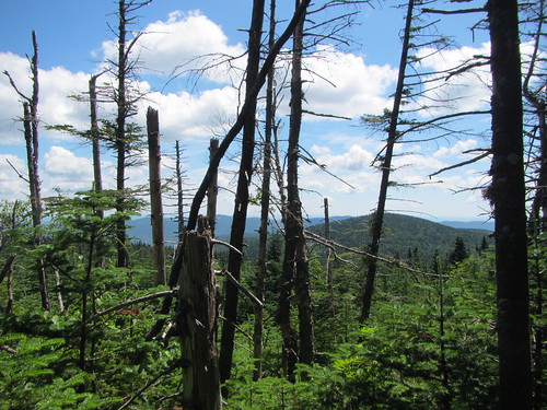
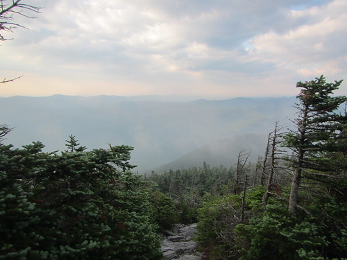
Day 13 came, and I was getting thoroughly sick of the Breadloaf Wilderness. The trail in the this area was quite overgrown, and I got tired of getting thwacked by wet evergreens while avoiding puddles. There were a few good views, though, as a reward.
Day 14 began with a hike up Mt. Abraham. I understand the view from it is quite fine. I, however, did not see it, as it was still shrouded with fog when I reached the top. This isn't necessarily a complaint - while it would be nice to see it someday, I had chosen to get started early from a very crowded camp in order to avoid the hordes. From Abraham one proceeds over several summits, and then it's down to the road. At the road, I hitched a ride into Waitsfield for my box and lunch (Three Mountain Cafe, which roasts their own coffee, was excellent), and then another ride to the Hyde-Away Inn.
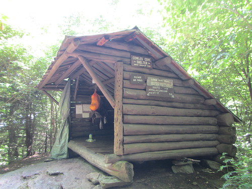
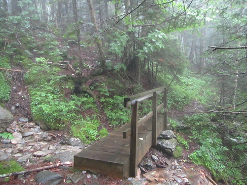
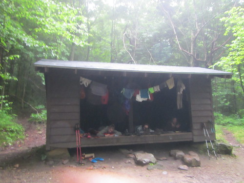
After a ride to the trailhead, I had high hopes for day 15, aiming for Birch Glen Lodge, but nature had other ideas. I stopped at Cowles Cove shelter just after lunchtime, knowing that nasty thunderstorms were supposed to be coming in. Under some circumstances I might have plodded on, but right after Cowles Cove is Burnt Rock, and a sign in the shelter warned direly of how slow it was under the best of circumstances, and how dangerous it was when wet. I sat down to be bored as I waited out the afternoon, closing the tarp door as the rain hit. (This was a feature on no other shelter.) Just as I wished for company, a group of eight campers and their two counselors arrived. While they were planning to tent, there was no point in making them muck around in the driving rain.*
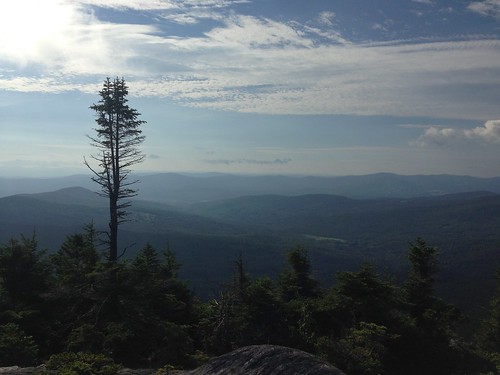
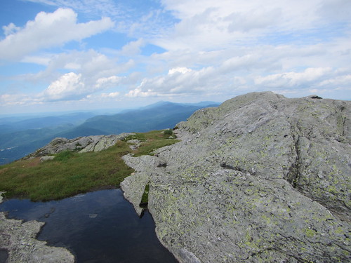
I was ready to move on day 16, despite worries about wet rocks - at least the rain had stopped. But Burnt Rock proved to be dry enough, and it was really fun. It's nearly all exposed rock, so not for the faint of heart, but it has great vistas. From there, though ... Next up was the Allen Brothers, Ira and Ethan, and those were some of my lowest moments on the trail. First, I thought I had lost my map. Then the trail went endlessly up and down on scrambly bits, and it looked like it might rain again. I was thoroughly sick of the trail and annoyed when I reached the top of Ethan Allen and paused for a snack. The food and rest helped, and then the sun came out, and everything looked a lot better. So I decided to go on, to Camel's Hump, which is a more magnificent version of Burnt Rock. It offered incredible 360 views.
Luckily for me, that was the low point on the trail. I was now 2/3 of the way done, and beginning to realize the end was in sight.
* Camp groups aren't allowed to stay in the shelters; some of the local camps use the LT on a weekly basis, and would drive out thru-hikers. We wouldn't even have all fit for the night. But for a couple of hours, a roof improved everyone's spirits. Although I'm not sure theirs were ever dampened.
No comments:
Post a Comment