January:
February:
March:
April:
May:
June:
July:
August:
September:

October:
November:
December:
Tuesday, December 30, 2014
Monday, December 29, 2014
Hiking Roxy Ann Peak
Today I finally hiked up Roxy Ann. It's a mountain in Medford, visible from my parents' house. When I lived there as a kid, I wasn't a hiker. On my trips back since that time, I have other plans or the weather has been bad. Also, I listened to what non-hikers said - it's hot, it's hard, there are rattlesnakes.
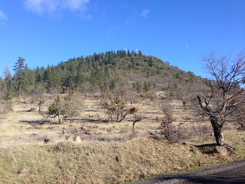
I am sure there are rattlesnakes, but the hike up to the top is a maintained dirt road probably 25 feet wide. Rattlesnakes aren't going to surprise you if you stay on the trail. The dirt road also means that the trail is smooth, easy walking, or as easy as possible for a trail that goes uphill. There are genuine trails that you can take to make a loop, but the three-mile trail to the top is simple and straightforward.
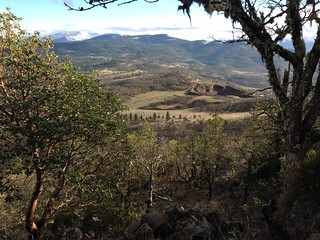
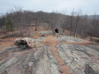
The above picture is from partway up, looking down at the rock pit. A side trail goes to the pit, if you want to see a hole in the ground up close. (We passed.) At the top of the peak are two towers, as well as a panoramic view of the valley looking west.
Roxy Ann is located in Prescott Park, named for George Prescott. (Go ahead, follow that link; it's a fascinating story, at least if you like stories about murder, conspiracy, and corrupt judges.)
The weather made for good hiking, too. Look at these blue skies:
Sunday, December 21, 2014
Dater Iron Mine scouting hike
In what was probably my last hike of 2014, I went on a scouting hike at Harriman State Park. We hiked from the Tuxedo park-and-ride down to Sloatsburg, passing over several mountain ridges and the Dater Iron Mine. The app tracking our distance went buggy about 1/3 of the way through, but the hike was around 14 miles, with substantial elevation gain and loss.
Saturday, December 20, 2014
Friday, December 12, 2014
Things only 38-year-old professors who should be grading exams understand
I am tired of your listicles.
No, I'm not "discovering" that there are no grown-ups, that we're all just faking it. All I ever thought "grown-up" meant was an age, and only the unlucky among us escape aging.
There are no things that "only tall people" will understand. I'm a shortie, but I'm not utterly lacking in empathy. Ditto for birth order, intro/extraversion, people from [place name], and "children of the [decade]."
I'm not even going to bother clicking on something built on gender essentialism or something that forgets gay, queer, or asexual people exist.
I'm tired of reading lists that assume we all have the same life trajectory. Apparently a single, childless, non-home-owning 38-year-old is a freak of nature, just like a 70-year-old who has uncomfortable shoes but no grandchildren.
There are now well over a thousand secrets to happiness. I barely have time to read them all, let alone perform them. The only life hack that has really made a difference for me is opening my bananas from the bottom.
"Look how dumb these people are" is beginning to feel mean, possibly because the same few items appear in them over and over.
Listicles of cute and/or funny animals are okay. I will accept more of those.
I am skilled enough to click on the correct "next page" button instead of a cleverly disguised ad, but I don't like being reminded that I am nothing but a delivery system for ad dollars.
Also not thinking very highly of me are listicles that start off with the assertion that I am spelling words wrong, using near-homonyms of the proper words in trite phrases, or using common household products wrong. Am I supposed to be suspectible to negging?
Your listicle has GIFs from bad television shows in it.
Your argument that [x] is "the best" lacks logical rigor.
I am perpetually slightly dissatisfied. It is never true that there is "no [place, age, life stage] I'd rather be." Get back to me when we have solved world hunger, I ride a winged unicorn, and night cheese firms and tones the buttocks, and I will re-evaluate my stance.
Monday, December 8, 2014
Finally debt-free
In April 2012, I decided I had to get serious about paying off my credit card debt. I'd been in New York City for eight months and paid off my moving costs, and I was finally making a real salary after eight years in grad school. Total credit card debt? $22,510.57.
This week, I finally paid the end of it off.
I didn't do anything fancy. I simply put a large chunk of my income towards the bills every month. First, I paid off the smaller of my two cards, then tackled the larger card. (The psychology of having a card paid off was more important than tackling the higher interest rate card.) Finally, about a year ago, I transferred what was left to a new 0% APR card.
I haven't totally sworn off credit cards. One card I've had for nearly two decades has a high credit limit that is good for my credit rating. That is linked to my iTunes account - it keeps it active, and it means my checking account isn't cluttered up with $1.29 charges. It gets paid off every month. The other card I use for purchases that are more secure on credit cards, such as airplane tickets. It gets paid off as well. The third card will be closed soon.
A huge weight has been lifted from my shoulders, but of course there were trade-offs. My savings account is practically empty. In fact, I have a negative net worth overall. My student loans aren't huge (although morbid as this sounds, at least if I die, my family won't have to pay them), but my 401(k) and rollover IRA will let me retire around age 70, if I plan to make it to 70 and a half. I've increased my 401(k) contribution - it should be higher, but first I need a savings buffer. That comes before paying off any student loans or maxing the 401(k).
This is the first time in my adult life I haven't had credit card debt. You know, that's pretty exciting.
Sunday, November 30, 2014
Batona Trail logistics
I ended my trip after two days because of the cold. Not the cold during the day, but at night. My first night was on the edge of my tolerance at 35 degrees, and it was going to be 5 degrees cooler the second night, and another 5 the third night. While my sleeping bag is rated to 15 degrees and I had a liner, I sleep cold.
A few logistics:
A few logistics:
- This was the biggest enemy I faced on the trail:
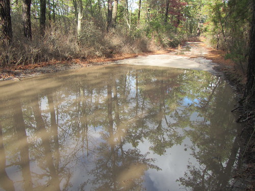
That’s right, puddles. Big and too deep to wade through, the danger came from having to walk around them when there were thickets right at their edge - including lots of greenbriar. I can see why in the summer people complain about ticks.
- The map is terrible. Now, I didn’t get lost. However, whoever drew the map knows nothing about usability. Sand roads, streams, contour lines, and borders all look identical. Most of the ponds aren’t shown. Segment distances aren’t given for side trails, such as to the campsites. There are two reroutes (the Bass River one was called a “relocation,” which brings to mind internment camps) not yet shown on the map. I hope when the redone map becomes available, it is better, because there aren’t any commercially available alternatives.
- Taking the bus to Atlantic City and then the NJ Transit 557 bus to Greenleaf Road and walking two miles to the trailhead worked fine. Next time, I’d go down to Atlantic City the night before and try to make it to Buttonwood Camp the first night.
- If you want to start at Batsto, take the train to Egg Harbor City or the 554 bus to the same and then call a taxi. It’s not worth walking the 7 miles.
- Bodine Field Camp is not worth the 1.2 mile hike to it. There is a water pump … somewhere. I couldn’t find it. There’s also no way to pay there.
- I thought water might be an issue at this time of year, but there was plenty. Just bring something to treat it with.
Saturday, November 29, 2014
Hiking the Batona Trail
I set out to hike the 50-something mile Batona Trail - recent reroutes have stretched it past its original 50 miles - over Thanksgiving. I didn't make it. But the part I did see was well worth it.
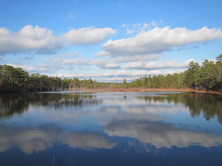
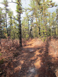
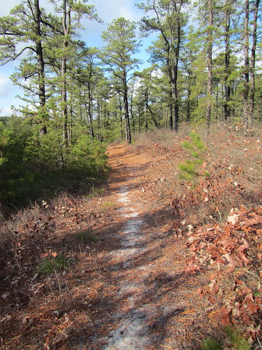
As I tend to be overly fixated on the landscape equivalent of charismatic megafauna, I was worried I'd find the trail dull. Certainly some hikers have. But the trail was surprisingly beautiful. It is mostly "just woods," although a few ponds break things up - it's not a trail of waterfalls, clifftop views, and dramatic rock formations. It reminded me of middle Tennessee's cedar glades, and my dad pointed out it looked like the land near one of their homes in the Upper Peninsula. In general, the UP has taller trees, but the Marquette area has sandier soil, much like the Pine Barrens.
The trail is completely flat - at least the part that I did, from Bass River to Batsto. Later on, Apple Pie Hill is the high point of the area and it features a fire tower. Flat means less scenic variety, but it's also easier hiking. As this was my first backpacking trip in about three and a half years, I was okay with easier. (I was still feeling it.)
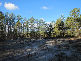
At night, the temperature dropped close to freezing. That was chillier than I like to sleep outside in. On the plus side, it means way less to worry about in the way of insects, and not drinking gallons of water like one would in the heat.
I'm not sure what my total mileage was, as I'm not sure how much longer the reroute at the beginning of the hike was. Best guess is that day 1 was between 12 and 13, including the road walk, and day 2 was almost 17, again including the road walk out.
Wednesday, November 26, 2014
Happy Thanksgiving
I leave tomorrow for a Thanksgiving weekend backpacking trip. The original plan had been to start today, but today's weather is an unpleasant mix of rain and snow. Tomorrow will be cold but dry.
Have a wonderful holiday. Enjoy family and friends and stay out of the Black Friday madness.
Saturday, November 22, 2014
Greetings from ASHE 2014
Hello from Washington, D.C., where it's the last day of the annual conference of the Association for the Study of Higher Education conference.
As always, it's nice to see colleagues that I only see once a year and catch up. This year, the conference was held in conjunction with UCEA, so I got to see some of my K-12 colleagues from Vanderbilt as well. I especially like seeing my younger colleagues who have found good jobs and are "all grown up."
Of course, ASHE isn't primarily a social hour. I went to more sessions that I have in recent years, and found the average quality to be higher than in years past. (Perhaps I just picked better, but the number of proposals does go up every year.) Some of the sessions were related to my own research; others were related to the issues I deal with as an instructor; others were simply things that sounded interesting. Frankly, I tend to learn as much - or more - from the latter, and sometimes it drifts over into my own work.
While the papers are important, the conference is perhaps most important as a networking tool. This happens both in meetings and in serendipitous encounters. For example, someone encouraged me to come work for [x], I learned about a grant opportunity in my research area, and I agreed to edit a book with a colleague. None of these would have happened if I hadn't been here.
Friday, November 14, 2014
Doing things I don't do
I recently took a month off from capoeira, and during that time I tried a lot of different physical activities. My favorite was the Brazilian Jiu-Jitsu, but it was obvious that I wouldn't have time to do it and capoeira both.
Much to my surprise, I ended up joining a gym. I had pretty much sworn off gyms, as I did plenty of hiking, capoeira, and yoga.
But the gym I joined made me re-evaluate that. One, it's a ridiculously hardcore gym where no one is there to hit on people. (I am not ridiculously hardcore. I am kind of soft- and squishy-core. Basically I'm a poser, trying to look badass in my roller derby shirt.) Picture a bunch of extremely fit people in all-black and tattoos and no shoes either punching each other* or lifting kettlebells, and you've got the idea. And I do like shoelessness. And wearing black.
It just hit me that there is no background music, at least downstairs in the exercise class space. You have no idea how wonderful that is, especially after my last foray into spin classes.
Also the gym has ridiculously trained trainers that teach their classes (full disclosure: I do capoeira with one of them, but really they're all ridiculously well-trained), and they don't do useless exercises or shout annoying platitudes at you. No one has yet told me to give 110%. I am a properly trained statistician, y'all, and I know we don't have 110% to give.
But the most important thing for me was that good-form weight training finally did the last bit of healing on my shoulder. My left arm is probably 99% of where it was before everything, and it very rarely gets sore in the way that suggests I'm overusing the wrong muscles. I'm also much more likely to go to class at the gym than to lie on my living room floor and do 30 reps with my 3-pound weight. I am not a home exercise person.
So, hey, I'm going to the gym. It actually means fewer days of capoeira, but my capoeira hasn't suffered for it. The increased strength has helped with my control, in fact.
* OK, yeah, they're doing Muay Thai. It's not a fight club.
Monday, November 10, 2014
Double circuit of Bear Mountain
Although Bear Mountain is one of the classics New York City-area hikes,
I've never done it. And on this Ramblers hike at Bear Mountain State Park, I
still didn't do it. Instead, we hiked around Bear Mountain twice, first
in a large circle and then in a smaller one. The total hike was 13.3 miles with 2,228 feet of elevation gain - not bad for not actually climbing a mountain.
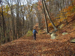
(Mind you, we did hike about halfway up Bear Mountain, and those are some killer stairs!)
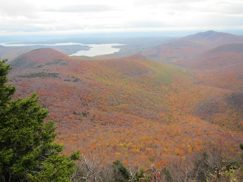
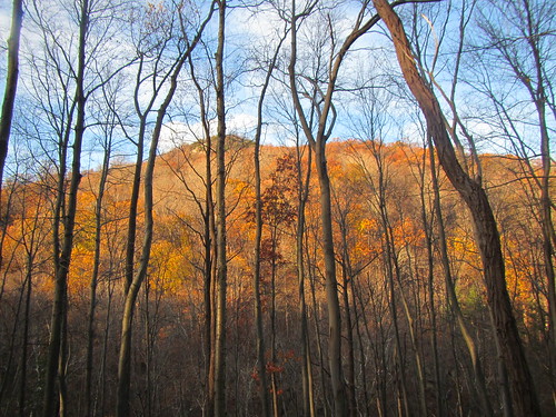
The leaves are mostly fallen but there still was a lot of colors. That, combined with it being a sunny, warm day, made for a beautiful hike. It was no surprise that the Hudson River, with Bear Mountain on one side and Anthony's Nose on the other, was lovely, but I didn't expect the Popolopen Gorge near the end of our hike to be so nice. It was hard to photograph: In the summer, leaves would be very thick, but even at this time of year trees obscure the bottom of the gorge in photographs, although the eye has no trouble picking those details out when actually present. The picture of Popolopen Torne below is one of the few good ones I captured.
Friday, November 7, 2014
Small data
I started keeping track of my hikes in mid-2002. This quick chart shows how many hikes I did per year every year since 2003, the first full year of tracking. A couple of things stand out.
First, in 2005 and 2012, I was dealing with injuries (undiagnosed IT band problems and a bone spur, respectively), that limited my time on the trail.
Second, 2014 will be the hikiest year yet for me since moving to New York, even if I do nothing in the next two months.
Third, the mean is about 28 hikes a year, or a little more than twice a month. (And 26 is the median and 30 is the mode!)
Fourth, I am the kind of person who should probably own a Fitbit or something, but I would probably get annoyed because it wouldn't track data exactly the way I want.
Fifth (and now we're way beyond "a couple of things"), hard data is interesting. If you had asked me how many times in a year I typically hiked, I'm not sure I could have given you an accurate answer. In general, humans are pretty bad at estimating how often we do things, or how many calories we eat, or how much time we spend doing any particular activity. My department has been trying to estimate how work we assign in our classes, and I considered polling my students. But - aside from the likely problem of deliberately misleading reporting - I'm not sure how accurate students would be able to be.
Sunday, November 2, 2014
100 days of new things
The 100 days project was born in a moment of rage. Someone had hurt me badly, and while I was angry at them, the impetus for this was rage at myself that I had let it happen. I had changed my life and fallen into a rut for someone who wasn’t worth it. Me! I was the one who, as a young child, always voluntarily tried new foods at restaurants. I moved across the country for college alone. And here I was spending my weekends sleeping in, going to brunch, napping again, and then, if we were feeling adventurous, watching a video. Something had to change.
I decided to do something new every day for 100 days. While the new thing could be something big like skydiving, it didn’t have to be. After all, I wouldn’t have time for that every day. But it had to be bigger than a new restaurant with familiar cuisine,
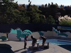
Over 103 days (including three rest days), I tried things I liked (glitch hop music) and things I didn’t (Insane Clown Posse). I shot a gun and smoked pot (in Colorado), but I also read Harry Potter fanfic and tried coco helado on days when time was short.
I tried a lot of new foods and cuisines. The best was Taiwanese from a food cart in Midtown, but the most surprising food was ramen. It turned out it didn’t have to be the dry-packet experience I swore off after college.
I consumed some new media and art forms. The dinosaur erotica was far and away the best conversation starter, although Straight Stuntin’ magazine was more educational. The Mary-Kate and Ashley movie proved to be un-get-through-able, while listening to ragas led me down a Wikipedia rabbit hole.
And Wikipedia - I edited a Wikiepedia entry, one of several technological new ventures. I also made a vine, tried Pinterest, and used an iPad in the classroom. And in the classroom I also tried polling software, took my students on a field trip, had a guest via Skype, and made an video with iMovie (not new - but not swearing at it was).
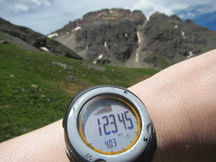
I hiked above 12,000 feet for the first time, took barre, Brazilian jiu jitsu, TRX, high intensity interval training, kettleball, and burlesque classes (where I learned to fan dance and chair dance). I went to capoeira classes at Joao Grande’s and the LIC Palmares groups, and I went to my first open roda.
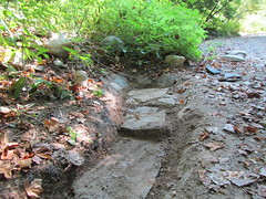
I led a Ramblers hike, made a snow angel in July, and brushed my teeth with baking soda. I helped build a rock-lined ditch and opened a Smarty Pig account. I bought a lottery ticket (not a winner) and hiked with the Catskills 3500 club.
And there were a few things that required actual courage, although not as much as jumping out of an airplane. I talked about one of my goals that I tend to keep to myself on Facebook. I went a day without complaining; that took two tries. I wrote up a business plan. I opened up to my capoeira Mestre. And on day 99, I finally forgave the person who had hurt me in the first place.
Towards the end, it became harder to find truly new things I could fit in around a busy day at work. There were also things I wished to try but couldn’t. I never did get that pickleback or try that taxidermy class. But I still can. To the extent I’m still in a rut, it’s only to the extent of having a regular job and activities I enjoy, and that’s okay with me.
Saturday, November 1, 2014
Saturday, October 25, 2014
Red Hill fire tower hike
The hike up to the Red Hill fire tower is short - less than two miles each way - and although it is somewhat steep, it has little in the way of rocky climbs. I was surprised, then, to have it entirely to myself on what started out as a sunny Sunday.
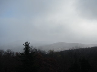
It was colder than the previous day, with temperatures in the 30s. As I climbed out of the car, I was half in clouds and half in sun with what looked suspiciously like snowflakes falling around me. This mixed weather would continue for the rest of the hike.
Upon my arrival at the top, I was greeted with what was definitely snow. Looking at the first photo, you might not believe it. Even from the fire tower, one direction showed mostly blue skies, but the other showed what we see in the second photo.
On summer weekends, a volunteer stays at the tower and opens the top to visitors. The volunteer season lasts through Columbus Day, so I had just missed it by one week. Nevertheless, you can still walk up the stairs and look around, which is where the second photo was taken. I didn't hang around long up there due to wind and cold. The top steps were even getting icy and slippery. I turned around and went back down the mountain. Of course, when I was about two-thirds of the way down, the cloud system blew out to bother another mountain, and the sun shone down through the trees. But that's part of hiking - you get the vagaries of weather.
Friday, October 24, 2014
Hiking the Burroughs Range
Three Catskills 3500 peaks in one hike - how very efficient! And how daunting!
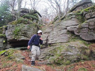
Because this hike was with the Catskills 3500 Club, and there were multiple cars, it was a shuttle. We began hiking at one end of the Burroughs range and finished at the other, doing nearly ten miles in the process. There were okay views from Slide and Cornell, and an excellent view at the top of Wittenberg. Along the way, of course, were plenty of rocks, but the trail was still easier than the Devil’s Path, where the peaks I did this summer are located.
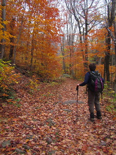
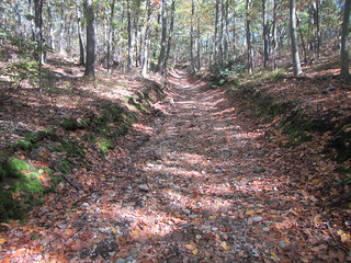
As you can see, the leaves were at their peak at lower elevations. We started in mixed forest, mostly beech and maple. Higher up, it became mostly beech, and then there was a thin layer of birch. All along there had been occasional balsam stands, but at the highest elevations, they dominated.
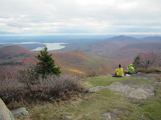
Plenty of rocks kept the terrain interesting. The fallen leaves on top of rock terrain meant keeping a close eye on one's footing, but that's an inevitable part of fall hiking. Unfortunately, the day was mostly gray, and we had a short bout of rain midway through. It wasn't enough to make us miserable, but it was enough that the views we had were not as spectacular as, I am told they can be. The photo below shows the view from Witternberg, with clouds hanging above the fall colors.
We encountered many other hikers and backpackers on the trail, including a few that were not prepared for what they were doing. One hiker had firewood strapped to her backpack; I really hope she was just carrying extra weight for training purposes, because otherwise it was a real coals-to-Newcastle situation. Then there was the group that had made it a mile from the parking lot before setting up camp in exhaustion, unable to make it the three or so miles to the shelter. They were carrying heavy equipment in duffle bags. Okay, people, I'm not saying you need to buy the latest, most expensive equipment at REI, but ... maybe next time try hauling your equipage around the block first?
Sunday, October 12, 2014
Walt Whitman birthplace and trail
After three years in the city, I felt it was finally time to experience Long Island - having been assured that Brooklyn and Queens do not count. The proper way to do this would undoubtedly involve a beach house in the summertime, but it's October, and I don't have that many friends who are beach house types.*
Instead I headed out to the center of the island to visit the birthplace of Walt Whitman and a nearby park named in honor of the same. I took the Long Island Railroad to Hicksville and then tried to catch the N79 bus, which dropped off passengers and then disappeared. It appeared I could either pony up for a taxi or wait an hour for the next bus; not filled with confidence in the Nassau Inter County Express (it's NICE!), I chose the taxi.
At the birthplace, I learned that Whitman loved having his photo taken; no doubt he would be all about the selfie today. The museum tour is self-guided, but the house tour is docent-led, which meant that I had a private tour - business was slow. The tour guide was very sweet and knowledgeable, and I had ample opportunity to admire Whitman's father's carpentry.
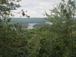
From there, it was a short walk to the park, which has a trail bearing Whitman's name. While his family moved to Brooklyn when he was relatively young, he spent summers back on Long Island visiting family and definitely walked those woods. I found the park itself to be rather uninteresting - pretty because there were trees and it was a nice sunny day, but not worth writing poetry about. I tried in vain to channel some Whitworthian enthusiasm.
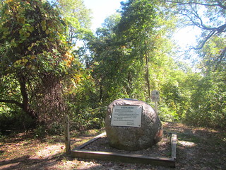
The high point of the trip was Jayne's Hill - and that's not attitude, that's altitude. Long Island tops out at 401 feet above sea, commemorated with the scenic boulder in the lower photo.
Afterwards, I walked past the birthplace to the mall, which was upscale and boring, but it was also the site of the bus stop. This time, a bus did appear, and my return trip was uneventful.
So that was Long Island.
* I have friends who live at the beach, which is a very different proposition.
Saturday, October 11, 2014
Time Management III: Research and writing
Disclaimer: This is the part of time management I don’t have down yet. With research and writing, the few externally imposed deadlines are for near-complete projects, such as conference proposals. Unlike grading, which is naturally breaks down into single-assignment bites, research projects must be artificially chunked. The actual doing of the work then reveals flaws in my original estimates and plans.
No doubt it helps to be part of a research juggernaut - to have grad students looking to you for assignments, to have funders with reporting deadlines, to have senior faculty not-so-subtly pressuring you. Those of us at teaching-oriented institutions (or in teaching roles at research-oriented institutions) have nothing but our own willpower to go on, and vey few of us have much of that.
I’ve found that scheduling research and writing the way I do grading is not as successful. I’ve poked around at various kinds of scheduling and productivity software, but none of it seems to be set up in ways that I find helpful. (There are even a surprising number of sticker-chart apps for kids, but they are all premised on earning some sum of points, rather than on due dates. They are also ugly. Where is the Lisa Frank reward app?) I suspect Gantt charts might be ideal, but they don’t integrate with calendar apps well.
At the moment, I am playing with using BusyCal’s To Do list. BusyCal is much like the basic calendar that comes with the Mac OS, except it seems to work better and isn’t quite as ugly. To dos keep my calendar less cluttered than adding them to each day (they appear in a sidebar) while still being visible.
It’s been helpful thus far with tasks easily chunked down into small enough bits, such as “write blog posts.” The challenge of breaking down larger projects is still there: “Write article” is just too much, and I certainly won’t accomplish it in one afternoon. How much progress should I be satisfied with in one session? But breaking some of these projects down into tasks ignores any dependencies, bringing me back to Gantt charting …
I’m working on it. I’ll keep on trying with the to dos for a while, at least, and see if that improves my work flow and rate.
Wednesday, October 8, 2014
Time management II: Tomato timing
This summer I found myself in the position of having to write nearly 1000 50-word article summaries. It’s a task that sounds interesting enough until you’ve written several dozen of them! (This was for our forthcoming book, which you will surely want to buy for all your friends and family.) The problem is primarily that the task seems endless and it is unvarying. And I was on deadline.
I found the answer in the Pomodoro technique. It’s pretty simple:
Set a timer for 25 minutes. Work diligently. When the timer goes off, mark an “x” on a piece of paper and set your timer for a five-minute break. Repeat. When you have four x’s, take a slightly longer break, 20-30 minutes.
This sounds like a lot of breaks, but those 25 minutes are solid work. Even I can go without Facebook for 25 minutes. As a result, I was able to work longer hours than I otherwise would have been able to.
I’ve been able to carry that technique with me into the school year. It doesn’t work for everything - classes and meetings being prime examples. But for grading, checking email, etc., it’s effective at keeping me on-task. I can work at most anything for only 25 minutes.
The x’s also help, not unlike stickers.
There are apps that will auto-time you, but it’s recommended you set the timer by hand each time. I guess it’s a way of taking ownership over what you are doing. I can’t vouch for that, not having used an app for comparison. One slight deviation I do make is that while one is supposed to stop work the moment the timer sounds, I take a few extra seconds to save any electronic work. You can imagine for yourself why that might be a sound idea.
Saturday, October 4, 2014
Time management I: Grading
I’m now in my fourth year of teaching … and I’m finally beginning to get a grip on this time management business. This is a fairly typical problem for new professors. Faculty members have plenty of immediate demands on their time (show up for class, respond to this urgent email), and it’s easy for less deadline-driven work such as grading and research to slide - particularly research.
My institution does not have a high research requirement, and I’m still working through the problem of fitting it in. My current technique is to wait until there is a deadline, a strategy we all know to be perilous. I have, however, finally figured out how to keep up with grading, a not insignificant problem for anyone teaching five classes without a TA.
In the end, there are two techniques that have worked for me, although I they many not work for everyone. First, at the beginning of the semester I put each assignment to be graded on my schedule. Each assignment is supposed to be graded within a week of being turned in, but I can’t grade too much on one day, or at all on any day with a heavy teaching load. This kind of planning balances my workload and insures no assignment is forgotten. Second, I have a wall calendar, and every time I finish grading an assignment, I get a sticker on that day.
Yes, I said sticker. As in, the way we motivate pre-schoolers to do their chores and use the potty.
It works for me because it makes me visibly accountable. Realistically, my colleagues aren’t checking up on me, but they could if they wanted to. And while I could draw x’s instead, stickers are more attractive. Right now, I have sparkly stars. It’s much cheaper than rewarding myself with a latte.
In the past, I’ve tried other things with less success. For example, I tried a policy of grading one assignment every day. That didn’t work so well on busy days. I tried a whiteboard with a list of to-be-graded assignments, which was only moderately successful: The list tended to get too long and too discouraging.
Grading, of course, is only one part of my job. Next up: Taming the endless task.
Sunday, September 21, 2014
Devil's Den Preserve
Yesterday I checked another state off my hiking list, adding Connecticut to the roll.
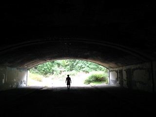
Devil's Den Preserve was the only hike of any significant length in the state listed in my local hiking guide. While the book didn't suggest that it was do-able via public transit, it is - as long as you don't mind nearly doubling the hike length with road walking.
It's three miles from the Cannondale stop on the Metro-North Danbury line to the entrance of the Nature Conservancy preserve. It's three miles of country roads ("country" meaning mansions on an acre or two each, "road" meaning 25 mph blacktop) with no sidewalks and mostly no shoulders. You would not want to do it at night.
The preserve itself is quite pleasant, with gentle undulations in the scenery that provide variety for the eyes without unduly tiring the legs. Well, that's provided your legs are in okay shape to begin with - mine were much more weary than I was willing to admit from a high intensity interval training class two days previous. The guidebook listed the hike around the preserve as 450 miles of elevation gain over seven miles; the road walk also has some elevation change.
Most of the really interesting stuff is near the entrance: Godfrey Pond, the old sawmill equipment, and Ambler's Gorge and Vista. At the far end of the park are the Great Ledge and the Redding Great Ledge. Of the vistas and ledges, only the Redding Great Ledge (pictured) is worth it; the others don't have any views, at least not while the trees are leafed out.
There is also a logistical challenge to doing this hike via train, as the return trains run every three hours. You're likely to have time to kill, and there isn't much to do in the vicinity: an expensive restaurant and an acupuncturist are right there, and supposedly there is a coffee shop a half-mile away. You might be better off renting a car from the city and driving.
I don't know that I would do this hike again, but it was worth doing once.
Sunday, September 14, 2014
Van Cortlandt Park hike
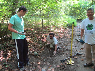
The Friends of Van Cortlandt Park group offers led hikes about once a month, so I decided to go on their September hike. I went in part because it was in the northeastern woods, a part of the park I don't know very well.
We hiked about four miles, starting at the wetlands in the southeastern, and then following the Croton trail into the northern half of the park. Luckily, the forecast rain held off.
Sunday, September 7, 2014
Trail building with Friends of Van Cortlandt Park
Yesterday, the Van Cortland Park volunteer trails crew started up again. We worked on a drainage ditch on the John Muir trail, in an area that can get pretty damp.
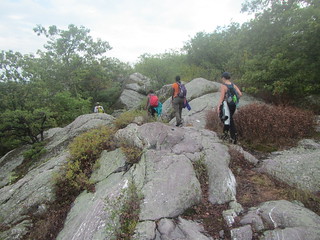
The ditch had been dug and the inside wall built from rocks. We lined the bottom completely and made good progress on the outside wall.
Although it was supposed to rain in the late afternoon, it held off. Although it would have been nice to see the ditch in action!
The ditch had been dug and the inside wall built from rocks. We lined the bottom completely and made good progress on the outside wall.
Although it was supposed to rain in the late afternoon, it held off. Although it would have been nice to see the ditch in action!
Friday, September 5, 2014
Appalachian Trail hike
On Sunday I went hiking with the Ramblers. The weather left something to be desired; it was brutally humid, and the forecast called for late-afternoon rain. Still, there was going to be ice cream, so why not?
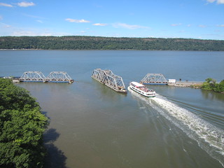
The hike started in Sterling State Park and then hopped onto the Appalachian Trail, ending at the Bellvale Farms Creamery. Although the hike was 14 miles, it felt longer. At 3:30 we got caught in a downpour, although being under the trees provided some shelter. Even after the rain stopped, we had to be careful climbing on slippery rocks.
We arrived for ice cream with perfect timing - 30 minutes prior to the next bus. The ice cream was very good (and I don't think it was just that everything tastes good after 14 miles). Then, as we waited for the slightly late bus, the rain returned - hard. My rainjacket covered my torso, but the rest of me was totally soaked, which was pretty much the case for all of us. Then the bus came and we had to endure two hours of blasting air conditioning. I was never so excited to get to a stifling hot subway platform in my life!
Nice hike, though. Rain happens.
Saturday, August 30, 2014
Not-so-obvious lessons I’ve learned about relationships from my past relationships
Some days I’m not sure I am learning anything, because I make the same damn mistakes over and over. Other days, I think maybe I have, even if the lessons are basic stuff. Like: Don’t date someone in the middle of a divorce. Did I really need to learn that the hard way?
These are the less obvious things I’ve learned. They may not apply to people dating for the first time - we all had to learn to be good kissers - but they do apply to both men and women. Except maybe #3.
- Your relationship(s) will not look like the models you grew up on. Whether it was Disney or your parents’ relationship or When Harry Met Sally, don’t try to reproduce it. You aren’t them (and, face it, none of us are Disney princesses), and times change, and stories always sound better after the fact.
- Most people are living the life they want. Unless they’re involved in actively trying to change it, don’t assume they ever will. Think hard about whether you can really share that life.
- Never date a man who calls you “pretty.” If they don’t think you’re “beautiful,” they think they’re settling.
- If the sexytimes are boring now, they’re not going to get better.
- Don’t date anyone with active mental health issues. I’m not saying you should never date someone who struggles with, say, depression. But if they’re in the middle of a very active battle with it, they aren’t in a good position to be starting a new relationship.
- If they aren’t willing to tell their parents about you, run like hell. (Exceptions can be made if they had an insane childhood and have cut off all contact with their parents. I haven’t experienced that one, but I imagine it comes with other challenges.)
- If you think you can do better, go out there and try. You’ll either find your inflated ego being knocked back down to a more realistic size, or you’ll discover that you have been selling yourself short all along.
- There is no value to nurturing a long-term crush. Either make your move or move on.
- If someone truly loves you, they’ll find a way to tell you. It may not be with those words, but they’ll make it clear.
- There are certain events in your life your partner has an obligation to be there for, such as funerals, illnesses, and getting out of prison. If they aren't there for you in those times, you're better off without them, because you are already doing the hard stuff without them.
Walking to the Bronx
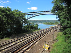
I had walked the bridges that connect Manhattan to Brooklyn, Queens, and Fort Lee, and between Queens and Brooklyn, but I hadn't realized until recently you could walk from the island of Manhattan to the Bronx via the Henry Hudson Bridge.
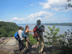
I started from the northern side of Inwood Park, meaning I had to wind around to end up where the entrance to the bridge is. The bridge itself isn't inspiring to walk on, as the pedestrian walkway is on the lower level. However, it is on the western side, so there are expansive views of the Hudson and Harlem Rivers. During my crossing, the Metro-North bridge below me pivoted open to allow a local cruise ship through.
Rather than turning back, I decided to explore the area and then walk east to the 1 train. The neighborhood under the bridge has a small park, some actual single-family homes, and a Metro-North station. The riverfront here is taken up with railroad track; that plus the bridge makes for a slightly noisy neighborhood, but the houses feel surprisingly tranquil (and are even more surprisingly affordable. I mean, relatively. For New York.).
From there, I realized, I could walk back to Manhattan another way, by walking to Marble Hill. Geographically it's part of the Bronx, but jurisdictionally it's part of Manhattan, because it used to be part of it geographically. (Perfectly clear?) From Marble Hill the Broadway Bridge crosses over to the island of Manhattan, and I didn't realize it was a pedestrian bridge as well. It's actually a much easier way to cross over - except that technically both ends are in Manhattan!
Monday, August 11, 2014
Grant's Tomb-Greenbrook Sanctuary hike
On Sunday, I led my first hike with the Ramblers. It was an urban/not urban hike, starting near Grant's Tomb and turning around on the Long Path.
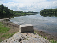
The hike up the west side of Manhattan was unremarkable; we elected to stay high and reached the George Washington Bridge rather quickly. We crossed the bridge and walked into Fort Lee to have brunch at the Original Pancake House, and then headed up the Long Path. We made it to where a small road comes in, connecting Greenbrook Sanctuary to Lost Book Preserve, before turning around. On the way back, we left the Long Path at the Dyckman Hill Trail and followed the shore for a bit. The water was peaceful after listening to traffic all day. Then we headed back up the Carpenter's Trail - a steep 300-foot climb - and back over the bridge to the train.
The weather was decent, although a tiny bit of haze made views not quite as crisp as they could have been, but it made for a good hike. The full hike was 21 miles.
Tuesday, August 5, 2014
Delaware River, Lenape, and Minisink hike
Back to New York City area hiking - not quite as spectacular as what Colorado has to offer, alas. This hike with the New York Ramblers was a ten-mile jaunt near Port Jervis, a town in New York but bordering New Jersey and Pennsylvania.
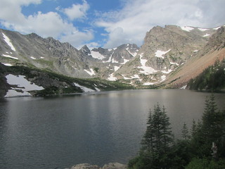
This photo was taken at the Tri-State monument, which we encountered near the beginning of the hike. To get there, you have to walk through an impressively large cemetery. From the monument, you can see New York in the foreground, New Jersey on the left, and Pennsylvania on the right.
Technically, this first part of the hike was on the Delaware River Heritage Trail, although it primarily makes use of streets in this area rather than feeling like a trail. From there, we walked to the Lenape and Minisink trails. The Lenape, blazed white, follows a ridgetop; the Minisink, blazed red, has more ups and downs. Both offer a few viewpoints into valleys below.
Now those of you who have hiked with me know that I do not like bees. I am not allergic, nor have I had an Incident, nor do I even get stung often - but bees seek to be particularly attracted to me. They will surround me and ignore my companions, which is quite unnerving. I also don't like hornets, wasps, or yellowjackets, although that is more rational. (If you've ever been chased by angry, aggressive hornets, you understand.)
So when we were about to start the loop, and I realized we were stepping through a particularly buzzy area, anxiety kicked in. But by that point going back was as bad as going forward, so forward I went. Two of my companions were stung, although I was not. However, I realized that we were going to come back this way at the end of the hike, so I had several miles in which to nurse said anxiety. What species were they? Would I recognize the spot when we came to it? Would I be eternally embarrassed if I detoured a mile around it through the undergrowth?
In the end, I did not recognize the spot and did manage to get stung, which while unpleasant was not nearly as bad as worrying about it. Several other hikers got it the second time around, too. My surmise is that these were yellowjackets - they seemed to be flying low and thus probably ground nesters, and a fellow hiker who got a better look said they were black and white.
That was probably the most exciting part of the hike, unfortunately. Otherwise it was pleasant enough. The hike itself was not strenuous, with less than 900 feet of elevation gain. The humid weather presented its own challenges, but you can't blame the trail for that.
Wednesday, July 30, 2014
Tuesday, July 29, 2014
Hike to Lake Isabelle
After a day back in Denver to catch up on things, I did a solo dayhike to Lake Isabelle. The hike is listed in 100 Classic Hikes in Colorado and for good reason. It's not, as far as Colorado goes, a strenuously killer hike, but the rewards are tremendous.
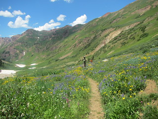
The trailhead lot was full, so after paying my $10 entrance fee I had to park at the day use area. I walked the long way around Brainerd Lake to the Niwot Cutoff Trail to catch the trail to Lake Isabelle. Along the way, I passed the north side of Long Lake; the trail offered many scenic glimpses of the lake. Past Long Lake, the trail climbed above a waterfall to Lake Isabelle, shown in the photo - an incredible beautiful lake with steep mountains rising on three sides. I continued on the trail until it started to climb away from the lake.
On my return, I took the Jean Lunning Trail south of Long Lake. It was considerably wetter than the north side, with more wildflowers as well as boardwalks through marshy areas. Finally, when I got off the Niwot Connector Trail, I elected to walk the short way back to my car, which was an excellent choice - four moose were grazing just a few feet off of the trail. Moose!
Monday, July 28, 2014
Rustler's Gulch hike
The hike to Rustler's Gulch was supposed to be our big wildflower hike, but previous day's hike to Ice Lake had already blown our minds. Rustler's Gulch was certainly pretty, and it had more wildflowers, but less variety.
We started off on an old jeep road. If you have a high clearance vehicle, you can park at the actual trailhead, but that was not us. This was also the steepest part of the hike, although overall it wasn't nearly as steep as either of the previous two days' expeditions.
Also working against the hike was that we were a little tired, as this was our fourth day of hiking; it was hotter than it had been, and the hike had little shade; and the number of bees, which anyone who has hiked with me can attest to my, er, lack of fondness for.
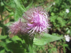
In spite of that, it was a very nice hike. We saw a field of ice lilies and several nice century plants, and the ground was veritably carpeted in yellow and purple. This photo is representative of most of the hike: long vistas with a profusion of flowers.
Sunday, July 27, 2014
Ice Lake and Island Lake hike
This hike was highly recommended by my friends, and it actually exceeded their expectations.
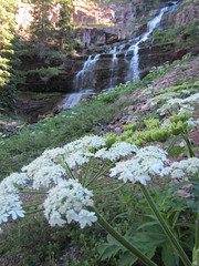
It started off promising when we were still in the parking lot, with hills rising up on all sides. From there, the trail headed uphill and entered the woods. The woods were very nice, but the first major attraction was the waterfall pictured at left. From there, the trail went in and out of woods, with rocky hills rising up around us. An old mine (of course) was a slight diversion, as were the abundant wildflowers we encountered. The trail emerged from the woods into a valley, where we crossed and re-crossed an unusually white stream. The stream pours out of Ice Lake, both deriving their colors from minerals.
After a brief respite in the valley, the trail headed up again on slopes too steep for trees. We kept pausing to take wildflower flowers along the way, but eventually we reached the cirque with Ice Lake.
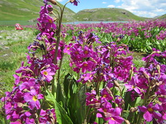
After a break, we decided to head on to Island Lake. You can also reach nearby Fuller Lake, but Friend C said it wasn't particularly exciting. Island Lake turned out to be very worthwhile. It has the same turquoise color as Ice lake, with, as you might expect, a small island in the middle. There were abundant pink flowers growing by it that perfumed the air. From there, we reluctantly turned around and headed back down.
The hike was 4.2 miles one-way, with significant elevation gain; it was the highest I had ever hiked, above 12,000 feet. It was well worth it, though. This hike checked off nearly every box for a great hike: waterfalls, mountains, scenic vistas, lakes, dramatic rocks, and wildflowers. The wildflowers in particular were a surprise, as my friends weren't anticipating them in such abundance and variety. We also discovered the existence of the hummingbird moth, which is exactly what it sounds like; picture a hummingbird with antennae, and you've got the hummingbird moth. Overall, it definitely rated as one of the best hikes I've done.
Subscribe to:
Posts (Atom)