Thursday, December 31, 2020

Sterling Forest Fire Tower

On my last day with a car, I met K at Sterling Forest State Park to hike to the fire tower there. The hike is, according to the visitors center, four miles round-trip, but the NY/NJ Trail Conference maps show it as slightly longer.

We followed the recommended route, which forms a lollipop loop. The return loop, on the red trail, is an old road and much easier, and if I had known that, I might have guided us to use that for both ways. But instead we took the more challenging trail up.

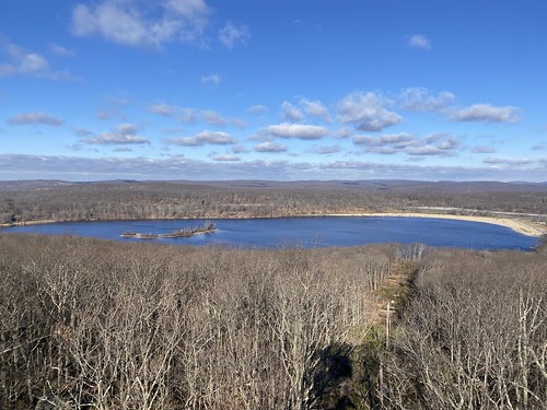
Either way, at the beginning we passed by the old ironworks and then Sterling Lake, both interesting and scenic. 

Sterling Forest tower

The tower itself was closed - not just the cab, but the stairs too. So no vistas, and I'll have to return to climb it. But it was still a nice hike, and good company!

Sterling Forest tower

Wednesday, December 30, 2020

Jackie Jones fire tower

I've spent lots of time in Harriman since moving to New York, but some corners of it are harder to reach via public transit. This includes the area around Lake Welch on the southeastern side of the park. I have passed through before - at least once, when I did the SBM end-to-end, but I haven't explored much. 

In fact, I even violated my rule of "never pass up a fire tower" when doing the SBM! So I wanted to visit the fire tower. I also wanted to see St. John's-in-the-Wilderness, a small church that my hiking club has visited, but I've never made those trips.

Jackie Jones & St. John's

Starting from the parking area at 106, I headed south on the Suffern-Bear Mountain trail. The water was really high, with a lot of ice, and there were a few dicey stream crossings. After passing the Orak ruins, I approached Jackie Jones Mountain. A large radio tower is actually visible before the fire tower.

Jackie Jones & St. John's

The tower was open, even the cab, so I enjoyed the views (not so much the graffiti) before continuing on. I passed Big Hill shelter, where a hiking club was setting up lunch, then turned onto the Long Path. There is a memorial to a flight that crashed.

I didn't so much miss the turnoff to the chapel as I missed the turn the main trail took to avoid the turnoff, which worked out just fine. The chapel was cute from the outside.

St. John's in the Wilderness

From there I followed the road (very low traffic) to the paths around Lake Welch. The sandy beach was closed for the season. Then it was back into the woods to catch a short bit of the SBM back to the parking area.


Lake Welch

Tuesday, December 29, 2020

Visiting Tallman Mountain

I wanted to find a hike that was a relatively short drive (yes, I had a car, briefly!) that I couldn't easily get to via public transit. Tallman Mountain sort of fit the bill. One can get there via bus, but I don't think I ever have. Also, it wasn't an area written up in either of my local hiking guides. Was it dreadful? Well, it's in the Palisades, so it has to be at least okay ... but you're already on top of a cliff, so how is there a mountain?

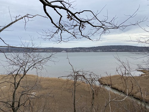
It turned out to be perfectly pleasant. The Long Trail runs through the park, as it does along the entire Palisades. That, along with a bike path, forms a decent loop. The mountain comes in because the Palisades have a break where Sparkill Creek enters the Hudson. On its south side, Tallman "mountain" just seems like a minor hill, but its north face heads steeply down to the water. 

Tallman State Park
As always in the Palisades, there are views off to the east of the Hudson, although this section is somewhat lower in elevation. There is also a marsh here along the western shore, which is visible through the trees as well. 
Tallman State Park

Overlook Mountain and new trails

On my final day in the Catskills, I opted to do a repeat hike that is just fun - Overlook Fire Tower. It's one of the most popular hikes in the Catskills, so the trail would be broken. Plus, the hike is on a gravel road, so while it's uphill the entire way, the terrain isn't difficult.

Because it is so popular, a second parking lot has been built down the road, with a connecting trail and two side loops added. These I had not yet done.

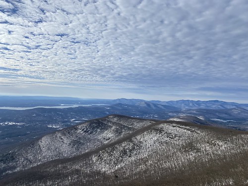
Despite not getting an alpine start, I saw only a few people on the trail when I set out. I stopped at the ruins before proceeding to the tower. Two women and a dog were at the overlook, but no one else was at the top of the mountain, so I climbed the tower.

Overlook Mountain

On the descent, many more people were streaming up the hill. But when I turned off to the access trail, the people disappeared.

These new trails were peaceful and enjoyable, but they don't go to any vistas or natural sites of interest. They're just a nice walk in the woods. 

Overlook Mountain

From there, it was home again, because a storm was due to come in that night. I just thought it would make for bad hiking, but it turned out to be devastating. It was rain, not snow, and it melted all the snow on the ground, causing massive flooding. This, in turn, caused major infrastructure damage.

Monday, December 28, 2020

Up Dutcher Notch

Due to anxiety about driving on black ice, I skipped doing a 3500 peak my second day in the Catskills in favor of a trail that was close to my motel. I needed to hit Dutcher Notch eventually for the all-trails patch, anyway.

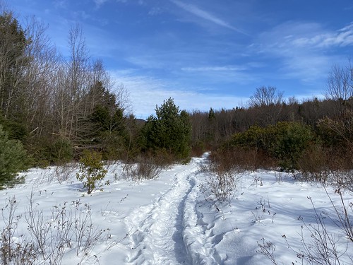
Dutcher Notch is a steep climb up to the Escarpment Trail. One could use it as a way to reach Blackhead, but it's not the easiest approach to it, so it gets less use than some other trails. This meant I needed to break out my snowshoes. It wasn't virgin snow, but it wasn't packed, either.

Dutcher Notch

It also doesn't have any particular views, which was fine on a gloomy, gray day.

Although only 1.9 miles, this hike pointed out how out of shape I am, thanks to 1,400 feet of elevation gain, plus the additional challenge of snowshoes. But since I was alone, I could hike as slow as needed!

As I approached the Escarpment Trail, there was a nice view of Blackhead (in the summer it would be obscured by the trees). 

Blackhead Mountain

The other thing this hike had was solitude - I encountered no other hikers on it that day.

Two easy Catskills hikes

I spent three days in the Catskills. Originally intended to be a week, I changed my plans for various reasons that proved fortuitous when a major storm wreaked havoc on the area the evening I left.

On the day I drove up, I broke up the drive with a stop at Onteora Lake. There are three trails there that are a part of the all-Catskills trail challenge, so I wanted to visit them. In the end, I didn't - I got distracted by the other loop trails, which I guess don't count as they are for mountain biking, maybe? 

Onteora Lake

The trail is quite popular, as it's near Kingston, relatively flat, and has excellent lake views, so no spikes or snowshoes were needed. The views of the lake, which come at the beginning of the hike, were excellent. The rest of the hike was through attractive woods.

I had hoped to do a second hike that afternoon, but the parking lot and driveway weren't sufficiently plowed, so on a whim I parked at nearby Olive Bridge dam. Honestly, it wasn't even clear to me that it was anything other than a parking lot, but there were other cars, and what looked like a view, so ...

The dam is the major one at the Ashokan Reservoir, and the top of it is open to pedestrians. Of course, it is flat and paved, and probably only a mile long. However, the views of the dam are spectacular.

Olive Bridge dam

Wednesday, December 23, 2020

Walking from VCP

This month I was faced with the conundrum of getting to Van Cortlandt Park to do my trail maintenance but not feeling comfortable on the subway. I had learned last month that Metro North felt reasonably safe, and was better about masking. It's also a shorter ride - about 20 minutes - but with a two-mile walk to the station at this end, and a mile and a half from the station to the park* (7 total, round-trip). So, I was curious about the feasibility of walking.

It's 7 miles to the park, 14 miles round-trip. But these are the short days of winter. And with any of these options, I had to walk in the park, too. I opted to compromise: Take Metro North up in the morning, when it is pretty empty, and walk back. 


Palisades
*This is coming in from the Hudson line, west of the park; it's actually shorter to come in from the east on the Harlem line.